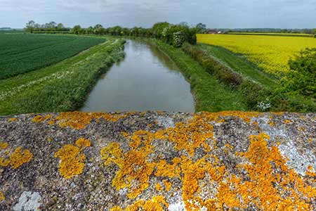
Oxford Canal & Stoneton from Upper Boddington
Northamptonshire Walk
County/Area - Northamptonshire & Warwickshire
Author - Lou Johnson
Length - 7.0 miles / 11.4 km Ascent - 450 feet / 136 metres
Time - 4 hours 0 minutes Grade - easy/mod
Maps 

Walk Route Description
Click image to see photo description.
Staring from the village of Upper Boddington, the route explores the countryside north of the village. Sections of the Oxford Canal Walk and the Millennium Way are used together with field paths. The walk starts from Northamptonshire but crosses into Warwickshire with some views across a wide area. A section follows the Oxford Canal, and the route passes close to the site of the medieval village of Stoneton and the adjacent manor.
The walk starts from The Plough in Upper Boddington (grid ref. SP483534). With your back to The Plough, walk left along the road and then turn right into Frog Lane. Where the lane bends left, bear right along a footpath between houses (with no cycling sign). Continue to Townsend Lane and turn left. Take the first footpath (initially enclosed) between houses and into fields. Maintain direction for 800 to reach a cross track (grid ref. SP478544). Turn left, and almost immediately right onto a waymarked path into a field. The path heads diagonally across the first filed and then maintains direction across more fields to reach a green lane (grid ref. SP473555). Go straight across the green lane and into the next field, walking slight left to a stile in the hedge. Bear left and keep to the right of a house to exit the field via a gate onto Leisure Drive on the outskirts of Priors Hardwick.
Turn left along the road and at the first junction where the lane bends left, continue ahead (signed as a no through road). The lane later becomes a track and continues across fields. Follow the track where it bends sharp left and continue to the Oxford Canal. Cross the bridge and drop down to the towpath. Turn south and continue with the canal on your left for just over two kilometres to reach bridge 127. Leave the canal here, cross the bridge and follow a grassy track southeast keeping to the left of farm buildings. Join an access drive and continue, following the track as it bends left by Stoneton Manor. Soon after the track bends right, leave the track, and take the signed path on the left across a large field to a stile by a power pole to a road (grid ref. SP465551).
Turn right, and after 600 metres go left along the access drive to Merryhill Farm. Just before the Farm, turn right and follow the bridleway around the field edge (hedge on your left). At the end of this field, you reach a cross path (the Millennium Way which is waymarked by black way markers. Turn right and after 140 metres left to return to Upper Boddington across field following the Millennium Way. Reaching Townsend Lane. Turn left and retrace your steps back to the Plough Inn in Upper Boddington.
Other walks nearby
| Walk 1790 | Byfield, Aston le Walls & Boddington Reservoir | easy/mod | 8.2 miles |
| Walk 1774 | Priors Hardwick & Wormleighton Circular | easy/mod | 8.0 miles |
| Walk 1085 | Upper & Lower Boddington | easy/mod | 7.0 miles |
| Walk 1825 | Chipping Warden, Thorpe Mandeville, Culworth Circular | easy/mod | 10.0 miles |
| Walk 3090 | Woodford Halse, Hellidon & Badby circular | moderate | 13.8 miles |
| Walk 1070 | Hellidon & Priors Marston | easy | 5.7 miles |
| Walk 3713 | Cropredy & Chipping Warden Circular | easy/mod | 8.6 miles |
| Walk 1820 | Napton on the Hill circular | easy | 5.0 miles |
| Walk 2430 | Napton-on-the-hill, Grand Union Canal & Beacon Hill | easy/mod | 7.4 miles |
| Walk 3704 | Napton & Stockton Circular | easy | 6.4 miles |
Recommended Books & eBooks
No suggestions for this area.Messaging & Social Media
Message Walking Britain and follow the latest news.

Mountain Weather
Stay safe on the mountains with detailed weather forecasts - for iOS devices or for Android devices.