The Ridgeway south of Wendover
Chilterns Walk
Region - Chilterns
County/Area - Buckinghamshire - North Buckinghamshire
Author - Donald Morton
Length - 7.3 miles / 11.8 km Ascent - 750 feet / 227 metres
Time - 4 hours 20 minutes Grade - easy/mod
Maps 

| Ordnance Survey Landranger 165 | Sheet Map | 1:50k | BUY |
| Anquet OS Landranger 165 | Digital Map | 1:50k | BUY |
Walk Route Description
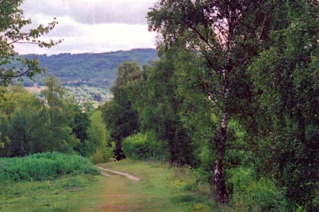
Click image to visit gallery of 7 images.
If arriving by car start from the car park in Wendover (Grid Ref SP868077) (Pay and display but free on Sunday). On leaving the car park turn left up the High Street and go straight on to pass Station Approach on the right, and still straight on over bridge over railway and A413. If arriving by train, turn right out of the booking hall, go up Station Approach and at the main road turn right to go over bridge over railway and A413.
Once over the bridge carry on uphill along the road. Opposite house number 50 cross road (CARE blind corner) to take the Ridgeway footpath. This is a well signed National Trail, either specifically with its name or with an acorn logo, so the first part of this walk is easy to follow. It starts up Bacombe Hill, a Nature Reserve. The original track was in a deep declivity, which can still be taken, but the signed route is now on higher ground to the right. Where the two paths rejoin extensive views start to open up to the right over the Vale of Aylesbury. Continue along the ridge on the obvious path. Where it splits to two gates in the fence ahead take the lower path and when this reaches a T-junction turn right to reach a National Trust area. The Boer War monument on top of Coombe Hill soon comes into sight. From this vantage point there are panoramic views through about 270 degrees, starting with Chequers to the South.
At the monument, turn left and continue along the ridge. Where the path splits, fork left on the same contour to enter woods and reach the exit from the National Trust area. Now follows a stretch through typical Chiltern beech woods. Having gone through the gates, follow the path along the edge of the woods to come out on a lane. Turn right and after a short distance turn left along a concrete drive for a very short distance and then right through a stepped fence gap. Turn left and follow the path through the woods, initially and intermittently with a fence to the right. Eventually the path goes through a gap in the fence to join a crossing path. Turn left. After going over a crossing footpath, leave the Ridgeway by turning left on a crossing bridleway.
Follow the bridleway down to a five way junction. Turn squarely right, on a footpath going up hill. Follow this to another multi track junction on the edge of the woods. Go through the gate into open fields (a clear cultivated area surrounded by woods, typical of the Chilterns) and go along the field edge, woods left. Look out for a way mark where you turn left back into the woods. At yet another multi track junction turn right along a bridle way. This soon becomes a tarmac lane going through the outskirts of Little Hampden, one of the remotest villages in the Chilterns, where there was once a pub, The Rising Sun, but alas no longer (although you may catch a sight of the old sign under the porch).
Continue down the lane and when you reach the village green turn left down the S. Bucks Way/Chiltern Way. The broad track goes into the woods, but fairly soon you need to look out for a much narrower path forking right which leads down to a cultivated "bottom" (dry valley). Go straight on, hedge right. At the lowest point dogleg right/left and then go up hill, hedge left. Enter woods and continue uphill to a crossing footpath. Turn left and follow the contours through wood and scrub with the open bottom down to the left. After several footpaths going off, mainly right, the path becomes a bridle way and starts to descend*. At the lowest point turn right alongside a fence (path not way-marked). After a short distance a footpath goes up off to the right and in a few yards emerges across a stile into a paddock. This is the start of a succession of stiles (useful seats for a picnic) from one paddock to another. The line is not straight. Sometimes a faint track on the grass is discernible, but it is as well while you are on the top of each stile to spot the next one. (Also look back and what you will see is a typical Chiltern agricultural clearing surrounded by beech woods.) Eventually you emerge onto a lane. Turn right and go along the lane to a cross roads at Dunsmore (Grid Ref SP862052). Turn left (signed Dunsmore Village only) and follow bridleway signs down the tarmac lane as far as The Beeches when it becomes a dirt path running down the side of the lovely garden. At a fork in the bridleway go right and down a fenced path between paddocks and into woods. The path turns right. Where it splits (marked by white stencilled arrows on a tree- the traditional route marker in the Chilterns but now usually faded and replaced by markers on special posts -when you think about it what a waste to kill trees to make posts to plant among trees) fork left steeply down. At a junction go straight on - another tree marker. At a cross track turn left -tree marker more difficult to spot - and soon emerge from the woods at a stile. Go diagonally left down the field. At the next stile again diagonally left over the hill to a kissing gate which leads to an enclosed path going straight on. When a lane is reached, turn right and go down to reach a bridge across the A413. At a T-junction turn left and thus into the centre of Wendover. Turn right for the car-park.
* If you wish to avoid the descent, and consequent ascent, if you turn sharp right up the bridle path instead of going down on it, or go up one of the earlier footpaths to the right you will come to a crossing bridle way. Turn left on this and it is a straight and level walk to the cross roads at Grid Ref SP862052.
Other walks nearby
| Walk 1138 | The Ridgeway at Chequers | easy/mod | 7.3 miles |
| Walk 2478 | Great Kimble Circular | moderate | 11.2 miles |
| Walk 3360 | Cholesbury Camp and Hawridge | easy | 4.4 miles |
| Walk 3098 | Tring & Wendover Woods | easy/mod | 7.5 miles |
| Walk 3669 | Grand Union Canal - Aylesbury to Wendover | moderate | 11.7 miles |
| Walk 3520 | Princes Risborough circular | easy/mod | 9.5 miles |
| Walk 2071 | Ivinghoe Beacon and Bridgewater Monument from Tring | easy/mod | 8.0 miles |
| Walk 2496 | Cow Roast and Aldbury from Tring Station | easy | 5.5 miles |
| Walk 1617 | Saunderton circular via Bledlow Ridge | moderate | 11.3 miles |
| Walk 1604 | Long Marston circular | easy/mod | 6.5 miles |
Recommended Books & eBooks
No suggestions for this area.Messaging & Social Media
Message Walking Britain and follow the latest news.

Mountain Weather
Stay safe on the mountains with detailed weather forecasts - for iOS devices or for Android devices.