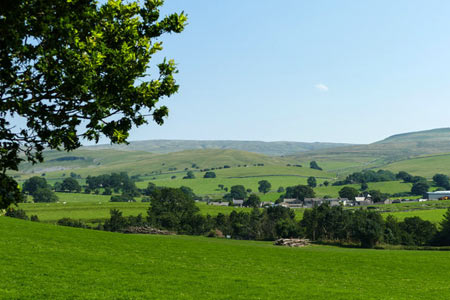
Nateby & Waitby Common from Kirkby Stephen
Cumbria Walk
County/Area - Cumbria - Eden Valley Mallerstang
Author - Lou Johnson
Length - 6.2 miles / 10.1 km Ascent - 600 feet / 182 metres
Time - 3 hours 40 minutes Grade - easy/mod
Maps 

| Ordnance Survey Explorer OL19 | Sheet Map | 1:25k | BUY |
| Anquet OS Explorer OL19 | Digital Map | 1:25k | BUY |
| Ordnance Survey Landranger 98 | Sheet Map | 1:50k | BUY |
| Anquet OS Landranger 98 | Digital Map | 1:50k | BUY |
Walk Route Description
Click image to see photo description.
This circular walk starts from the market town of Kirkby Stephen and follows a circular route to explore the rolling country to the south-west of the town. The route uses riverside paths, paths across the rolling country and a short section of road walking. The views are generally good.
Kirkby Stephen usually has plenty of parking including a car park to the west of the main road (grid ref. NY772088). Wherever you park locate the entrance to the parish church in the Market Square. With your back to the church turn left and walk down the narrow road next to the newsagents. Follow the sign for River Eden and Frank's Bridge down an alley, Stone Shot. At the bottom turn left and cross Frank's Bridge. Turn right along a path following the River Eden which is on your right.
Continue along the riverside path to reach a footbridge over Ladthwaite Beck (grid ref. NY779082). Here you join a walled track that leads you to the main B6259 through Nateby (grid ref. NY774069). Turn left along the road for a short distance and take the signed bridleway leading down to a bridge below Wharton Hall (grid ref. NY771064). Cross the bridge and walk up to a track which leads south to Wharton Hall. Turn right along this track for about 300 yards and take the track/footpath on your left which will take you gently uphill to a path junction at grid ref. NY766063. Here take the path on your right following the wall to take you under the Settle and Carlisle railway to Easegill Head. Continue through the buildings here and follow the access track up to the A683.
Turn right along the A683 to Lane Head. Turn left here along the A685 and almost immediately turn right down a quiet lane leading to Waitby to cross the eastern flank of Waitby Common. After three quarters of a mile, take the lane on the right. This is the first lane on the right since leaving the main road. Follow this lane for about 200 yards to turn right onto a signed footpath. The path goes under the Settle and Carlisle railway. Ignore the path on your left and continue half right across the field to a wall (grid ref. NY756074). Here go half left and follow the path to Greenriggs. Go between the buildings and follow the access road back into Kirkby Stephen.
Other walks nearby
| Walk 1382 | Mallerstang circular | easy/mod | 7.0 miles |
| Walk 1386 | Hartley Birkett & Nine Standards Rigg | easy/mod | 4.5 miles |
| Walk 3573 | Wild Boar Fell from Pendragon Castle | moderate | 8.3 miles |
| Walk 1383 | Pendragon Castle | easy | 2.3 miles |
| Walk 1341 | Nine Standards Rigg | moderate | 6.0 miles |
| Walk 1389 | Fell End Clouds | easy | 3.0 miles |
| Walk 1342 | Randygill Top from Weasdale | moderate | 6.0 miles |
| Walk 1616 | Bowderdale and the Calf | moderate | 10.0 miles |
| Walk 1160 | Wild Boar Fell & Swarth Fell | moderate | 7.0 miles |
| Walk 1768 | Thomas Gill and Ravenseat from Tan Hill | moderate | 8.7 miles |
Recommended Books & eBooks
Walking the Lake District Fells - Patterdale
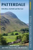 Part of the Walking the Lake District Fells series, this guidebook covers a wide range of routes to 35 Lakeland summits that can be climbed from Ambleside, Grasmere and Patterdale and the Thirlmere and Ullswater valleys, with highlights including Helvellyn and Fairfield. Suggestions for longer ridge routes are also included.
More information
Hadrian's Wall Path
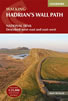 Hadrians Wall Path guidebook to walk the 84 mile National Trail. Described in both directions, the main description is west to east between Bowness-on-Solway and Wallsend, Newcastle, with extensions to Maryport and South Shields. With extensive historical information related to this World Heritage site and separate 1:25,000 OS map booklet included.
More information
Messaging & Social Media
Message Walking Britain and follow the latest news.

Mountain Weather
Stay safe on the mountains with detailed weather forecasts - for iOS devices or for Android devices.