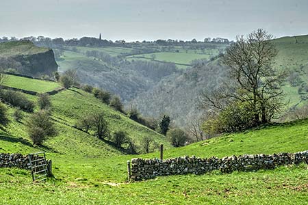
Wetton & Manifold Valley from Wetton
Peak District Walk
Nat Park - Peak District - Dovedale Manifold Valley
County/Area - Staffordshire
Author - Lou Johnson
Length - 3.6 miles / 5.9 km Ascent - 800 feet / 242 metres
Time - 2 hours 40 minutes Grade - easy/mod
Maps 

| Ordnance Survey Explorer OL24 | Sheet Map | 1:25k | BUY |
| Anquet OS Explorer OL24 | Digital Map | 1:25k | BUY |
Walk Route Description
Click image to visit gallery of 6 images.
The start of this Peak District walk in the White Peak is the free car park at grid ref. SK108553 where there are public toilets. This car park is signed from most roads entering the village. Cross the stile at the back of the car park (no footpath sign) and cross a large paddock usually with horses grading. Continue across the paddock to a lane. Turn left and follow the lane bearing right at the first junction. On the left there is a signed track to Thor's Cave and immediately after a footpath sign pointing down a field towards the Manifold Valley. Although Thor's Cave is not included in this walk you can include it as an optional 'extra'. Descend the field. At the first footpath junction (Thor's Cave is signed to the left) continue ahead soon reaching a footbridge over the River Manifold.
Cross the footbridge and turn right along the well-maintained Manifold Way. Take care as this is a mixed-use track and you will be sharing the route with cyclists. After about 700 metres of easy walking you reach a lane (grid ref. SK098556). Turn right across the River Manifold (which is usually just a dry river bed) and almost immediately take the footpath on the left. You are now entering the National Trust managed open access area of Wetton Hill. Follow the clear path up the dry valley probably seeing few walkers as make you progress through pleasant limestone scenery.
After about 1.5 kilometres you reach an open area with a three-storey house ahead (grid ref. SK104566). Bear right here on a grassy path climbing steadily with a stone wall to your immediate left. After 500 metres look out for a step stile built into the wall on your left (grid ref. SK107562). Cross this stile and immediately bear right over another stile. The onward path goes half left across this field to another wall stile. Cross this and follow the clear path as it climbs briefly past limestone outcrops. The way ahead is obvious and with good views in all directions you descend to a track with a water reservoir surrounded by grass banks on your left.
Continue down the track into the village of Wetton. Reaching the road (grid ref. SK108554) continue straight ahead. If you wish to visit the café, then turn right here. Walk past the pub (on your right) and continue to the first lane on your right, which has signs directing you to the car park and WC. Turn right and the car park is a short walk along the lane.
Other walks nearby
| Walk 2537 | Ecton Hill & Wetton from Wetton Mill | moderate | 7.0 miles |
| Walk 1021 | Milldale & Hall Dale | easy/mod | 5.0 miles |
| Walk 1257 | Wolfscote Dale | easy/mod | 7.5 miles |
| Walk 1709 | Milldale and Wolfscote Dale | easy/mod | 6.5 miles |
| Walk 3597 | Manifold Valley, Thor's Cave, Ecton & Wetton Hills from Alstonefield | moderate | 10.0 miles |
| Walk 3601 | Dove & Manifold Valleys | moderate | 10.0 miles |
| Walk 2252 | Manifold Valley and Ecton Hill | easy/mod | 6.3 miles |
| Walk 2455 | Lum Edge & Revidge Moor | easy/mod | 6.5 miles |
| Walk 3455 | Manifold Valley & Dovedale om Ilam | moderate | 9.5 miles |
| Walk 3527 | Dovedale and Manifold Valley from Ilam | moderate | 7.5 miles |
Recommended Books & eBooks
Great Mountain Days in the Pennines
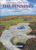 An inspirational guidebook to 50 classic walks on the rolling Pennine landscape. The graded routes, between 6 and 13 miles in length, cover classic Pennine fells and moorland such as Whernside, Ilkley Moor and Pendle Hill; exploring the North and South Pennines, Yorkshire Dales, Howgills and Dark Peak. Many routes are also suited to fell running.
More information
Dark Peak Walks
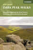 Guidebook to 40 walks in the Dark Peak area of the Peak District National Park. 35 circular routes for most abilities, from 8km to 19km, around Edale, Marsden, Fairholmes, Baslow and Castleton, including Kinder Scout and Mam Tor, and 5 longer (25km to 45km) routes highlighting the best of the Gritstone Edges, High Moorland and Deep Valleys.
More information
Messaging & Social Media
Message Walking Britain and follow the latest news.

Mountain Weather
Stay safe on the mountains with detailed weather forecasts - for iOS devices or for Android devices.