Highcliff Nab and Guisborough Moor from Commondale
North York Moors Walk
Nat Park - North York Moors - North York Moors West
County/Area - North Yorkshire
Author - Andy Chaplin
Length - 11.1 miles / 18 km Ascent - 1090 feet / 330 metres
Time - 6 hours 40 minutes Grade - moderate
Maps 

| Ordnance Survey Explorer OL26 | Sheet Map | 1:25k | BUY |
| Anquet OS Explorer OL26 | Digital Map | 1:25k | BUY |
Walk Route Description
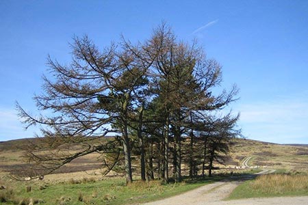
Click image to visit gallery of 3 images.
This walk in the North York Moors National Park is a circuit around the Skelderskew, Guisborough and Commondale Moors with a slight detour to take in Highcliff Nab to enjoy the great views northwards to the coast. The walk starts at the parking area (grid ref. NZ656105) just west of the village of Commondale. From here you walk east along the road back into the village. Bear left at the junction in front of the Cleveland Inn and continue along the road to the village church.
Do not take the first path off on the left but continue parallel to the road until a track heads off northwards along the east side of a fence. The path soon follows a line of boundary stones then angles off eastwards to join the road. Almost immediately you go left on? Quakers Causeway path which becomes a paved footpath after a half mile.
Branch left at the intersection of paths (grid ref. NZ659130) then follow this path to Westworth Wood. The paths were not particularly clear in the wood so, if in doubt, try to stay near the eastern edge and if you start to follow a beck valley then you need to get further over to the east.
The entrance into Guisborough woods is a gate and enclosure at grid ref. NZ635144. From there you take a path straight over the top of the hill to pick up the Cleveland Way. Then follow the Cleveland Way it all the way to Highcliff Nab. There are spectacular views north all the way along the top.
From the Nab head south on the Cleveland Way until it goes into Guisborough Moor where you leave the CW and follow the moor track east along the northern fence towards the trig point. From here you follow moors tracks south over Penrod Hill then east and south again towards North Ings. For all of this section you exchange the great views north to the coast for great views south across the moors towards Levendale and Sleddale.
At the farm at North Ings, the footpath goes around the east of the property and then picks up the track again as it makes its way down to the parking place near Commondale.
Other walks nearby
| Walk 1538 | Baysdale Circular | moderate | 9.5 miles |
| Walk 3187 | Esklets and Rosedale Head from Westerdale | moderate | 11.0 miles |
| Walk 3737 | Commondale & Esk Valley | easy/mod | 8.2 miles |
| Walk 1050 | Highcliff Nab & Roseberry Topping from Slapewath | moderate | 10.5 miles |
| Walk 1467 | Cleveland Way - Roseberry Common to Tidy Brown Hill | moderate | 15.0 miles |
| Walk 1450 | Little & Great Fryup Dales | moderate | 8.3 miles |
| Walk 1330 | Roseberry Topping & Captain Cook's Monument | easy/mod | 6.5 miles |
| Walk 3160 | Roseberry Topping and Captain Cook's Monument | easy/mod | 6.3 miles |
| Walk 2930 | Roseberry Topping from Newton under Roseberry | easy | 3.2 miles |
| Walk 1452 | Leaholm Moor & Scaling Dam | moderate | 9.8 miles |
Recommended Books & eBooks
Trail and Fell Running in the Yorkshire Dales
 Guidebook to 40 of the best trail and fell runs in the Yorkshire Dales National Park. Ranging from 5 to 24 miles, the graded runs start from bases such as Ribblehead, Dent, Sedbergh, Malham and Grassington and take in the region's diverse delights, from castles and waterfalls to iconic mountains such as Whernside, Ingleborough and Pen Y Ghent.
More information
Messaging & Social Media
Message Walking Britain and follow the latest news.

Mountain Weather
Stay safe on the mountains with detailed weather forecasts - for iOS devices or for Android devices.