Pennypie and Blanchland from Baybridge Walk
Walk 2815 - Route Maps
Route Map
Digital Maps - Copyright © 2011-2024. All rights reserved.
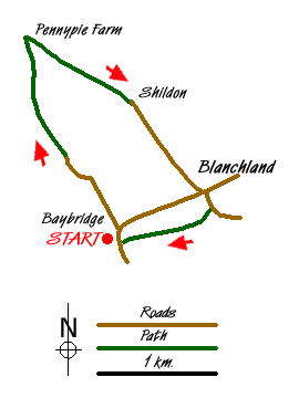
Sketch Map
Suggested Maps 

| Ordnance Survey Explorer OL43 | Sheet Map | 1:25k | BUY |
| Anquet OS Explorer OL43 | Digital Map | 1:25k | BUY |
| Ordnance Survey Landranger 87 | Sheet Map | 1:50k | BUY |
| Anquet OS Landranger 87 | Digital Map | 1:50k | BUY |
It is recommended you take a map. The preferred scale is 1:25k.
Start Point Details
Ordnance Survey Grid Ref NY957499
Latitude 54.843893 Longitude -2.068485
Postcode DH8 9UB
what3words start brief.freezing.glance
Walk description may contain detailed information on the start point for this walk.
Further Information
North Pennines
This National Landscape (formerly AONB), the second largest in area, covers some wild and remote landscapes in northern England. The area is dominated by the Pennine hills and includes large areas of undulating heather moors and peat. North Pennines Walking Guide
Northumberland County
Northumberland is a county of contrasts. The North Sea coast offers some excellent walking and includes the island of Lindisfarne. Inland, there is some glorious countryside with the hills and moors of the Cheviots as an ever present backdrop. Historic houses, castles and villages provide added interest to many walks.
Walk grading - Learn how each walk is assessed and select a walk to suit your ability and experience by going to Walk Grading Details.
Messaging & Social Media
Message Walking Britain and follow the latest news.

Mountain Weather
Stay safe on the mountains with detailed weather forecasts - for iOS devices or for Android devices.