Barnes to Richmond along the Thames Path
London Walk
County/Area - London
Author - Lou Johnson
Length - 6.0 miles / 9.8 km Ascent - 100 feet / 30 metres
Time - 3 hours 10 minutes Grade - easy
Maps 

| Ordnance Survey Explorer 161 | Sheet Map | 1:25k | BUY |
| Anquet OS Explorer 161 | Digital Map | 1:25k | BUY |
| Ordnance Survey Landranger 176 | Sheet Map | 1:50k | BUY |
| Anquet OS Landranger 176 | Digital Map | 1:50k | BUY |
Walk Route Description
Click image to visit gallery of 9 images.
This is a straightforward linear walk that follows a section of the Thames Path. To complete the circuit you can use the regular train service between start and finish for the return leg. The route is flat throughout and there is plenty to see en-route.
The start is Barnes railway station (grid ref. TQ222756) which is served by regular trains from Waterloo. Exit the station on the north side and follow Station Road into the centre of Barnes. Arriving at Barnes Green, turn left into Barnes High Street. There is a 'village' feel to this area and it is hard to imagine you are so close to a major city. After 300 metres you reach the Thames.
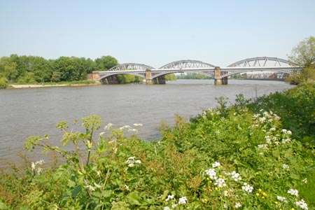
Cross the road and join the Thames Path. Walk upstream with the river to your right. The route requires very little description and is well signed throughout. Do remember this section is shared with cyclists who seem to be averse to using their bells to warn of their approach. Under Barnes Bridge the path leads to Mortlake. On this section, you are likely to see many rowers training especially at weekends. Under Chiswick Bridge, past the National Archive on your left, under another railway bridge and you reach Kew Pier and Bridge.
Kew Gardens is passed on the left and there is a convenient entrance is you wish to pay admissions to visit this wonderful attraction. Across the river lies Syon Park. Kew Gardens becomes the Old Deer gardens on the left and you pass the Richmond Lock and Footbridge. This is operated by the Port of London Authority and is the last lock until the estuary.
If the weather is fine, the path is likely to get much busier as the centre of Richmond is reached. Passing under a road and rail bridge, the pubs and cafes on the waterfront at Richmond come into sight. Richmond station is reached by taking Water Lane on the left. This leads into George Street with the station a short walk down on the right.
Other walks nearby
| Walk 1326 | The Thames Path Putney to Barnes | easy | 4.0 miles |
| Walk 3448 | Richmond Park and Petersham Circular | easy/mod | 8.9 miles |
| Walk 3069 | Queensway to Buckingham Palace | easy | 3.5 miles |
| Walk 1322 | Green Park to Trafalgar Square | easy | 2.5 miles |
| Walk 2360 | Green Park to Westminster via Sloane Square | easy/mod | 5.5 miles |
| Walk 3012 | Green Park to Trafalgar Square via Lambeth Bridge | easy | 4.5 miles |
| Walk 3698 | Central London from Green Park | easy | 5.2 miles |
| Walk 1570 | Westminster to Green Park via St. Paul's | easy/mod | 5.5 miles |
| Walk 3013 | Trafalgar Square circular | easy | 3.0 miles |
| Walk 1734 | Hampton Court Parks and Gardens | easy/mod | 6.5 miles |
Recommended Books & eBooks
Walking in London
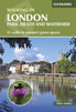 A guidebook to 25 walks in London's green spaces and nature reserves, covering both the city centre and Greater London area. Taking in woods and forests, parks and heaths, canals and rivers, the guide includes a wealth of information about some of the species you might encounter as well as the history and conservation of these areas.
More information
The Thames Path Map Booklet
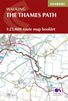 Map of the 180 mile (288km) Thames Path National Trail, from London's Thames Barrier to the river's source near Cirencester in Gloucestershire. This booklet is included with the Cicerone guidebook to the trail, and shows the full route on OS 1:25,000 maps. The easy riverside route takes around two weeks to walk.
More information
Messaging & Social Media
Message Walking Britain and follow the latest news.

Mountain Weather
Stay safe on the mountains with detailed weather forecasts - for iOS devices or for Android devices.