Holme next the Sea and Thornham
Norfolk Walk
County/Area - Norfolk
Author - Barry Mackie
Length - 7.5 miles / 12.2 km Ascent - 220 feet / 67 metres
Time - 4 hours 0 minutes Grade - easy/mod
Maps 

| Ordnance Survey Explorer 250 | Sheet Map | 1:25k | BUY |
| Anquet OS Explorer 250 | Digital Map | 1:25k | BUY |
| Ordnance Survey Landranger 132 | Sheet Map | 1:50k | BUY |
| Anquet OS Landranger 132 | Digital Map | 1:50k | BUY |
Walk Route Description
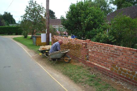
Click image to visit gallery of 9 images.
This part of the Norfolk coast is both designated as an Area of Outstanding Natural Beauty (AONB) and also has one of England and Wales's 15 National Trails passing through it. The walk described here visits the AONB, using some sections of the National Trail, The Peddars Way & Norfolk Coastal Path. The route is almost equally divided between first crossing some of the open arable countryside that is so predominant in East Anglia and then alongside some fascinating coastline. During the walk, Holme Nature Reserve and the picturesque village of Thornham are visited
Leave the car park, (grid ref TF698438) and immediately you are on the National Trail, so look out for the distinctive black and white acorn logo that will help to guide you for much of the walk. Turn left into the lane, away from the sea and soon cross the River Hun to reach the A149 road. Go straight over this road, passing between the two large wooden posts on the far verge and onto the unmade footpath, continuing in a south southeast direction. The route is very much into the countryside now, with the track continuing alongside hedgerows and fields. There are some nice views over open farmland and ahead of you an old windmill tower (alongside the farmhouse at grid ref TF705416).
At the edge of a field (grid ref TF703418) turn left to reach the minor road. The Peddars Way trail turns right at this point, but we leave it for a while and instead turn left (North) along this minor road for approx 150m to reach a farm track (not waymarked) heading west (right) across the fields away from the road. Follow this track (Green Bank) from which you will be able to see the coast a couple of miles away on your left, to reach the road. Continue for a short distance to the junction, and unless you have been paying close attention to the map, you will be pleasantly surprised to see a trig pillar on the left side. This really is quite fitting, as since starting at the car park you will have been on the gentlest of uphill gradients, and at 49m this place is actually the highest land reached throughout the walk.
Maintain direction (East) along the road to reach the T-junction, then turn left (north) along the road towards Thornham. When you reach the main road (A149) turn right into the village where most of the cottages are constructed with a very attractive combination of brick, flint and local stone. To cross the road safely, pick a spot well before the sharp bend and then turn left into Church Street, passing the pub and restaurant on the left and a superb flint walled church on your right.
Here you rejoin The Peddars Way trail. At the end of this lane turn left onto the path and then soon left again over the wooden footbridge to start along the coastal path. Most of this early section will be along the top of the sea defence embankment and therefore well above the surrounding lands, which are predominantly salt marshes and reed beds. The views you get, particularly to the coastal side will be somewhat determined by the state of the tides, but whatever the sea level this is an unusual and remarkable place.
Alongside the path there are several very useful information boards and lots to see and admire. Stop off at the Visitor Centre (not shown on the OS Explorer map) some 100m off the path as you go through Holme Nature Reserve. There you will be able to get ice creams and sort drinks and also get plenty of information about what is happening on the reserve. The walk finishes as you get close to the boundary of the golf course. Just turn left off the trail as you come alongside the car park to return to the start point.
Notes
The Peddars Way & Norfolk Coast Path is a National Trail. As with all these routes, you will find that the waymarking will be excellent, although do not expect perfect conditions underfoot. At every change in direction, there are the distinctive acorn symbols that are used on all the national trails. There are no problems on the coastal path, and there are plenty of opportunities to come off along this section and explore the sand dunes and beaches. Do take notice and heed the various warning signs though, an incoming tide can quickly leave you stranded.
How to get there
By car - Leave the town of Hunstanton and head west on the A149, then turn left at grid ref TF669429. At the end of the lane (signposted to the beach) is the car park on the right side.
By public transport - There is a regular bus service that stops at the same junction on the A149. Traveline - tel 0871 200 22 33.
Other walks nearby
| Walk 2922 | Old Hunstanton to Thornham by the Coast Path | easy | 4.5 miles |
| Walk 3640 | Thornham Circular | easy | 5.0 miles |
| Walk 3514 | Brancaster to Burnham Overy Staithe | easy | 6.0 miles |
| Walk 3416 | Hunstanton from South Beach, Heacham | easy | 6.0 miles |
| Walk 1640 | Snettisham Beach RSPB reserve | easy | 4.0 miles |
| Walk 1035 | Burnham Market | easy | 5.5 miles |
| Walk 3256 | Great Bircham & Fring Circular | easy/mod | 8.4 miles |
| Walk 1908 | Wells-next-the-Sea & Holkham Park | easy/mod | 8.0 miles |
| Walk 2101 | Holkham Park circular | easy | 4.5 miles |
| Walk 3254 | Holkham & Holkham Park Circular | moderate | 10.2 miles |
Recommended Books & eBooks
No suggestions for this area.Messaging & Social Media
Message Walking Britain and follow the latest news.

Mountain Weather
Stay safe on the mountains with detailed weather forecasts - for iOS devices or for Android devices.