Eston Moor from Flatts Lane
Redcar and Cleveland Walk
County/Area - Redcar and Cleveland
Author - Peter Smyly
Length - 3.0 miles / 4.9 km Ascent - 400 feet / 121 metres
Time - 1 hours 50 minutes Grade - easy
Maps 

| Ordnance Survey Explorer OL26 | Sheet Map | 1:25k | BUY |
| Anquet OS Explorer OL26 | Digital Map | 1:25k | BUY |
| Ordnance Survey Landranger 93 | Sheet Map | 1:50k | BUY |
| Anquet OS Landranger 93 | Digital Map | 1:50k | BUY |
Walk Route Description
Click image to visit gallery of 6 images.
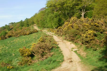
This is a gentle walk up a ridge overlooking the town of Middlesbrough with views out to the North Sea beyond and towards Roseberry Topping and Urra Moor in the opposite direction. The walk is not very long and presents no difficulties in terms of terrain, gradient or route finding and could be done in a couple of hours.
The start point is the car park at Flatts Lane Woodland Country Park. Take the path up the grassy hill and cross carefully over Flatts Lane which is quite a busy road but without a pavement. A narrow path on the other side leads up through woodland to join, at a T junction of paths, a much wider path (a bridleway) coming in from the right. Bear left and follow the path up the hill, the gradient being generally gentle and the way ahead unmistakably clear. Views of Middlesbrough appear on the left and, as the ridge and path gain height, the beacon of Eston Moor appears in the distance ahead. As the gradient eases off, a sheet of water, Carr Pond, appears on the right. The centre section is so overgrown as to give the appearance of two separate ponds, though the section to the left is much more vegetation-free and is home to some ducks.
The bridleway leads along the ridge to the beacon which marks the highest point, though it unfortunately has graffiti on it. There is a bit of an escarpment with rock outcrops off to the side and, as far as Middlesbrough is concerned, features of note include the transporter bridge. Roseberry Topping's dome-shaped appearance stands out in the distance to the south/south east along with Captain Cook's Monument. Urra Moor and Cringle Moor can also be seen further over to the right.
Return to the car park by reversing the outgoing route.
Other walks nearby
| Walk 3160 | Roseberry Topping and Captain Cook's Monument | easy/mod | 6.3 miles |
| Walk 2930 | Roseberry Topping from Newton under Roseberry | easy | 3.2 miles |
| Walk 1330 | Roseberry Topping & Captain Cook's Monument | easy/mod | 6.5 miles |
| Walk 1467 | Cleveland Way - Roseberry Common to Tidy Brown Hill | moderate | 15.0 miles |
| Walk 1050 | Highcliff Nab & Roseberry Topping from Slapewath | moderate | 10.5 miles |
| Walk 2685 | Highcliff Nab and Guisborough Moor | moderate | 11.1 miles |
| Walk 2174 | Warsett Hill from Saltburn-by-the-Sea | easy | 4.3 miles |
| Walk 1468 | Wain Stones, Bank Foot & Bloworth Crossing | moderate | 14.3 miles |
| Walk 1538 | Baysdale Circular | moderate | 9.5 miles |
| Walk 1469 | Carlton Bank, Scugdale, Raisdale & Kirby Bank | moderate | 10.5 miles |
Recommended Books & eBooks
No suggestions for this area.Messaging & Social Media
Message Walking Britain and follow the latest news.

Mountain Weather
Stay safe on the mountains with detailed weather forecasts - for iOS devices or for Android devices.