Cholesbury Camp and Hawridge
Chilterns Walk
Region - Chilterns
County/Area - Buckinghamshire - South Buckinghamshire
Author - Lou Johnson
Length - 4.4 miles / 7.2 km Ascent - 300 feet / 91 metres
Time - 2 hours 30 minutes Grade - easy
Maps 

| Ordnance Survey Explorer 181 | Sheet Map | 1:25k | BUY |
| Anquet OS Explorer 181 | Digital Map | 1:25k | BUY |
Walk Route Description
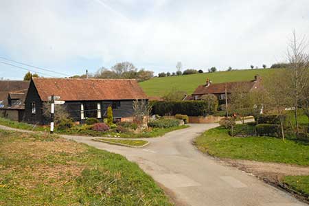
Click image to visit gallery of 6 images.
This Chilterns walk is an ideal way to spend a few hours exploring the countryside to the east of the village of Cholesbury. Parking is available adjacent to the cricket pitch (grid ref. SP932071). After parking and with your back to the cricket field, turn right and walk the short distance to the road junction. Turn right (signed Tring and Wigginton) and follow this road for about 400 metres passing a side road on your left to reach a signed footpath on your right (just before a large house on your left. Turn right here and follow the footpath heading left keeping the boundary to Cholesbury Common on your left. Follow this path, ignoring paths on your right heading across the common for just over a kilometre to reach a lane (grid ref. SP943069).
Cross the lane and continue on the clear path into Hawridge Common again keeping the boundary to the open access area on your left. Ignore paths leading off to the right and continue through light woodland to reach a lane at Vale Farm (grid ref. SP949062). Continue straight ahead here along the lane and take the rising footpath on your right through woodland to reach a road junction (grid ref. SP950060). Cross Cholesbury Lane and take the lane signed to Hawridge Church. Follow the lane past St Mary's church on your left to reach the end of the lane. Take the signed footpath leading down an enclosed path between houses and into open fields. Turn left at the first footpath junction and in a short distance turn right and descend into the valley.
Turn right along the valley path and follow this for about to two kilometres of pleasant walking to reach Ray's Hill (grid ref. SP933068). Cross the road and take the footpath opposite. At the first footpath junction turn right and climb gently up to the main road through Cholesbury. Turn left and take the first road on your right (Parrot's Lane). Bear left into a driveway to the Church. Bear left onto a signed footpath that leads around the impressive earthworks of Cholesbury Camp and follow this in an almost complete circle to return to the main road through the village. Turn left and continue past the Village Hall on your left to return to the start.
Other walks nearby
| Walk 3098 | Tring & Wendover Woods | easy/mod | 7.5 miles |
| Walk 2071 | Ivinghoe Beacon and Bridgewater Monument from Tring | easy/mod | 8.0 miles |
| Walk 2496 | Cow Roast and Aldbury from Tring Station | easy | 5.5 miles |
| Walk 3503 | Circular from Berkhamsted | easy | 4.0 miles |
| Walk 1297 | Berkhamsted and Northchurch Commons | easy | 5.0 miles |
| Walk 1399 | Berkhamsted & Northchurch Commons | easy | 5.5 miles |
| Walk 2369 | Chesham & Little Missenden Circular | easy/mod | 9.4 miles |
| Walk 1149 | Chesham to Rickmansworth (Chess Valley) | easy/mod | 10.5 miles |
| Walk 1060 | Little Missenden and Amersham | easy/mod | 8.5 miles |
| Walk 1392 | Chesham & Cholesbury Circular | moderate | 16.0 miles |
Recommended Books & eBooks
No suggestions for this area.Messaging & Social Media
Message Walking Britain and follow the latest news.

Mountain Weather
Stay safe on the mountains with detailed weather forecasts - for iOS devices or for Android devices.