Upper Erme Valley & Ugborough Moor
Dartmoor Walk
Nat Park - Dartmoor
County/Area - Devon
Author - Lou Johnson
Length - 9.3 miles / 15.1 km Ascent - 1400 feet / 424 metres
Time - 6 hours 0 minutes Grade - moderate
Maps 

| Ordnance Survey Explorer OL28 | Sheet Map | 1:25k | BUY |
| Anquet OS Explorer OL28 | Digital Map | 1:25k | BUY |
Walk Route Description
Click image to see photo description.
This interesting Dartmoor walk explores the upper Erme Valley has many archaeological sites including Iron Age settlements, stone rows, stone circles and Bronze Age burial cairns. Care is needed with navigation, a map essential, and in places the going can be tough. The walk is not recommended after heavy rain. The return route uses a section of the Two Moors Way following the former Redlake Tramway which offers relaxed walking.
The start is the parking area at Harford Moor Gate (SX643595) a short distance east of Harford village. After parking walk back down the lane through Harford passing the church on your right. Continue along the lane to cross the bridge over the River Erme. Continue along the lane past a house on your left to reach a wooden gate on the right (grid ref. SX635596). Go through the gate and follow the rising track beyond. The path keeps to the right of the woodland and leads to a get. Pass through the gate and head slightly right to the Tristis Rock. From here initially head northwest to locate the Burford Down Stone Row and then follow the row north to a gate (grid ref. SX636606).
From this gate head roughly north to reach a hedge which you keep on your left to continue to reach a track which is flanked by the foundations of prehistoric settlements (grid ref. SX637612). Cross the track and walk north to Hillson's House (grid ref. SX637623). From here bear left on a path to the stone row on Stalldown Barrow. Turn north and follow a path (vague in places) that heads north/north-east crossing Bledge Brook to reach the Dancers Stone Circle (SX635645). Continue north for 600 metres following the adjacent stone row to reach a cairn. Bear right and descend to the river and follow it upstream to find a suitable crossing point.
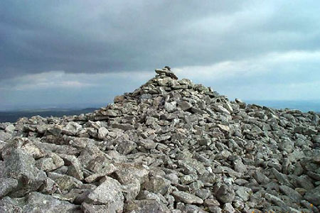
Once across the river head south/southeast to locate a rising path. This leads to the former Redlake Tramway at grid ref. SX644643, which is now a section of the Two Moors Way. Follow the clear path south for just over a kilometre before veering left to reach the summit of Three Barrows on Ugborough Moor. After enjoying the extensive view follow the rough descending path south to re-join the former tramway, which is followed for two kilometres. An interesting diversion in to visit Longstone and Hobjohn's Cross which lie a short way off the tramway on your right. Where the tramway curves right, take a rough path heading southwest back to Harford Moor Gate.
Other walks nearby
| Walk 3223 | Avon Dam Reservoir & White Barrows | easy/mod | 5.5 miles |
| Walk 2219 | The Avon Dam Reservoir from Shipley Bridge | easy | 3.5 miles |
| Walk 3641 | Avon Dam & Redlake Tramway from Shipley Bridge | moderate | 7.2 miles |
| Walk 1657 | Huntingdon Warren & Lud Gate from Scorriton | moderate | 7.0 miles |
| Walk 2013 | The Plym Valley from Plym Bridge | easy | 5.0 miles |
| Walk 2015 | The Meavy & Plym valleys from Shaugh Bridge | moderate | 6.0 miles |
| Walk 1083 | Eylesbarrow & Sheeps Tor | moderate | 8.0 miles |
| Walk 2018 | Saltram Park & Hardwick Wood, Plymouth | easy | 5.0 miles |
| Walk 2016 | Cross Gate to Nuns Cross via Leather Tor | moderate | 8.0 miles |
| Walk 3458 | Sharrah Pool from New Bridge | easy | 3.4 miles |
Recommended Books & eBooks
No suggestions for this area.Messaging & Social Media
Message Walking Britain and follow the latest news.

Mountain Weather
Stay safe on the mountains with detailed weather forecasts - for iOS devices or for Android devices.