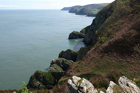
Heddon Valley from Woody Bay
Exmoor Walk
Nat Park - Exmoor
County/Area - Devon
Author - Lou Johnson
Length - 5.3 miles / 8.6 km Ascent - 1400 feet / 424 metres
Time - 4 hours 0 minutes Grade - moderate
Maps 

| Ordnance Survey Explorer OL9 | Sheet Map | 1:25k | BUY |
| Anquet OS Explorer OL9 | Digital Map | 1:25k | BUY |
Walk Route Description
Click image to see photo description.
This walk along the North Devon coast in the Exmoor National Park provides an excellent introduction to the dramatic scenery in this area. The rolling hills of the interior drop steeply to the sea and this route offers superb views along the coat. The outward route uses the South West Coast Path to reach Heddon's Gate from where a high-level path is followed back to the start.
The start is the small parking area (grid ref. SS676486) on the side of the narrow lane dropping from Martinhoe Common down to Woody Bay. To reach the start, take Berry's Ground Lane from Martinhoe Common which is signed to Woody Bay. At the first junction bear left following the lane downhill signed Woody Bay and Lynton via the toll road. Descend the lane, continue around a sharp right-hand bend and the parking area is short way down on the right. To start the walk, continue downhill and take the first tarmac lane on the left signed as a no through road. Follow the lane for 600 metres to a hairpin bend. Leave the lane at this point and take the broad path signed as the South West Coast Path (grid ref. SS672490).
The path is easy to follow and after an initial section through trees the view opens up as you make progress to pass above Great Burland Rocks to reach Highveer Point with Heddon's Mouth Beach below. The path then descends across the hillside into the valley. A path comes in from the beach on your right and continues up the Heddon valley. Reaching a path junction (grid ref. SS655488), continue ahead leaving the South West Coast Path which heads right. Continue along the clear path to reach Hunter's Inn (grid ref. SS655482) where refreshments are available.
Retrace your steps along the path by the side of the Hunter's Inn and bear right off the path used to reach this point. The path/track climbs steadily up through trees before looping around a side valley into more open country soon arriving above Highveer Point. The path bears right with views down to the path used earlier. You soon reach a concessionary path on your right leading up to The Beacon, a former Roman Fort. To continue the main route, continue straight ahead as it winds its way above the coast with excellent views to be enjoyed. The path bears right with West Woodybay Wood below on your left. Continue following the clear path to reach a lane at a hairpin bend. Bear left and follow the lane downhill to the parking area.
An alternative starting point is the National Trust Heddon Valley pay and display car park near Hunter's Inn (grid ref. SS655482). If you take this option take the signed path to the right of the Inn and after a short way bear right at the first path junction. The follow the instructions in paragraph 4 to the parking area. Then follow the outward route as described above.
Other walks nearby
| Walk 3394 | Holdstone Down & Trentishoe | moderate | 7.0 miles |
| Walk 3391 | Valley of Rocks frrom Lynton | easy/mod | 3.8 miles |
| Walk 1910 | Countisbury and Watersmeet from Lynmouth | easy/mod | 4.5 miles |
| Walk 3729 | Foreland Point | moderate | 5.0 miles |
| Walk 3393 | Great Hangman Hill | easy/mod | 4.3 miles |
| Walk 1727 | Shallowford, Hoar Oak Tree & The Chains | moderate | 11.7 miles |
| Walk 2387 | Pinkery Pond Circular | easy/mod | 5.8 miles |
| Walk 1263 | The Doone Valley | moderate | 8.5 miles |
| Walk 1262 | Watersmeet & Foreland Point | mod/hard | 10.5 miles |
| Walk 3386 | Barle Valley & Cow Castle from Simonsbath | easy/mod | 6.4 miles |
Recommended Books & eBooks
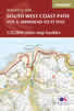
South West Coast Path Map Booklet - St Ives to Plymouth
 Map of part of the southern section of the 630 mile (1014km) South West Coast Path National Trail. Covers the trail from St Ives to Plymouth along the west Cornwall and Devon coastline. This convenient and compact booklet of Ordnance Survey 1:25,000 maps shows the route, providing all of the mapping you need to walk the trail in either direction.
More information
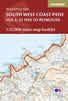
South West Coast Path Map Booklet - Minehead to St Ives
 Map of the northern section of the 630 mile (1014km) South West Coast Path National Trail. Covers the trail from Minehead to St Ives along the north Devon and Cornish coastline. This convenient and compact booklet of Ordnance Survey 1:25,000 maps shows the route, providing all of the mapping you need to walk the trail in either direction.
More information
Messaging & Social Media
Message Walking Britain and follow the latest news.

Mountain Weather
Stay safe on the mountains with detailed weather forecasts - for iOS devices or for Android devices.