Dog Rose Ramble (London Borough of Ealing)
London Walk
County/Area - London
Author - Peter Smyly
Length - 8.1 miles / 13.2 km Ascent - 250 feet / 76 metres
Time - 4 hours 20 minutes Grade - easy/mod
Maps 

| Ordnance Survey Explorer 172 | Sheet Map | 1:25k | BUY |
| Anquet OS Explorer 172 | Digital Map | 1:25k | BUY |
Walk Route Description
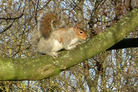
Click image to visit gallery of 4 images.
For walkers already acquainted with parts of the London Loop and the Capital Ring, this walk will have a familiar feel about it as it features some of the greener spaces of London's suburbia, this time in the London Borough of Ealing. Sturdy footwear is advisable as, depending on recent weather conditions, wet and muddy stretches are likely to be encountered from time to time. If you are hoping to find "Dog Rose Ramble" waymarkers at reasonably frequent intervals you are likely to be disappointed, therefore be prepared to route-find in your usual preferred fashion preferably using the relevant OS 1:25000 map. The route coincides with part of the waymarked Hillingdon Trail. By London standards, this is a walk of some variety in terms of scenery.
Although the four mounds of the Northala Fields are slightly off route, they are easily the best bit of the whole walk if included, offering height and airy views far and wide stretching as far as Box Hill and the North Downs in one direction and Harrow on the Hill and Horsenden Hill in another. If you think you are familiar with London parks, then this is one with a difference that could not be mistaken for any other. The second mound is probably the best of the four since it is not only one of the two highest along with the first, it also has a viewing platform with display boards pointing out the various distant landmarks. See the link for more details - Greenford Parks
Exit Northolt station and turn right down Mandeville Road. On reaching Church Road (on your left), turn right here along a path leading into Islip Manor Park. Exit the park at the far end and turn left down Islip Manor Road. Cross the busy Western Avenue via the footbridge and follow a tarmac path between wire fences which switches direction a few times. Leave this path to follow a path on the right through woodland to emerge in the open at the golf course.
The way ahead is less clear here but bear left alongside the hedge also on the left and when a practice area appears ahead bordered by very high netting, follow this around to the right to locate an exit from the golf course through a small section of woodland, then into the open. Passing the dinosaur golf on the left, cross the busy road ahead and continue down the road opposite, Sharvel Lane. The lane passes a shooting school on the left and later, a farm on the right. Just past the farm, Golden Bridge appears ahead next to a car park.
Turn left here over a wooden stile with Yeading Brook on your right. Initially the path here is unclear due to low hanging tree branches and encroaching vegetation but the way ahead becomes clearer when the path forks away from the stream. The route switches to the right to cross the stream at a bridge. Take the next path on the left passing a pond on the left. Follow signs for the Hillingdon Trail as far as the canal, the way involving the crossing of two roads while a subway passes under the third one after which a walk across the field ahead leads to a path that leads over a bridge to the canal.
Turn left along the towpath of the canal and follow this as far as a point where the route leaves the canal at the first footbridge after the busy A40 leading across a road to Northolt and Greenford Park with its distinctive church. Passing through the grounds of the church, bear left downhill to exit the churchyard and keep ahead along Church Road. At the T junction ahead, turn right along Mandeville Road to return to Northolt Station.
If making the digression to the Northala Fields, once the noise of traffic from the approaching A40 can be heard ahead, leave the canal at a wooden footbridge to cross the park ahead. Northala Fields are on the other side of Kensington Road.
Other walks nearby
| Walk 3664 | Northwood Hills to Northolt | moderate | 10.3 miles |
| Walk 1381 | Uxbridge to Ruislip | easy/mod | 13.3 miles |
| Walk 3321 | Denham Circular | easy/mod | 10.0 miles |
| Walk 2173 | Hatton Cross to Uxbridge (London Loop) | moderate | 10.3 miles |
| Walk 3122 | Moor Park to Rickmansworth | easy/mod | 7.0 miles |
| Walk 3448 | Richmond Park and Petersham Circular | easy/mod | 8.9 miles |
| Walk 1931 | Rickmansworth circular via Croxley Green and Watford | easy/mod | 7.0 miles |
| Walk 3054 | Barnes to Richmond along the Thames Path | easy | 6.0 miles |
| Walk 3069 | Queensway to Buckingham Palace | easy | 3.5 miles |
| Walk 2062 | Cassiobury Park & Grand Union Canal, Watford | easy | 2.0 miles |
Recommended Books & eBooks
Walking in London
 A guidebook to 25 walks in London's green spaces and nature reserves, covering both the city centre and Greater London area. Taking in woods and forests, parks and heaths, canals and rivers, the guide includes a wealth of information about some of the species you might encounter as well as the history and conservation of these areas.
More information
Messaging & Social Media
Message Walking Britain and follow the latest news.

Mountain Weather
Stay safe on the mountains with detailed weather forecasts - for iOS devices or for Android devices.