Dr Blackall's Drive & Ponsworthy
Dartmoor Walk
Nat Park - Dartmoor
County/Area - Devon
Author - Lou Johnson
Length - 6.8 miles / 11.1 km Ascent - 800 feet / 242 metres
Time - 4 hours 10 minutes Grade - easy/mod
Maps 

| Ordnance Survey Explorer OL28 | Sheet Map | 1:25k | BUY |
| Anquet OS Explorer OL28 | Digital Map | 1:25k | BUY |
Walk Route Description
Click image to see photo description.
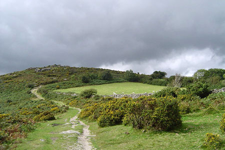
This Devon walk explores a scenic section of the Dartmoor National Park lying north of the Dart Valley. The route follows Dr Blackall's Drive which offers fine views over the valley, visits the summit of Mel Tor, passes through the village of Ponsworthy and finishes with a section along the River Dart. Part of the walk follows the Two Moors Way.
The start is New Bridge car park (grid ref. SX711708). After parking turn right up the narrow lane to Hannaford. The lane climbs steadily and after 1.5 kilometres reaches a road junction in open moorland (grid ref. SX707715). Bear left and continue to a "Poundsgate" sign. Turn left here onto a clear track. After 50 metres, at the first junction, turn left to join Dr Blackall's Drive, which is also the route of the Two Moors Way. Follow this track southwest to skirt the slopes of Aish Tor on your right. The track curves to the right and follows a meandering course northwest with the wooded Dart Valley below on your left.
After just over two kilometres of easy walking the track bends sharp right (grid ref. SX695724). Bear left off the track and follow the path to the rocky summit of Mel Tor. After enjoying the excellent view descend northeast to re-join the track. The track is enclosed by walls and soon turns sharp left still between walls. Reaching an open area, turn sharp right and continue north following the wall on your right. Pass through a parking area to reach the B3357.
Go straight across to continue following the Two Moors Way. There are several paths, so head to the left-hand end of the trees ahead. Bear slightly right to follow the onward path north to reach a road (grid ref. SX695739). Turn right along the road to a junction. Continue ahead signed to Ponsworthy. The road soon becomes a narrow lane and descends to reach a T-junction in the village after 500 metres (grid ref. SX700738). Turn right uphill and continue for 800 metres to reach Leusdon Common. Reaching a fork, bear left along the lane signed to Leusdon Church. Pass the church on the left and start to descend quite steeply down the lane with some views over the Dart Valley ahead.
Reaching the hamlet of Lower Town, take the signed path on the right just past a stone barn (grid ref. SX711729). Follow the clear track with the hedge on your right. Follow the track where it bends sharp right and then bear left following the track to pass in front of Spitchwick Manor. Reaching a T-junction of tracks, turn left following the hedge which should be on your left. Continue to reach a group of trees where the path bears half right and enters woodland. Continue through Great Wood to reach a lane (grid ref. SX716720).
Turn right and follow the steep lane down to a junction. Bear right, signed to Ashburton. You soon reach the banks of the River Dart on your left. Just past some metal railings on your left, you can access the banks of the River Dart. Continue along the bank of the Dart for a kilometre back to New Bridge car park.
Reaching the start - The car park can be reached from the A38 at the southern end of Ashburton. Exit the A38 and take the B3352 signed to Ashburton. Continue straight head and you soon pass a brown sign on the left "New Bridge 3 miles". Continue ahead ignoring all side roads and turn left into the car park just after crossing the River Dart.
Other walks nearby
| Walk 1657 | Huntingdon Warren & Lud Gate from Scorriton | moderate | 7.0 miles |
| Walk 3463 | Sharp Tor, Corndon Tor & Yar Tor Circular | easy/mod | 3.4 miles |
| Walk 3757 | Buckland in the Moor Circular | easy/mod | 6.3 miles |
| Walk 3462 | Corndon Tor & Yar Tor Circular | easy/mod | 4.3 miles |
| Walk 1260 | Haytor Rocks & Hound Tor from Saddle Tor | moderate | 7.5 miles |
| Walk 3201 | Bellever Tor & Postbridge | easy/mod | 5.5 miles |
| Walk 3202 | Postbridge & Challacombe Down from Bellever | moderate | 9.8 miles |
| Walk 2838 | Laughing Tors | easy | 3.5 miles |
| Walk 3223 | Avon Dam Reservoir & White Barrows | easy/mod | 5.5 miles |
| Walk 2219 | The Avon Dam Reservoir from Shipley Bridge | easy | 3.5 miles |
Recommended Books & eBooks
No suggestions for this area.Messaging & Social Media
Message Walking Britain and follow the latest news.

Mountain Weather
Stay safe on the mountains with detailed weather forecasts - for iOS devices or for Android devices.