Trwyn Crou from Cwmtydu Walk
Walk 3492 - Route Maps & Profile
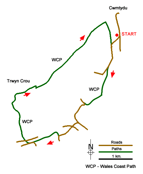
Route Map
Digital Maps - Copyright © 2011-2024. All rights reserved.
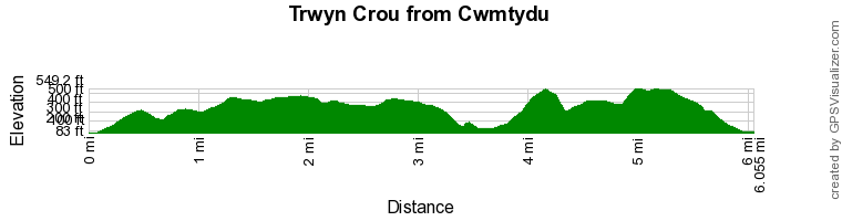
Route Profile
Sketch Map
Suggested Maps 

| Ordnance Survey Explorer 198 | Sheet Map | 1:25k | BUY |
| Anquet OS Explorer 198 | Digital Map | 1:25k | BUY |
It is recommended you take a map. The preferred scale is 1:25k.
Start Point Details
Ordnance Survey Grid Ref SN357569
Latitude 52.185806 Longitude -4.404764
Postcode SA44 6LQ
what3words start pampered.zone.harp
Walk description may contain detailed information on the start point for this walk.
Further Information
Ceredigion
Ceredigion is a coastal county in mid-Wales. The Cambrian Mountains covering much of the east of the county and offer excellent walking. The highest point is Plynlimon at 2,467 feet (752 m). In complete contrast to the wilds of the mountains, Ceredigion's 50 miles (80 km) of coastline has sandy beaches and, in places, high cliffs. Several attractive seaside resorts provide excellent bases for exploration. The Wales Coast Path follows the full length of the coast.
Walk grading - Learn how each walk is assessed and select a walk to suit your ability and experience by going to Walk Grading Details.
Messaging & Social Media
Message Walking Britain and follow the latest news.

Mountain Weather
Stay safe on the mountains with detailed weather forecasts - for iOS devices or for Android devices.