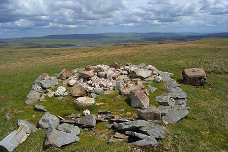
Meldon Hill from Cow Green Reservoir
North Pennines Walk
Region - North Pennines
County/Area - Durham & Cumbria
Author - Lou Johnson
Length - 9.2 miles / 15 km Ascent - 1300 feet / 394 metres
Time - 5 hours 50 minutes Grade - moderate
Maps 

| Ordnance Survey Explorer OL19 | Sheet Map | 1:25k | BUY |
| Anquet OS Explorer OL19 | Digital Map | 1:25k | BUY |
| Ordnance Survey Explorer OL31 | Sheet Map | 1:25k | BUY |
| Anquet OS Explorer OL31 | Digital Map | 1:25k | BUY |
| Ordnance Survey Landranger 91 | Sheet Map | 1:50k | BUY |
| Anquet OS Landranger 91 | Digital Map | 1:50k | BUY |
Walk Route Description
Click image to see photo description.
This North Pennine walk starts from Cow Green Reservoir and follows a counter clockwise route initially visiting the summit of Meldon Hill. The return route descends to the Pennine Way (with an option extension to nearby High Cup Nick) and continues via Cauldron Snout waterfall back to the start. The route crosses remote terrain with few if any clear paths. Therefore, this walk is for experienced hillwalkers only! A good sense of direction is required together with the relevant OS 25k map. A GPS device would also be useful.
The start is the car park overlooking Cow Green Reservoir (grid ref. NY810309) which can be reached from the B6277 in Teesdale. After parking familiarise yourself with the terrain on Meldon Hill which rises on the other side of the reservoir. There are several paths that lead down to the reservoir shore. Take one of these and head WNW following the shore. When I walked this route the water level in the reservoir was low and I walked along the shore. You reach a small peninsula (grid ref. NY795313) and the best route is to take the shortest route keeping well north of the 503 spot height. There is some soft ground, but this can generally be avoided.
Continue along the shore to reach the point where the River Tees empties into the reservoir. The river needs to be crossed. I found some convenient stones about 100 metres up the river and managed to cross with dry feet. When the river is in spate crossing may not be possible.
Once safely across the river head roughly south keeping to the left of the small hill (spot height 534) to locate Mattergill Sike. I followed trods on the north side continuing upstream to grid ref. NY774301. From here I headed south climbing the northern flank of Meldon Hill. Do be careful as there are shake holes some of which are not marked on OS maps. The route steepens as you gain height. Reaching the summit plateau there is a cairn to the east which offers a good view down to Cow Green Reservoir and a derelict OS trig column.
Leaving the summit, head south for 400 metres and then descend roughly parallel with Watersinking Sike for a similar distance before making a beeline for the Pennine Way which was reached at grid ref. NY783270. (Here you have the option of turning west and following the Pennine Way to High Cup Nick. This option is well worth the effort if you have the time and energy and adds 8 kilometres to the walk.) For those returning directly to Cow Green, turn left along the Pennine Way and follow the well walked path to Birkdale and Cauldron Snout. Once across the River Tees turn left leaving the Pennine Way and head back to the start.
Other walks nearby
| Walk 3424 | Cronkley Fell from Hanging Shaw | easy/mod | 7.0 miles |
| Walk 3526 | Hanging Shaw, Cronkley Scar, Low Force & High Force | moderate | 12.7 miles |
| Walk 1659 | Race Head & Sedling Rake from Wearhead | easy/mod | 6.0 miles |
| Walk 3099 | High Force, Low Force and the River Tees | easy/mod | 7.5 miles |
| Walk 3758 | Tynehead and Ashgill Force from near Garrigill | easy/mod | 8.2 miles |
| Walk 2393 | Weardale Circular from Westgate | easy/mod | 6.4 miles |
| Walk 1084 | Garrigill, Alston & Nenthead | moderate | 13.1 miles |
| Walk 1339 | High Cup Nick | moderate | 10.5 miles |
| Walk 3011 | Dufton Pike | easy/mod | 5.5 miles |
| Walk 3070 | Knock Fell & High Cup Nick | mod/hard | 12.0 miles |
Recommended Books & eBooks
Walking in the North Pennines
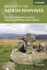 This guidebook describes 50 day walks across the North Pennines, England's remotest Area of Outstanding Natural Beauty taking in parts of Cumbria, County Durham and Northumberland. Most of the routes are circular and they range from 5 to 14 miles, with something to suit all abilities. Route descriptions are accompanied by 1:50K OS mapping.
More information
The Pennine Way
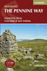 Guidebook to the Pennine Way National Trail with OS map booklet. The 265 mile route from Edale to Kirk Yetholm takes three weeks to walk and is suitable for fit and experienced long distance walkers. The route crosses the Peak District, Yorkshire Dales and North Pennines National Parks. Includes separate OS 1:25,000 map booklet of the route.
More information
Messaging & Social Media
Message Walking Britain and follow the latest news.

Mountain Weather
Stay safe on the mountains with detailed weather forecasts - for iOS devices or for Android devices.