Shotley Gate & Ewarton from Chelmondiston
Suffolk Coasts and Heaths Walk
Region - Suffolk Coasts and Heaths
County/Area - Suffolk
Author - Lou Johnson
Length - 10.6 miles / 17.2 km Ascent - 450 feet / 136 metres
Time - 5 hours 50 minutes Grade - moderate
Maps 

| Ordnance Survey Explorer 197 | Sheet Map | 1:25k | BUY |
| Anquet OS Explorer 197 | Digital Map | 1:25k | BUY |
| Ordnance Survey Landranger 169 | Sheet Map | 1:50k | BUY |
| Anquet OS Landranger 169 | Digital Map | 1:50k | BUY |
Walk Route Description
Click image to see photo description.
This Suffolk walk starts from Chelmondiston and explores the Orwell and Stour Estuaries passing through Shotley Gate along the way. The route then crosses fields and passes through woods to return to the start. For some of the walk the route follows the Stour and Orwell Walk before using paths and tracks to return to Chelmondiston.
The start is the pay and display car park on Pinmill Road (grid ref. TM205378). After parking return to the road and turn right. After 20 metres turn left up steps to join the Stour and Orwell Walk which is generally easy to follow with green and yellow way markers. This long-distance footpath will be followed for most of the walk. At the end of the wood, turn left in front of a house and join the path along the embankment close to the south bank of the River Orwell.
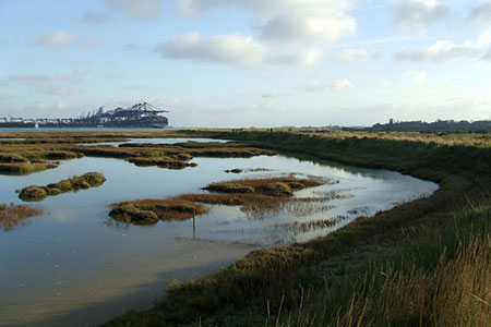
The path initially skirts salt marshes on your left with wooden duck boards across potentially muddy stretches. The path is near level and the walking easy and you soon turn south after passing Collimer Point. Ahead you can see the cranes at Felixstowe. The path briefly passes another area of salt marsh before continuing to follow an embankment. Reaching Shotley Marina, bear left keeping the Marina on your right. Cross a lock and continue past the HMS Ganges Museum on your right.
Continue ahead with the River Stour on your left to reach Shotley Pier. Across the estuary is the Parkeston Quay ferry terminal. Shortly after you reach the Bristol Arms on your right. Leave the road here and continue straight ahead through a picnic area. The path then runs parallel to the river on your left. Continue along the main path to reach Rose Farm Cottages. Turn right here up a sandy track. After 400 metres you reach Shotley Cottage with its impressive chimneys. Turn left here to re-join the Stour and Orwell Walk following a path along the right-hand side of a field. At the end of the field turn right and keeping the hedge on your right continue for 150 metres.
Turn left along a clear path across a field, continue over a track to the end of the field. Turn left on a fenced path. Turn right at a large tree and with a small lake on your left follow the clear path which veers north to pass in front of Ewarton Hall Farm (on your left) to reach a road. Turn left along the road and continue to a road junction with the impressive gateway to Ewarton Hall on your left. Bear half right off the road to join Warren Lane.
After a kilometre, the Stour and Orwell Walk turns left. Keep straight ahead here with a wood on your left. At the end of the wood there is a woodland on your right. Continue through a gate top join a track. Keep straight ahead at a junction, pass houses on your right, and then turn left into Grove Lane. At the first junction continue ahead to reach a wood on your right. Turn left at the first footpath sign into the woods. Follow the main track past a cottage on your right to reach the edge of the wood. Turn left along the field with the wood on your left. Reaching the end of the wood, turn right across a field.
At the far side of the field, turn left for 80 metres to a path junction. Turn right along the right-hand edge of the field. At the corner of the field, the path bears left and then continues towards houses. Follow the fenced path between houses to reach Main Road in Chelmondiston. Turn right past the Red Lion pub. Turn left and join Church Road and continue to reach the gate into the church with an adjacent brown footpath sign on the right. Turn left into Collimer Close and immediately right onto a bridleway. The route initially passes houses before running parallel to a fence. Go through a gate, cross a footbridge and the car park used at the start is on the left.
Other walks nearby
| Walk 2374 | Freston Circular | easy/mod | 6.6 miles |
| Walk 1648 | Church End & Erwarton from Shotley Gate | easy | 6.0 miles |
| Walk 2096 | Alton Water, Stutton & Tattingstone | easy | 5.5 miles |
| Walk 2149 | Circuit of Alton Water | easy/mod | 7.6 miles |
| Walk 3267 | Ramsholt, River Deben and Shottisham Circular | easy/mod | 9.2 miles |
| Walk 3658 | Manningtree, Flatford Mill and Dedham | easy/mod | 7.1 miles |
| Walk 3660 | Stour Valley & Dedham from Flatford Mill | easy | 3.5 miles |
| Walk 2366 | The Naze from Walton-on-the-Naze | easy | 6.0 miles |
| Walk 3724 | River Box from Stoke-by-Nayland | easy | 6.0 miles |
| Walk 2428 | The Rivers Ore & Alde from Orford | easy/mod | 11.0 miles |
Recommended Books & eBooks
Suffolk Coast and Heath Walks
 Guidebook to three long-distance routes exploring the varied landscapes of the Suffolk Coast and Heaths AONB. The Suffolk Coast Path covers 55 to 60 miles from Lowestoft to Felixstowe. The Stour and Orwell Walk is 40 miles from Felixstowe to Cattawade near Manningtree, while the Sandlings Walk is 59 miles from Ipswich to Southwold.
More information
Messaging & Social Media
Message Walking Britain and follow the latest news.

Mountain Weather
Stay safe on the mountains with detailed weather forecasts - for iOS devices or for Android devices.