The Gloup, Deerness Brough & Mull Head
Orkney Islands Walk
County/Area - Orkney Islands - Orkney Mainland
Author - Lou Johnson
Length - 4.0 miles / 6.5 km Ascent - 550 feet / 167 metres
Time - 2 hours 30 minutes Grade - easy
Maps 

| Ordnance Survey Explorer 461 | Sheet Map | 1:25k | BUY |
| Anquet OS Explorer 461 | Digital Map | 1:25k | BUY |
Walk Route Description
Click image to see photo description.
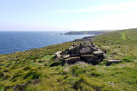
This short circular Orkney Mainland walk offers an interesting insight into the coast at Mull Head. The highlights are the Gloup, a collapsed cave, Deerness Brough and the headland. In addition, the area sees abundant birdlife in season.
The start is the Mull Head carpark (grid ref. HY590079) on the north-east coast of Deerness. Nearby is the Mull Head Visitor Centre. After parking follow the path to the coast. You soon pass the Gloup is a collapsed cave 80 metres wide, 40 metres long and 25 metres deep which ends in a land bridge on the coast. Reaching the sea turn left and follow the coast path north.
After a kilometre of easy walking along the cliff tops you reach the Deerness Brough, a grass topped rocky island, which was connected to the mainland many centuries ago. A steep descent to the bottom of Little Burrageo is followed by a steep, narrow ascent along the south face of the Brough to reach the summit. A safety rope is in place to assist the precipitous ascent (and descent). Once on the Brough you will see the remains of a chapel, which was part of a much greater complex of buildings.
Return to the mainland and continue north on the coast path to reach the Chip of Mull, the most northerly point at Mull Head. The path turns west and passes an OS trig column before heading south-west. Continue past a rock arch and at the next fence (grid ref. HY582090) turn inland. Continue along the fence for 600 metres and turn right. Continue ahead for 200 metres to reach track. Turn left and follow the track back towards the start. The track bends sharp left and passes in front of the visitor centre to reach the car park which is on your left.
Other walks nearby
| Walk 1991 | Vat of Kirkbuster & Bay of Houseby | easy/mod | 7.6 miles |
| Walk 3742 | Westness Heritage Trail | easy | 3.0 miles |
| Walk 3648 | Old Man of Hoy & Glens of Broadiface | moderate | 10.0 miles |
| Walk 1666 | Stacks of Duncansby | easy | 3.0 miles |
| Walk 3649 | Old Man of Hoy from Rackwick | easy/mod | 5.4 miles |
| Walk 3650 | Rackwick, Old Man of Hoy & Cuilags | mod/hard | 9.6 miles |
| Walk 3651 | Noup Head from Backarass Farm, Westray | easy | 4.5 miles |
| Walk 3287 | Morven, Smean & Maiden Pap | hard | 10.2 miles |
| Walk 3101 | Ben Bhraggie traverse | easy/mod | 4.7 miles |
| Walk 2530 | The Foinaven & Arkle Traverse | very hard | 16.5 miles |
Recommended Books & eBooks
No suggestions for this area.Messaging & Social Media
Message Walking Britain and follow the latest news.

Mountain Weather
Stay safe on the mountains with detailed weather forecasts - for iOS devices or for Android devices.