Rhewl, Moel y Gamelin & Moel Morfydd
Clwydian Hills Walk
Region - Clwydian Hills
County/Area - Denbighshire
Author - Lou Johnson
Length - 5.4 miles / 8.8 km Ascent - 1800 feet / 545 metres
Time - 4 hours 30 minutes Grade - moderate
Maps 

| Ordnance Survey Explorer 256 | Sheet Map | 1:25k | BUY |
| Anquet OS Explorer 256 | Digital Map | 1:25k | BUY |
Walk Route Description
Click image to see photo description.
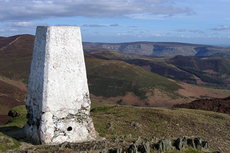
This Clwydian Hills walk starts from the hamlet of Rhewl, which lies northwest of Llangollen in the Dee Valley. The undulating route initially ascends Moel y Gamelin (577 metres) before following the ridge westwards to cross Moel y Gaer and Moel Morfydd (549 metres) from where a descent is made into the valley to follow a track and lane back to the start. Once height is gained you can enjoy some wonderful views and great walking.
There is limited off road parking in Rhewl (grid ref. SJ182449). After parking walk up the lane to the right of the chapel. After a short way go half right up a drive to follow the signed footpath. Pass to the left of a cottage, go through a gate and follow path through a kissing gate into woodland. The path runs beside a stream before continuing right across a footbridge. Initially head left but soon after bear right up the hillside to reach the edge of a plantation (grid ref. SJ184454). Bear left with the trees on your right and continue to the end of the plantation.
At the end of the plantation, turn right and follow a rising track with the trees on your right. Reach the top of the plantation continue ahead to a fork in the paths where you head left towards a spoil tip. Keeping the tip on your right. Continue up the path heading northwest across the hillside with a path soon joining from the right. Maintain direction and follow a clear path heading to the summit of Moel Gamelin.
Descend from the summit in a westerly direction to join a clear track that descends quite steeply to a col and a cross track (grid ref. SJ171465). Continue ahead and climb up to the summit of Moel y Gaer with its earthwork. Descend steeply to a col and after a short ascent continue on the clear track to the summit of Moel Morfydd. Head west from the summit along the track. Keep ahead at the first junction, turn sharp left at the next junction, and take the right fork at the next junction to join a path heading southeast across the southern flank of Moel Morfydd.
Follow the path to a fence (grid ref. SJ163452). Cross a stile and continue downhill with the fence on your left. Continue downhill to reach a broad col (grid ref. SJ163449). Turn left along a grassy track with a fence on your right. The track soon becomes a sunken path between trees. It is easier to keep to the left and follow a grassy trod with the trees on your right. Continue down the valley to join the access track for Cymmo Farm (on your left). Follow this track into the valley. Pass a group of cottages on your right to reach the valley road. Turn right back to the start.
Other walks nearby
| Walk 1845 | Castell Dinas Bran from Llangollen | easy/mod | 4.0 miles |
| Walk 1067 | Ruabon Mountain & The Limestone Edges of Llangollen | moderate | 11.0 miles |
| Walk 2598 | Ruabon Mountain, World's End & Panorama Circular | moderate | 12.5 miles |
| Walk 2460 | Pontcysyllte Aqueduct Circular | easy | 4.5 miles |
| Walk 1989 | Llanarmon Dyffryn Ceiriog Circular | moderate | 6.0 miles |
| Walk 2388 | Chirk Castle & Ceiriog Valley | easy/mod | 6.0 miles |
| Walk 3031 | Cadair Berwyn | moderate | 9.3 miles |
| Walk 1528 | Moel Famau | easy/mod | 10.0 miles |
| Walk 1256 | Cadair Bronwen | moderate | 9.5 miles |
| Walk 1259 | Foel Fenli & Moel Famau from Loggerheads | moderate | 9.5 miles |
Recommended Books & eBooks
No suggestions for this area.Messaging & Social Media
Message Walking Britain and follow the latest news.

Mountain Weather
Stay safe on the mountains with detailed weather forecasts - for iOS devices or for Android devices.