Manningtree, Flatford Mill and Dedham
Essex Walk
County/Area - Essex & Suffolk
Author - Lou Johnson
Length - 7.1 miles / 11.5 km Ascent - 300 feet / 91 metres
Time - 3 hours 50 minutes Grade - easy/mod
Maps 

| Ordnance Survey Explorer 196 | Sheet Map | 1:25k | BUY |
| Anquet OS Explorer 196 | Digital Map | 1:25k | BUY |
Walk Route Description
Click image to see photo description.
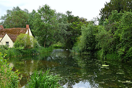
This walk exploring the Stour Valley from Manningtree with the river forming the Essex/Suffolk boundary. The route includes a variety of scenery from the marshes beside the river to picturesque Flatford Mill which was the subject of John Constable's best-loved paintings. The walk continues to Dedham before returning along the Stour Valley back to the start. The route uses sections of the Stour Valley Path and St. Edmund Way.
The start is Manningtree railway station (grid ref. TM094322) from where there are regular services to Liverpool Street, Ipswich, and Norwich. Exit the station and turn right and follow the road down to the main car park. At the bottom of the ramp turn left past the footpath fingerpost to turn right onto the St. Edmund Way. The path runs parallel to the railway and then turns right through an underpass following a track in a northerly direction. After 300 metres the route turns left and continues along a track between hedges. The path then turns right to reach the south bank of the River Stour. Turn left and with the river on your right continue upstream. After 700 metres the path turns right and continues to Flatford Lock (grid ref. TM077332).
Bear right across the bridge into Suffolk and continue ahead when reaching a road. Bear left up the path into Flatford Mill car park (NT). Continue north through the car park to the exit. Turn left along Flatford Road. After 200 metres take the signed footpath on the right. The path runs parallel to the road for about half a kilometre to re-join the lane. Turn right and almost immediately left down a narrow track (signed to Fen Bridge and Dedham). Follow the track past a house on your left and continue to cross a bridge. 100 metres beyond the bridge turn right onto the St. Edmund Way and continue to the B1029 in Dedham (grid ref. TM058366).
Turn left along the B1029 and continue across a bridge into Essex and the centre of Dedham. Reaching a T-junction with the church opposite, turn left and continue into Brook Street. Just after Dedham Art & Craft Centre (on your right) the road bends to the right. On the bend, turn left taking the right-hand of two tracks (signed to Flatford). The route passes Dedham Hall on your left and continues to the River Stour. Bear left along the river and continue to Flatford. Reaching the bridge over the river, bear right and retrace your steps back to the start.
Other walks nearby
| Walk 3660 | Stour Valley & Dedham from Flatford Mill | easy | 3.5 miles |
| Walk 2096 | Alton Water, Stutton & Tattingstone | easy | 5.5 miles |
| Walk 2149 | Circuit of Alton Water | easy/mod | 7.6 miles |
| Walk 2374 | Freston Circular | easy/mod | 6.6 miles |
| Walk 3724 | River Box from Stoke-by-Nayland | easy | 6.0 miles |
| Walk 2017 | Pin Mill to Shotley Gate | easy | 5.5 miles |
| Walk 1639 | Erwarton, Church End & River Orwell from Pin Mill | easy/mod | 8.0 miles |
| Walk 3642 | Shotley Gate & Ewarton from Chelmondiston | moderate | 10.6 miles |
| Walk 1648 | Church End & Erwarton from Shotley Gate | easy | 6.0 miles |
| Walk 3556 | Arlesford Creek & Brightlingsea Circular | easy | 6.0 miles |
Recommended Books & eBooks
No suggestions for this area.Messaging & Social Media
Message Walking Britain and follow the latest news.

Mountain Weather
Stay safe on the mountains with detailed weather forecasts - for iOS devices or for Android devices.