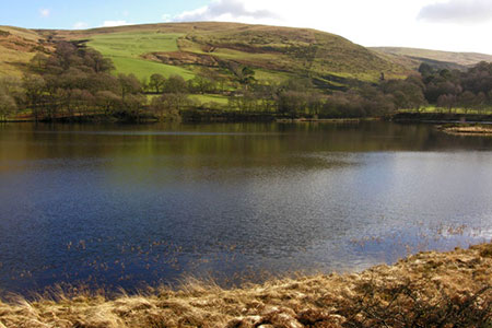
Claerwen Valley & Dam from Dolymynach Reservoir
Powys Walk
County/Area - Powys - Powys Central
Author - Lou Johnson
Length - 7.4 miles / 12 km Ascent - 1100 feet / 333 metres
Time - 4 hours 50 minutes Grade - moderate
Maps 

| Ordnance Survey Explorer 200 | Sheet Map | 1:25k | BUY |
| Anquet OS Explorer 200 | Digital Map | 1:25k | BUY |
Walk Route Description
Click image to see photo description.
This Powys walk explores the Claerwen Valley and an area of higher ground rising to the north of Dolymynach Reservoir. The route uses paths and forestry tracks to explore the area and passes the Claerwen Dam. To reach the start take the B4518 southwest from Rhayader to the village of Elan. Continue ahead on a minor road, cross the Caban-coch reservoir and continue up the valley to reach the smaller Dolymynach Reservoir. Towards the head of this reservoir is a small parking area on the right (with an information board0 which provides a convenient starting point (grid ref. SN900617).
After parking cross the road and take the lane to the left of the telephone box. Cross the bridge over the Afon Claerwen and take the right fork shortly after. The road bends sharp right passing in front of some barns and continues up the valley to cross a side stream before reaching Rhiwnant Farm (grid ref. SN895617). Pass between the barns and follow the track to the right. Continue for a further 300 metres and take the right fork (grid ref. SN891618). Continue ahead keeping the river on your right for three kilometres to reach a road with Cerrig Cwplau farm on your left (grid ref. SN869634).
Turn right across the bridge with Claerwen Dam rising to tour left. Follow the road around to the right passing toilets on your left and a large parking area on your right. Ignore the road coming in from the left and continue to a fingerpost on the left just before some trees (grid ref. SN878630). Turn left and follow the bridleway which rises steadily across open ground to reach a group of masts at Cefn Llanerchi (grid ref. SN899636).
Continue ahead on the bridleway with Llanerchi Wood on your left. The track the descends with trees on either side. 600 metres from entering the trees you reach a cross track (grid ref. SN908636). Turn right and follow the track for just under two kilometres to reach the point where Dolymynach Dam is down to your left. From here a narrower path slants down the hillside to the road (grid ref. SN904617). Bear right along the road and walk back to the start.
Other walks nearby
| Walk 2498 | Gorllwyn circuit, Elan Valley | easy/mod | 6.8 miles |
| Walk 3297 | Crugyn Ci, Esgair Perfedd & Penygarreg - Elan Valley | moderate | 7.5 miles |
| Walk 2736 | Teifi Pools from near Strata Florida | easy/mod | 6.2 miles |
| Walk 1365 | Strata Florida to Tregaron | moderate | 9.5 miles |
| Walk 2472 | Abbeycwmhir Circular | easy/mod | 7.2 miles |
| Walk 1363 | The Elephant Walk from Tregaron | easy/mod | 5.5 miles |
| Walk 3086 | Pen y Garn from near Devil's Bridge | easy/mod | 6.8 miles |
| Walk 1362 | Tregaron & Cors Caron circular | easy | 4.0 miles |
| Walk 1361 | Tregaron & Twm Town circular | easy | 3.5 miles |
| Walk 1364 | Tregaron & Llandewi Brefi circular | easy/mod | 4.5 miles |
Recommended Books & eBooks
The Cambrian Way
 Guidebook to the Cambrian Way, a challenging three-week mountain trek through Wales from Cardiff to Conwy. The 470km un-waymarked route is presented from south to north. Often sticking to long, beautiful ridgelines, it crosses wild and rugged terrain and visits many of Wales's highest mountains, including Snowdon.
More information
Messaging & Social Media
Message Walking Britain and follow the latest news.

Mountain Weather
Stay safe on the mountains with detailed weather forecasts - for iOS devices or for Android devices.