View of Yorkshire's "Big Three" from Rowantree Grains
Walk Photo 119603
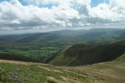
Caption - Rowantree Grains (the col between Arant Haw and Calders) provides an excellent view south with Yorkshire's 'Big Three' - Ingleborough, Whernside and Pen-y-ghent) in view.
Walk 1196 : The Calf
Photographer : Lou Johnson
Use back button to return to the photo gallery lists.
Further Information
Location Map
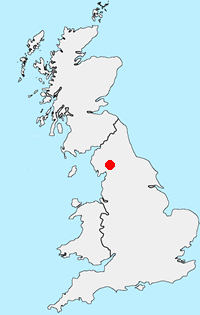
Howgills
Situated east of the Lake District, the Howgills lie mostly within the boundaries of the Yorkshire Dales National Park. The Howgills are one of the forgotten walking areas in England. The "hippo like" outlines of the fells are distinctive, most often seen by those tearing up the M6 motorway between Kendal and Penrith. Despite the lack of crags it is great walking country and you can wander for hours in the knowledge you are unlikely to meet more than a handful of other people. Poor parking (except in Sedbergh and a few other areas) helps to keep the number of people wandering the Howgills to a minimum. More Information
Messaging & Social Media
Message Walking Britain and follow the latest news.

Mountain Weather
Stay safe on the mountains with detailed weather forecasts - for iOS devices or for Android devices.