Druid's Castle Rocks, Brimham Rocks
Walk Photo 372601
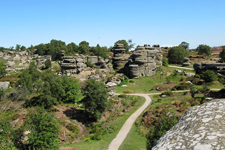
Caption - Looking northwards from the top of one of the nearby rocks towards the Druid's Castle Rocks, Brimham Rocks, Nidderdale AONB.
Walk 3726 : Brimham Rocks Circular
Photographer : David Tyers
Use back button to return to the photo gallery lists.
Further Information
Location Map
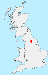
Nidderdale AONB
The Nidderdale National Landscape (formerly AONB) is an area of natural beauty in North Yorkshire sharing its western border with the Yorkshire Dales National Park to the east and south. The AONB includes most of Nidderdale itself, part of lower Wharfedale, the Washburn valley and part of lower Wensleydale. The highest land is Great Whernside which rises to 704 metres above sea level on the border with the Yorkshire Dales National Park. Pateley Bridge is the only town with Otley, Ilkley, Masham and Ripon just outside the borders. More Information
Messaging & Social Media
Message Walking Britain and follow the latest news.

Mountain Weather
Stay safe on the mountains with detailed weather forecasts - for iOS devices or for Android devices.