Ambleside Walks and Walking Guide
Lake District, Cumbria
Find Ambleside circular walks which are varied with routes to suit allabilities. The village is located near the northern end of Lake Windermere, is popular with walkers offering excellent amenities including accommodation, cafés, bars and restaurants. The town has a wide range of outdoor shops too. Public transport provides regular access to many of the walks listed below. The nearest railway station is at Windermere.
All Ambleside walks are free to download and print, and all routes have mapping and GPX files. Ambleside offers a wide range of walking. Easy circular walks suitable for families can be followed on Loughrigg Fell, around Elterwater and near Grasmere. Challenging hill walks include the Fairfield Horseshoe, the Langdale Pikes and Bowfell.
★ = GPS file available
| Walk | Description | Grade | Miles |
|---|---|---|---|
| 2053★ | Claife Heights & Near Sawrey | easy | 2.50 |
| 3519★ | High Sweden Bridge from Ambleside | easy/mod | 3.00 |
| 3410★ | Latterbarrow from Hawkshead | easy | 4.00 |
| 1141★ | Elterwater circular | easy/mod | 4.00 |
| 2026★ | Loughrigg from Pelter Bridge near Rydal | easy/mod | 4.00 |
| 3697★ | Loughrigg Fell from Skelwith Bridge | easy/mod | 4.50 |
| 1059★ | Colwith Force and Skelwith Force from Elterwater | easy/mod | 4.80 |
| 2841★ | Seat Sandal via Grisedale Tarn from Grasmere | moderate | 5.00 |
| 2033★ | Tilberthwaite & Wetherlam | moderate | 5.00 |
| 1171★ | Pike o' Blisco from Blea Tarn | moderate | 5.00 |
| 2270★ | Tilberthwaite and Holme Fell Little Langdale | easy/mod | 5.50 |
| 2715★ | Skelwith Bridge & Loughrigg from Elterwater | easy/mod | 5.50 |
| 1682★ | Rydal Water & Grasmere | easy/mod | 5.50 |
| 2254★ | Grisedale Tarn from Grasmere | moderate | 5.50 |
| 1565★ | Rydal Water & Grasmere circular | easy/mod | 6.00 |
| 2582★ | Pike o' Stickle, Harrison Stickle & Pavey Ark | moderate | 6.00 |
| 1736★ | Langdale Pikes and High Raise FROM New Dungeon Ghyll | mod/hard | 6.10 |
| 2042★ | The Langdale Pikes with an ascent of Jack's Rake | very hard | 6.25 |
| 3075★ | Rydal Water & Loughrigg from Ambleside | easy/mod | 6.50 |
| 1463★ | School Knott & Grandsire from Ings | easy/mod | 6.50 |
| 1684★ | Lingmoor Fell & Langdale from Elterwater | easy/mod | 7.00 |
| 1472★ | Alcock Tarn & Rydal Water from Grasmere | easy/mod | 7.00 |
| 1132★ | Great Langdale & The Crinkle Crags | mod/hard | 7.00 |
| 2932★ | Green Burn horseshoe from Grasmere | moderate | 7.00 |
| 1023★ | Wansfell Pike & Wansfell from Ambleside | easy/mod | 7.50 |
| 2037★ | Bowfell & Rosset Pike via the Climber's Traverse | hard | 7.50 |
| 1144★ | Lingmoor Fell from Blea Tarn | moderate | 8.00 |
| 2073★ | Harrison Stickle, Pike o'Stickle & Rosset Pike | moderate | 8.25 |
| 1207★ | Great & Little Langdales from New Dungeon Ghyll | moderate | 8.50 |
| 1157★ | Bowfell and Esk Pike from Old Dungeon Ghyll | hard | 8.75 |
| 1111★ | High Raise & Helm Crag from Grasmere | mod/hard | 9.50 |
| 3423★ | Dove Crag & Red Screes - Scandale Horseshoe | mod/hard | 9.50 |
| 1170★ | Fairfield Horseshoe (short route) from Ambleside | mod/hard | 9.50 |
| 1154★ | Between Grasmere and Langdale | moderate | 9.50 |
| 3034★ | Red Screes & Other Fells from Ambleside | mod/hard | 10.00 |
| 1320★ | Shorter Kentmere Horseshoe | mod/hard | 10.50 |
| 1134★ | Wetherlam and The Carrs from Little Langdale | mod/hard | 10.75 |
| 1002★ | The Fairfield Horseshoe from Ambleside | mod/hard | 11.00 |
| 2652★ | Photographer's Kentmere Horseshoe | mod/hard | 13.50 |
| 1823★ | Fairfield Horseshoe & Loughrigg from High Close | mod/hard | 14.00 |
The walks listed above are the nearest 40 from Ambleside when measured in a straight line.
Recommended Reading
Outdoor Adventures with Children - Lake District
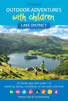 Guidebook to 40 outdoor adventures in the Lake District with children under 12, including walking, cycling, orienteering, paddling, boating, hostelling and more. Graded activities for varying age ranges or for families with children of different ages.
More information
The Cumbria Way
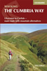 A guidebook to the 73 mile Cumbria Way, an easy long-distance walk though the heart of the Lake District National Park, from Ulverston in the south to Carlisle in the north, with good transport links to either end. The route is largely low-level but this guide offers alternative mountain days to climb some of the famous fells en route.
More information
Further Information
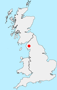
Walk Location Map
Walking in Lake District
Walking in the Lake District National Park is amongst the best in the British Isles. The natural beauty has attracted many artists and writers through the centuries and today the same scenery provides the perfect backdrop to a wide variety of walks. The National Park is located wholly within Cumbria with Windermere, Ambleside and Keswick the main tourist towns. For many this is the finest area in England for walking with a wide variety of scenery. Even on the busiest weekends it is possible to get away from the crowds by carefully selecting one of the less-visited fells. More Information
Walk grading - Learn how each walk is assessed and select a walk to suit your ability and experience by going to Walk Grading Details.
Messaging & Social Media
Message Walking Britain and follow the latest news.

Mountain Weather
Stay safe on the mountains with detailed weather forecasts - for iOS devices or for Android devices.