Books and Maps
This section is designed to include a summary of recently published books and mapping useful for all walkers in the British Isles. Links are provided so you can obtain further detailed information and complete on-line purchases.
Cicerone Press 
An excellent range of guides and maps produced by a publisher dedicated to outdoor activities including walking, scrambling and cycling. The following are a selection from their exhaustive catalogue.
Walking in Cornwall
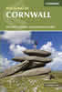 This guidebook includes routes to 40 day walks in Cornwall. From short, easy strolls to longer, wilder routes, there is plenty to appeal to both families and experienced walkers. The walks explore the interior and coasts, including walks through picturesque villages, old tin-mining areas and the Lizard and Land's End Peninsulas.
More information
Walking in County Durham
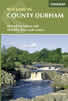 Guidebook offering detailed descriptions of 40 day walks, plus 10 traffic-free cycle routes along old railway trackbeds. Together they cover 450 miles and spread all over County Durham to show the region's history and natural wonders. The terrain covered ranges from field paths to open moorlands, from the North Sea to the high Pennines.
More information
Walking the Munros Vol 2 - Northern Highlands and the Cairngorms
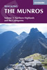 Guidebook to walking the northern Munros, covering the northern Highlands, the Cairngorms and the Isle of Skye. 70 routes are described, including those up Ben Macdui, Braeriach and Cairn Gorm. Routes range from 7 to 46km, requiring a fair level of fitness. The second of two guidebooks to walking Scotland's Munros: peaks higher than 3000ft.
More information
Walking in Torridon
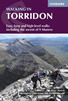 This guidebook contains 52 day walks in Torridon, a remote and much-loved area of the Scottish Highlands. Based around Shieldaig and Slioch, the routes are split into 3 sections: easy walks, long and high level walks and mountain ascents over 2000ft including 9 Munros, and 5 outline suggestions for major ridge walks.
More information
Snowdonia: 30 Low-level and easy walks - North
 Guidebook describing 30 walks in Snowdonia, Wales. Routes are mostly low level and on clear paths and showcase the region's beautiful scenery and rich history and culture. Part of a 2-volume set, this northern volume includes the Snowdon area, the Ogwen and Conwy Valleys, Betws-y-Coed, Beddgelert, Ffestiniog and the coast.
More information
Walking the Lake District Fells - Langdale
 Part of the Walking the Lake District Fells series, this guidebook covers a wide range of routes to 25 Lakeland summits that can be climbed from the Great Langdale valley, Ambleside and Grasmere, with highlights including Scafell Pike, Bowfell, the Langdale Pikes and Helm Crag (the Lion and the Lamb). Includes suggestions for longer ridge routes.
More information
South West Coast Path Map Booklet - St Ives to Plymouth
 Map of part of the southern section of the 630 mile (1014km) South West Coast Path National Trail. Covers the trail from St Ives to Plymouth along the west Cornwall and Devon coastline. This convenient and compact booklet of Ordnance Survey 1:25,000 maps shows the route, providing all of the mapping you need to walk the trail in either direction.
More information
Anquet Digital Mapping 
The excellent digital mapping supplied by Anquet is available in a range of formats. Probably the most popular with walkers are their digital format and detailed OS Explorer maps at 1:25k scale. OS Landranger 1:50k maps are also available although showing less detail. Harveys produce Superwalker maps at 1:25k and British Mountain Maps at 1:40k both offering a different style of mapping to the more familiar OS maps. Harvey maps often include additional detail, including more paths, not shown on OS mapping.
For regular walkers there are a number of packages available which offer considerable savings:
| OS Explorer 1:25k Mapping of Complete Great Britain | More Information |
| OS Explorer 1:25k Mapping of British National Parks | More Information |
News & Reviews
A range of product reviews including books and maps are available. The following reviews are the most recent.
Wainwright Hill Bagging Map - A scratchable map showing all 214 Wainwrights in the Lake District. More info.
the people's poncho 2.0 - Lightweight, stylish and lightweight alternative to traditional waterproofs ideal for walkers. More info.
the people's poncho - A durable, lightweight, stylish and compact alternative to traditional waterproofs ideal for walkers with 10% Discount. More info.
AZ Adventure Series Maps - Convenient 1:25000 OS maps in booklet form covering the National Trails of Britain. More info.
Walking in the Aire - A new book by Lee Senior featuring 14 walks in the Aire valley. More info.
West Yorkshire's Wild Side - Two new books in the 'Wainwright' style featuring Calderdale and moorland walks. More info.
Follow Walking Britain for the latest news. 
![]()