Betws-y-Coed Walks and Walking Guide
Snowdonia, Conwy
Find circular walks nera Betws-y-Coed which is a convenient centre for walking in the Snowdonia National Park. The town has excellent amenities including a wide range of cafés, bars and restaurants. Campsites and caravan parks are also available. The choice of hotel, guest house and bed and breakfast accommodation is varied with many establishments near the town centre. Public transport is limited but the Snowdon Sherpa service provides excellent links for walkers during the season. There is also a railway service to Llandudno Junction with connections to other parts of the UK.
All walks are free to download and print, and all routes have mapping and GPX files. There are many walking highlights which include Moel Siabod, the high Carneddau, Tryfan and the Glyders plus some excellent walks from Llyn Eigiau. Local walks include forest trails and some easy short hill walks near Capel Curig. Llyn Crafnant also provides some wonderful walking with choice of level routes or excursions into the hills.
★ = GPS file available
| Walk | Description | Grade | Miles |
|---|---|---|---|
| 2766★ | Capel Pinnacle / Y Pincin from Capel Curig | easy | 1.00 |
| 3005★ | Clogwen from Bryntyrch, Capel Curig | easy | 2.00 |
| 2679★ | Circuit of Llyn Crafnant from Trefriw | easy | 3.50 |
| 3001★ | Tryfan North Ridge from Ogwen Valley | hard | 3.50 |
| 2855★ | Gallt yr Ogof & Braich y Ddeugwm | moderate | 4.00 |
| 1661★ | Crimpiau from Capel Curig | easy/mod | 4.50 |
| 2821★ | Melynllyn & Dulyn Reservoir from Llyn Eigiau parking | easy/mod | 5.50 |
| 1151★ | Moel Siabod from Pont Cyfyng | hard | 5.50 |
| 1215★ | Tryfan & Llyn Ogwen from Ogwen Valley | mod/hard | 5.50 |
| 3056★ | Pen yr Helgi Du from Ogwen Valley | moderate | 5.50 |
| 3026★ | Tryfan & the Eastern Tops from Ogwen Valley | hard | 5.75 |
| 2919★ | Moel Siabod & Capel Curig | moderate | 6.00 |
| 1037★ | Two lakes of the Gwydir Forest - Llyn Elsi and Llyn Parc from Betws-y-Coed | easy/mod | 6.50 |
| 1332★ | Gwydir ForestLakes from Tyn Llwyn | easy/mod | 6.50 |
| 3402★ | Moel Siabod circular from Pont Cyfyng | moderate | 6.50 |
| 2638★ | Craig Eigiau, Melynilyn & Dulyn Resrs nr. Tal-y-Bont | moderate | 7.00 |
| 2608★ | Crimpiau & Creigiau Gleision from Llyn Crafnant | moderate | 7.50 |
| 2650★ | Tryfan, the Glyders & Y Garn from Ogwen Valley | very hard | 8.00 |
| 3024★ | North West of Blaenau Ffestiniog from Crimea Pass | mod/hard | 8.50 |
| 2200★ | Eastern Carneddau from Capel Curig | moderate | 8.50 |
| 2542★ | Foel Grach & Llyn Eigiau | moderate | 8.50 |
| 1635★ | Garnedd Uchaf & Llyn Eigiau from near Tal-y-Bont | mod/hard | 9.00 |
| 2592★ | Llyn Geirionydd & Llyn Bychan from Llyn Crafnant | moderate | 9.50 |
| 2902★ | Creigiau Gleision & Llyn Cowlyd from Capel Curig | moderate | 9.50 |
| 3047★ | The Carneddau from Llyn Eigiau | hard | 10.00 |
| 1150★ | The High Carneddau from Ogwen Valley | hard | 10.00 |
| 2300★ | Glyder Fach from Capel Curig | mod/hard | 11.50 |
| 2536★ | Llyn Crafnant, Capel Curig & Llyn Colwyd from Trefriw | mod/hard | 13.00 |
| 2820★ | Carneddau traverse from Llyn Ogwen | mod/hard | 14.00 |
| 1232★ | Carnedd Llewelyn, Llyn Eigiau & Llyn Cowlyd | hard | 16.00 |
The walks listed above are the nearest 30 from Betws-y-Coed when measured in a straight line.
Recommended Reading
Snowdonia: 30 Low-level and easy walks - North
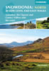 Guidebook describing 30 walks in Snowdonia, Wales. Routes are mostly low level and on clear paths and showcase the region's beautiful scenery and rich history and culture. Part of a 2-volume set, this northern volume includes the Snowdon area, the Ogwen and Conwy Valleys, Betws-y-Coed, Beddgelert, Ffestiniog and the coast.
More information
The Cambrian Way
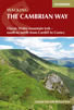 Guidebook to the Cambrian Way, a challenging three-week mountain trek through Wales from Cardiff to Conwy. The 470km un-waymarked route is presented from south to north. Often sticking to long, beautiful ridgelines, it crosses wild and rugged terrain and visits many of Wales's highest mountains, including Snowdon.
More information
Further Information
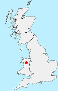
Walk Location Map
Walking in Snowdonia
Walking in TSnowdonia (Eryri) National Park is much more than the highest mountain in England and Wales. Mainly mountainous, it encompasses a large area of beautiful and often spectacular wild landscapes. Located in North Wales, the National Park offers a tremendous variety of walks with many challenging mountain routes. More Information
Walk grading - Learn how each walk is assessed and select a walk to suit your ability and experience by going to Walk Grading Details.
Messaging & Social Media
Message Walking Britain and follow the latest news.

Mountain Weather
Stay safe on the mountains with detailed weather forecasts - for iOS devices or for Android devices.