Gower Peninsula WalksWalking Routes & Hiking Trails
Find Gower Peninsula walks from the list below which features the best walking routes in the area. Most are circular walks and are listed from the shortest and easiest to the longest more challenging routes.
| Walk | Description | Grade | Miles |
|---|---|---|---|
| 1967★ | Worms Head from Rhossili | easy | 3.30 |
| 2277★ | Oxwich Point Circular from Oxwich | easy/mod | 3.50 |
| 2358★ | Parc le Breos near Parkmill | easy | 3.60 |
| 1980★ | Pwlldu Head & Bishopston Valley from Southgate | easy | 4.00 |
| 3258★ | The Beacon from Rossili | easy | 4.00 |
| 2724★ | Whiteford Sands from Llanmadoc | easy | 5.10 |
| 2191★ | Cheriton & Weobley Castle from Landimore | easy/mod | 5.20 |
| 2144★ | Port-Eynon from Pilton Green | easy/mod | 6.40 |
| 1960★ | Worms Head from Pilton Green | easy/mod | 7.50 |
| 2287★ | Cefn Bryn & Penrice from Oxwich | easy/mod | 7.70 |
| 1691★ | Whiteford Point & Broughton Bay from Llanmadoc | easy/mod | 8.50 |
| 2424★ | Harding's Down & Rhossili Down | moderate | 9.00 |
| 3761★ | Cefn Bryn & Three Cliffs Bay from Penmaen | moderate | 9.00 |
| 1828★ | Three Cliff Bay & Ilston Cwm from Southgate | easy/mod | 9.00 |
★ GPS file ☩ Route profile
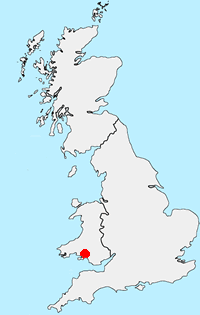
Location Map
Gower Peninsula Guide
The Gower or the Gower Peninsula is projects west into the Bristol Channel. Part of the City and County of Swansea, the Gower became the first area in the United Kingdom to be designated an Area of Outstanding Natural Beauty in 1956.
Gower-Peninsula Walking Guide
Other walks in Britain - For a list of all the areas where walks are available go to the Main Walk Index.
Walk grading - Learn how each walk is assessed and select a walk to suit your ability and experience by going to Walk Grading Details.
Messaging & Social Media
Message Walking Britain and follow the latest news.

Mountain Weather
Stay safe on the mountains with detailed weather forecasts - for iOS devices or for Android devices.