Pembrokeshire WalksWalking Routes & Hiking Trails
Find Pembrokeshire walks from the list below which features the best walking routes in the area. Most are circular walks and are listed from the shortest and easiest to the longest more challenging routes.
The Pembrokeshire walks listed below allow you to explore this scenically varied area. Highlights include the rugged coast, and the wild moors of the Preseli Hills. Many of the walks also allow you to explore ancient sites, historic buildings, interesting villages, and small bustling harbours. All the walks are free to download and print, and all routes have GPS files.
| Walk | Description | Grade | Miles |
|---|---|---|---|
| 3482★ | Garn Fawr & Garn Fechan Hillforts | easy | 1.50 |
| 3468★ | Foel Drygarn Hillfort, Preseli Hills | easy | 1.80 |
| 3474★ | Dinas Island from Cwm-yr-Eglwys | easy | 3.00 |
| 3475★ | Caldey Island Circular | easy | 3.00 |
| 3366★ | Bosherston Lily Ponds from Broad Haven | easy | 3.40 |
| 3477★ | Porthgain, Abereiddi Bay & Blue Lagoon | easy | 3.70 |
| 3467★ | Foel Drygarn Hillfort circular, Preseli Hills | easy/mod | 3.70 |
| 3497★ | Angle Peninsula from West Angle Bay | easy | 3.70 |
| 3362★ | Marloes Sands Circular | easy | 4.50 |
| 2057★ | St. David's Head & Carn Llidi | easy/mod | 4.50 |
| 2291★ | Mynydd Carningli from Newport | easy/mod | 4.50 |
| 1209★ | Saundersfoot & Tenby | easy/mod | 4.50 |
| 3363★ | Swanlake Bay from Manorbier | easy/mod | 4.80 |
| 2485★ | Broad Haven & Druidston Circular | easy/mod | 4.90 |
| 3469★ | Foel Cwmcerwyn from Rosebush, Preseli Hills | moderate | 5.00 |
| 3480★ | Strumble Head from Garn Fawr | easy/mod | 5.00 |
| 3364★ | The Stackpole Estate from Stackpole Quay | easy | 5.00 |
| 3365★ | Bosherston Lily Ponds, Broad Haven & St. Govan's Chapel | easy/mod | 5.00 |
| 1210★ | Porth Clais & St Justinian's | easy/mod | 5.50 |
| 2056★ | Pointz Castle from Solva | easy/mod | 5.50 |
| 3465★☩ | Foel Eryr Circular, Preseli Hills | moderate | 6.00 |
| 3491★☩ | Cwm yr Esgyr & Cemaes Head from Poppit Sands | moderate | 6.10 |
| 3367★ | Nab Head & Musselwick Sands from Marloes | easy/mod | 6.20 |
| 3466★ | The Preseli Ridge along the Golden Road | moderate | 6.40 |
| 3476★ | Porthgain & Blue Lagoon from Abereiddy | easy/mod | 6.50 |
| 3479★☩ | Strumble Head & Garn Fawr Hillfort | moderate | 6.80 |
| 3496★ | St Anne's Head & Dale Peninsula | easy/mod | 7.00 |
| 3473★ | Marloes Peninsular Circular | easy/mod | 7.00 |
| 1434★ | Abercastle & Trefin Circular | moderate | 7.50 |
| 3481★☩ | Carregwastad Point & Strumble Head Circular | moderate | 7.70 |
| 3490★☩ | Cemaes Head & Clawddcam from Poppit Sands | moderate | 8.30 |
| 3494★☩ | Pwllygranant & Cebwr Bay from Moylgrove | mod/hard | 8.50 |
| 3498★☩ | Freshwater West & Angle | moderate | 8.70 |
| 3483★☩ | Penberry & St Davids Head from Whitesands Bay | moderate | 9.00 |
| 3495★ | St. Govan's Chapel, Bosherston & Elegug Stacks | moderate | 9.60 |
| 1997★ | St. David's & Coast Path Circular | moderate | 9.70 |
Walks that start in adjacent counties / areas.
Walks that start in adjacent counties or areas but cross the boundary and include sections of the route within Pembrokeshire.
| Walk | Description | Starts In |
|---|---|---|
| 3369★☩ | Pendine to Amroth Coast Path | Carmarthenshire |
★ GPS file ☩ Route profile
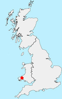
Location Map
Pembrokeshire Guide
Pembrokeshire is home to the Pembrokeshire Coast National Park, which is the only national park in United Kingdom established because of the coastline. In addition to the glorious coastline, The Preseli Hills in the north of the national park also offer excellent walking. The Preseli Hills are an area of high moorland with Foel Cwmcerwyn (536 m.) the highest point. The 190-mile (310 km) Pembrokeshire Coast Path offers a challenging route allowing you to explore the magnificent coast. Outside the national park boundaries, you can enjoy rural countryside.
Other walks in Britain - For a list of all the areas where walks are available go to the Main Walk Index.
Walk grading - Learn how each walk is assessed and select a walk to suit your ability and experience by going to Walk Grading Details.
Messaging & Social Media
Message Walking Britain and follow the latest news.

Mountain Weather
Stay safe on the mountains with detailed weather forecasts - for iOS devices or for Android devices.