The Wrekin from near Cluddley
Shropshire Hills Walk
Region - Shropshire Hills
County/Area - Shropshire
Author - Lou Johnson
Length - 3.0 miles / 4.9 km Ascent - 820 feet / 248 metres
Time - 2 hours 20 minutes Grade - easy/mod
Maps 

| Ordnance Survey Explorer 242 | Sheet Map | 1:25k | BUY |
| Anquet OS Explorer 242 | Digital Map | 1:25k | BUY |
| Ordnance Survey Landranger 127 | Sheet Map | 1:50k | BUY |
| Anquet OS Landranger 127 | Digital Map | 1:50k | BUY |
Walk Route Description
Click image to visit gallery of 3 images.
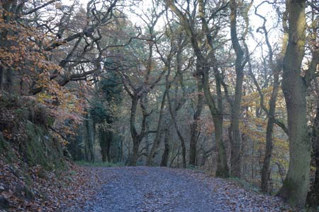
Of volcanic origins the Wrekin is one of a string of hills stretching from Telford south to Church Stretton near the Long Mynd. The Wrekin has close associations with the surrounding area and dominates the landscape around the modern town of Telford. This direct approach is a straightforward half day walk and offers a grandstand view of the surrounding countryside over a wide area. On a clear day the view extends as far north as Jodrell Bank with the Welsh mountains filling the skyline to the west. In good weather the route can be busy and parking can be very limited.
The start is the car park (Grid ref. SJ638092) on the minor road leading from Junction 7 of the M54 to the village of Little Wenlock. After parking cross the road and take the footpath that bears left in front of the derelict toilet block. Climbing gently the path turns south-west to reach a junction (Grid ref. SJ637088). Turn right here and continue climbing past the cafe and through a gate. The wide path (or track) turns through 180 degrees and continues climbing along the main ridge. Passing a radio tower, the topograph and trig point come into view. It is from these that the best views can be had. To return to the start simply retrace your steps.
Other walks nearby
| Walk 1941 | Outwoods & Beffcote | easy | 4.1 miles |
| Walk 2353 | Aqualate Mere & Sutton | easy | 5.2 miles |
| Walk 2678 | Wenlock Edge & Broadstone from Wilderhope Manor | easy/mod | 6.4 miles |
| Walk 3447 | Caer Caradoc, Hope Bowdler & Willstone Hills | moderate | 7.0 miles |
| Walk 2499 | Aqualate Mere & Forton | easy/mod | 8.0 miles |
| Walk 1837 | Norbury Junction Circular | easy | 4.6 miles |
| Walk 2269 | Norbury Junction, Gnosall & Aqualate Mere | easy/mod | 8.1 miles |
| Walk 2027 | Weston, Lee Brockhurst and Stanton | easy/mod | 8.5 miles |
| Walk 1097 | Caer Caradoc | easy/mod | 3.5 miles |
| Walk 2345 | Clee Hills | easy/mod | 6.8 miles |
Recommended Books & eBooks
Hillwalking in Shropshire
 Guidebook to 32 walking routes in Shropshire in the West Midlands. The routes range from 3 miles (5km) to 12 miles (19km), taking in highlights such as The Wrekin, Wenlock Edge, Long Mynd and Stiperstones, Castle Ring and Bury Ditches. Many routes start near delightful towns and villages including Church Stretton, Ludlow and Bishops Castle.
More information
Messaging & Social Media
Message Walking Britain and follow the latest news.

Mountain Weather
Stay safe on the mountains with detailed weather forecasts - for iOS devices or for Android devices.