Urgha Beag Circular from near Tarbert
Outer Hebrides Walk
County/Area - Outer Hebrides
Author - Andy Chaplin
Length - 11.8 miles / 19.2 km Ascent - 2430 feet / 736 metres
Time - 8 hours 20 minutes Grade - moderate
Maps 

| Ordnance Survey Explorer 455 | Sheet Map | 1:25k | BUY |
| Anquet OS Explorer 455 | Digital Map | 1:25k | BUY |
Walk Route Description
Click image to see photo description.
This walk, and a shorter part of it, is also described on the rather excellent website Walk Highlands which, had we found it before we went to Harris, would have made at least one of our walks in the Hebrides a lot less shambolic. There are two areas to park near the south of Lochanan Lascadail near Urgha which is on the road from Tarbert to Scalpay. The furthest east, just past the bridge over the stream between the north and south Laxadale Lochs is at the start of the well defined path signposted to Reinigeadal.
The path climbs uphill, passing a memorial, and over a couple of small bridges until it passes, at its highest point, between Beinn Tharsuinn and Trolamul. Until the road was built to Reinigeadal in the 1980s this path was used by children attending the secondary school in Tarbert and the postman. Having walked it - I would have come to some mutually beneficial arrangement.
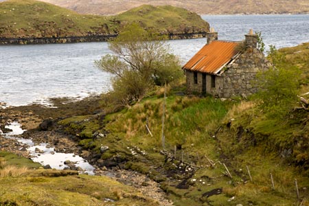
There are good views - in good weather - and the top of the pass is marked by a cairn. As you start to descend, after 1.5 miles from the start of the walk, a path marked with a cairn and stone marker leads off right to the deserted village of Molinginis. Carry straight on at this point and descend down to the sea at Loch Trolamaraig.
Steep inclines off the side of the path have never been my favourite feature of a walk and the bending path down to the bridge and beach at Loch Trolamaraig are not too bad but I cheered up when the quarter mile descent was over.
Climb up the far side where there are great views of the coast towards Reinigeadal. There is a bridge over one of the streams coming down from Todun and you pass the remains of a settlement as the path continues along the top of the steep cliffs and eventually makes its way up to the road from Eilean Anabaich to Reinigeadal.
Turn left along the road which climbs up to the east of Todun, passing three small lochs along the way. It then descends to Eilean Anabaich and continues along the shore of Loch Maraig. The chances are you will be passed at some point by a post office van or a school bus - they have it easy these days.
Just before the bridge over the river there is a footpath signed to Urgha. Turn left onto this path, pass through a gate and climb up next to a stream and you will come to another path at a t-junction. Turn left here and follow the clear route south which goes initially uphill until you look down on Lochanan Lascadail. The path comes down the west side of the loch for about 1.75 miles before finally climbing away to meet the road up on the right. Turn left along the road to return to the parking area at the start.
Other walks nearby
| Walk 1566 | Isle of Scalpay circular, Harris | easy | 5.3 miles |
| Walk 2442 | An Cliseam, Isle of Harris | moderate | 3.0 miles |
| Walk 1165 | The Quirang | easy | 3.2 miles |
| Walk 2806 | Udal & Aird a' Mhorain Point from Greinetobht | easy/mod | 6.5 miles |
| Walk 1164 | The Storr Sanctuary | easy/mod | 3.2 miles |
| Walk 2640 | The Storr & Old Man of Storr | moderate | 5.5 miles |
| Walk 1890 | The Butt of Lewis from Eoropie | easy | 3.8 miles |
| Walk 2002 | Dun Caan, Isle of Raasay | moderate | 10.6 miles |
| Walk 2589 | Marsco | moderate | 8.7 miles |
| Walk 3760 | Glamaig (Sgurr Mhairi & An Coileach) | mod/hard | 4.5 miles |
Recommended Books & eBooks
No suggestions for this area.Messaging & Social Media
Message Walking Britain and follow the latest news.

Mountain Weather
Stay safe on the mountains with detailed weather forecasts - for iOS devices or for Android devices.