Kent Coast Path from Deal
Kent Walk
County/Area - Kent
Author - Lou Johnson
Length - 8.2 miles / 13.3 km Ascent - 100 feet / 30 metres
Time - 4 hours 10 minutes Grade - easy/mod
Maps 

| Ordnance Survey Explorer 150 | Sheet Map | 1:25k | BUY |
| Anquet OS Explorer 150 | Digital Map | 1:25k | BUY |
Walk Route Description
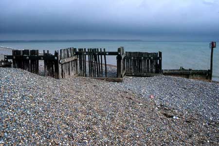
Click image to see photo description.
This Kent walk combines the interesting medieval town of Sandwich with a section of the England Coast Path. The route follows the Saxon Shore Way across pastures to reach the coast. Turning south, three kilometres of walking beside the sea leads towards Deal. Turning inland the route uses field paths to return to Sandwich where you should allow time to explore this fascinating and well-preserved town.
The start is the Gazen Salts pay and display car park (grid ref. TR329586) in Sandwich. After parking follow the entrance road south and turn left along Strand Street. Reaching the High Street, turn left to reach the river. Turn right and continue along the path adjacent to the river. Stay on the main path for 500 metres and just after crossing a stream (grid ref. TR336581), turn half right and follow a clear path with the stream on your immediate right. You are now following the Saxon Shore way in an easterly direction.
After just over a kilometre of easy walking you cross a tarmac track. Continue ahead passing the club house of Royal St. George's Golf Course on your right. Continue along the waymarked path east across the golf course to reach a metal kissing gate and Princes Drive (grid ref. TR359586). Cross the road and continue ahead to the shoreline and turn right. You are now on the England Coast Path.
After three kilometres of easy and sometimes bracing walking, you start to pass the greens of Royal Cinque Ports Golf Course. Turn right at a gravel track (grid ref. TR370559) and continue to reach Golf Road after 300 metres. Turn right along the road and at the first fork ignore the Byway signed to the right along a gravel track. Continue ahead along the road as far as the track leading left to Deal and Sandwich Shooting Club (Grid ref. TR363565). Turn left along the track and just before the entrance turn right onto a grassy path heading north to enter a large field. Keep to the left-hand edge of the field and continue north for a kilometre. For one section you join a clear track. Stay ahead when the track bends right.
Reaching a clear track, turn left. Follow the track as it bends left and then right. Almost immediately after the right-hand bend, veer half right off the clear track onto a grassy track (grid ref. TR352571). Follow the grassy track across a bridge and continue to join a tarmac lane. After 350 metres the lane bends left. Turn right here onto a track with an adjacent fingerpost. Follow the clear track around the edge of a field to reach a field corner with a house on your right (grid ref. TR336567). Turn right onto a narrower track, cross a bridge across fields keeping to the left-hand edge. The Path leads you to Dover Road. Turn right and continue into Sandwich.
Other walks nearby
| Walk 1561 | Ramsgate to Margate, Isle of Thanet | easy/mod | 7.8 miles |
| Walk 2381 | St Margaret's at Cliffe from Kingsdown | easy/mod | 6.3 miles |
| Walk 2249 | Reculver & St Nicholas at Wade | easy/mod | 8.2 miles |
| Walk 3219 | Canterbury to Whitstable | easy/mod | 10.5 miles |
| Walk 2923 | Folkestone to Dover along the North Downs Way | easy/mod | 8.2 miles |
| Walk 3617 | The Wye Downs and Crundale | easy/mod | 6.0 miles |
| Walk 2444 | Wye, Crundale & Wye Downs | moderate | 8.6 miles |
| Walk 2805 | Chilham circular from Wye | moderate | 17.0 miles |
| Walk 1044 | Wye and the Crundale Downs | moderate | 9.2 miles |
| Walk 1637 | Rivers Swale & Oare | easy | 5.0 miles |
Recommended Books & eBooks
Walking in Kent
 A guidebook describing 40 walks in the county of Kent. Covering west Kent and The Weald and north and east Kent, including the Kent Downs and the Greensand Hills. Walks of 5 to 9 miles explore rivers and coastline, beautiful countryside and historic villages. With outlines of 11 longer walks ranging from 15 to 163 miles.
More information
Messaging & Social Media
Message Walking Britain and follow the latest news.

Mountain Weather
Stay safe on the mountains with detailed weather forecasts - for iOS devices or for Android devices.