Rievaulx Moor from Cowhouse Bank
North York Moors Walk
Nat Park - North York Moors - North York Moors West
County/Area - North Yorkshire
Author - Andy Chaplin
Length - 9.5 miles / 15.4 km Ascent - 500 feet / 152 metres
Time - 5 hours 20 minutes Grade - moderate
Maps 

| Ordnance Survey Explorer OL26 | Sheet Map | 1:25k | BUY |
| Anquet OS Explorer OL26 | Digital Map | 1:25k | BUY |
| Ordnance Survey Landranger 100 | Sheet Map | 1:50k | BUY |
| Anquet OS Landranger 100 | Digital Map | 1:50k | BUY |
Walk Route Description
Click image to visit gallery of 3 images.
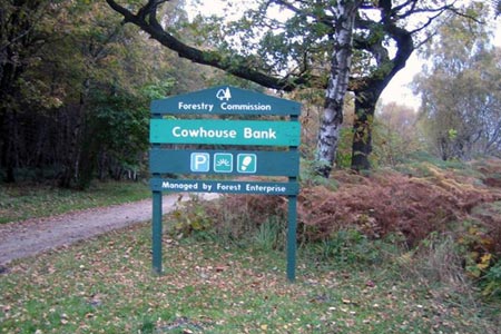
This North York Moors walk around Rievaulx moor is easy to follow and gives periodic views into the lower valleys below the Rievaulx Bank. There is plenty of Forestry Commission parking at Cowhouse Bank (SE612887) which is reached from Helmsley.
Follow the track from the parking to the north west, keeping above and following all the way around Cowhouse Bank, Clark Bank, Helmsley Bank, Rievaulx Bank and Ayton Bank. It is easy walking with periodic views of the lower countryside to the north and the moor to the south.
Just before the information board at Newgate Bank follow the track to your left onto the moor. When the track is about to enter the woods turn left again and pick up the track that does an arc towards the Heater Rigg Plantation. As you enter the woodland you have to do a quick left-then-right to pick up the forest road leading south through Acre Grain Plantation.
The footpath off to the left at grid reference SE591881 is not well marked but it is an obvious path through the trees. Follow it down to and across the beck and then up to the junction of five paths to the west of High Baxton's Farm. Take the footpath across the fields to the road between High and Middle Baxton's Farms then go south on the road.
Take the first path on the left and at the meeting with the Tabular Hills Walk bear left on the Keld Lane track and follow it to the road above Carlton. Stay on the Tabular Hills Walk all the way to Riccal Dale Wood.
At the point where the THW heads off down the bank towards the river Riccal, bear left and follow the reasonably well-defined track heading back through the woods to the parking - always keeping to the track nearest to the western edge of the woods. This part can be boggy and may get churned up by horses but there are compensating chances to get views down into Riccal Dale.
At the end you come out back at the Cowhouse Bank parking.
Other walks nearby
| Walk 1525 | Beck Dale & Rievaulx from Helmsley | moderate | 9.8 miles |
| Walk 3398 | Rollgate Bank & Aumery Park from Fadmoor | moderate | 11.0 miles |
| Walk 1542 | The Rudland Ridge from Ousegill Bridge | moderate | 10.1 miles |
| Walk 1622 | Hawnby, Bilsdale West and Wetherhouse Moors | moderate | 8.3 miles |
| Walk 1524 | Cold Kirby, Rievaulx Bridge & Wass | moderate | 12.5 miles |
| Walk 2029 | Lastingham & Rosedale from Hutton-le-Hole | moderate | 12.0 miles |
| Walk 1704 | Oswaldkirk, Nunnington & Harome circular | moderate | 11.5 miles |
| Walk 2702 | Ampleforth, Shallow Dale, Yearsley Moor & Wilderness | moderate | 9.5 miles |
| Walk 3581 | Gormire Lake from Sutton Bank National Park Centre | easy/mod | 3.4 miles |
| Walk 1544 | Chop Gate, Round Hill & Stumps Cross | moderate | 10.1 miles |
Recommended Books & eBooks
Trail and Fell Running in the Yorkshire Dales
 Guidebook to 40 of the best trail and fell runs in the Yorkshire Dales National Park. Ranging from 5 to 24 miles, the graded runs start from bases such as Ribblehead, Dent, Sedbergh, Malham and Grassington and take in the region's diverse delights, from castles and waterfalls to iconic mountains such as Whernside, Ingleborough and Pen Y Ghent.
More information
Messaging & Social Media
Message Walking Britain and follow the latest news.

Mountain Weather
Stay safe on the mountains with detailed weather forecasts - for iOS devices or for Android devices.