Harley's Mountain from Lingen
Herefordshire Walk
County/Area - Herefordshire
Author - Lou Johnson
Length - 7.5 miles / 12.2 km Ascent - 1050 feet / 318 metres
Time - 4 hours 50 minutes Grade - easy/mod
Maps 

| Ordnance Survey Explorer 201 | Sheet Map | 1:25k | BUY |
| Anquet OS Explorer 201 | Digital Map | 1:25k | BUY |
Walk Route Description
Click image to see photo description.
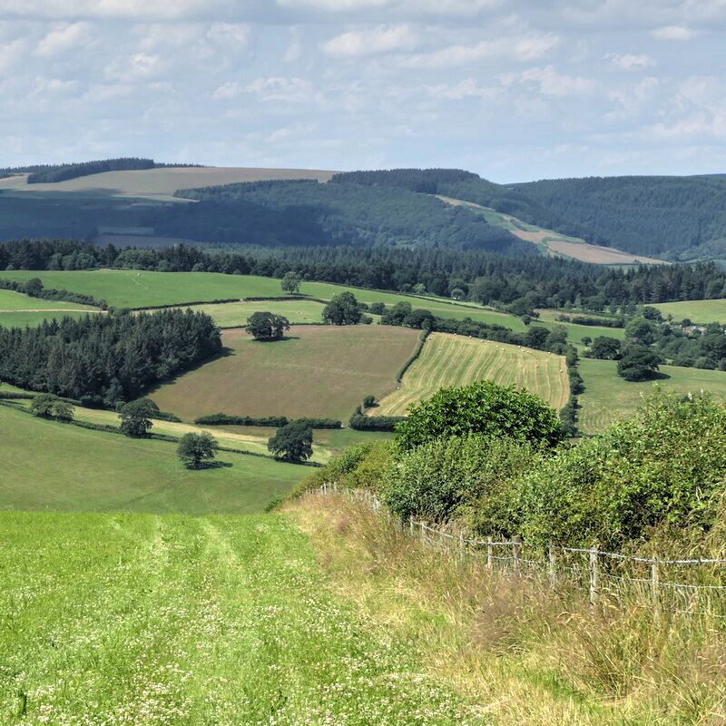
This Herefordshire walk from Lingen explores the hills and valleys lying to the west of the village. The route uses part of the 150-mile-long Herefordshire Trail, paths, and quiet lanes. The high point of the walk is the misleadingly named Harley's Mountain which rises to 386 metres above sea level. Despite its lack of height, the summit area offers fine views across the hilly landscape of northwest Herefordshire.
The start is the layby by St Michael and All Angels church (grid ref. SO365672). You are requested to park carefully. After parking, with your back to the church, walk left and take the first footpath (Herefordshire Trail) on your right through a metal kissing gate. Walk along the right-hand edge of the field to a stile. Maintain direction across the next field to a stile and adjacent metal gate. Bear left along the rising lane and continue for 400 metres. Ignore the first footpath on the right and continue to the fingerpost by a telegraph pole on the right. Go through a gate and shortly after a kissing gate. The path parallels a stream on your right. Pass through two more kissing gates to reach open hillside.
Reaching a path junction (grid ref. SO353678), fork right and pass through a gate. The path soon crosses the stream and then fork left up through trees. Continue along the edge of the wood (with a field to your right) to reach a track near Red House (grid ref. SO346683). Cross the track and follow an enclosed rising bridleway north. Reaching the ridge and a path junction (grid ref. SO345689) on Harley's Mountain. Turn left downhill across a field. The path then joins a track which followed down to a lane.
Turn right and follow the quiet lane for four kilometres to a reach a road junction opposite Oaklands (grid ref. SO364695) in the hamlet of Birtley. Turn right and continue toa T-junction. Take the enclosed bridleway opposite. After 300 metres the bridleway veers right, joins a track and continues towards Deerfold Cottage. Just before the cottage bear right into a field and follow the path along the left-hand edge of the field. Pass through a gate into a second field keeping to the right-hand edge. Just past a gate cross the stile on your right. Descend through trees to cross a stile into a field. Bear half-left across the field to a small bridge. After crossing the bridge maintain direction to a kissing gate and bridge. The path soon turns left and heads south passing the earthworks of a motte and bailey on your left. Continue through the churchyard back to the layby used at the start of the walk.
Other walks nearby
| Walk 1673 | Shobdon Hill and Croft Ambrey from Shobdon Estate | moderate | 12.5 miles |
| Walk 2816 | Kinsley Wood, Stowe and Offa's Dyke | moderate | 12.0 miles |
| Walk 1907 | Stowe & Offa's Dyke from Kinsley Wood | moderate | 7.0 miles |
| Walk 1787 | Pembridge, Eardisland & the Arrow Valley | easy/mod | 7.4 miles |
| Walk 3643 | LLan-fawr & Lugg Valley from Whitton | moderate | 7.5 miles |
| Walk 3631 | Panpunton Hill & Stowe from Knighton | moderate | 7.8 miles |
| Walk 3285 | The Hergest Ridge and Huntington from Kington | moderate | 12.0 miles |
| Walk 3300 | The Hergest Ridge from Kington | moderate | 8.5 miles |
| Walk 3614 | Herrock Hill from Kington | moderate | 8.0 miles |
| Walk 2840 | High Vinnals & Richard's Castle | easy/mod | 6.0 miles |
Recommended Books & eBooks
No suggestions for this area.Messaging & Social Media
Message Walking Britain and follow the latest news.

Mountain Weather
Stay safe on the mountains with detailed weather forecasts - for iOS devices or for Android devices.