Rattlebrook Peat Railway
Dartmoor Walk
Nat Park - Dartmoor
County/Area - Devon
Author - Lou Johnson
Length - 7.3 miles / 11.9 km Ascent - 1000 feet / 303 metres
Time - 4 hours 40 minutes Grade - easy/mod
Maps 

| Ordnance Survey Explorer OL28 | Sheet Map | 1:25k | BUY |
| Anquet OS Explorer OL28 | Digital Map | 1:25k | BUY |
Walk Route Description
Click image to see photo description.
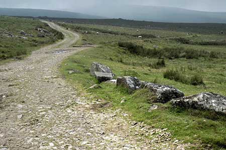
This Dartmoor walk explores the remains of the Rattlebrook Peat Railway which operated from 1879 until 1931 to carry processed peat to main line railway at Bridestowe from the moors east of the works at the head of the Rattle Brook. At its peak, the works employed around a 100 men. The railway was laid to standard gauge and horses were used to move the wagons. From the main line the railways gained 1000 feet and the route was engineered to produce as favourable a gradient as possible. It is worth noting the loaded wagons travelled downhill.
The start of the walk is a car park (grid ref. SX525853) off the A386 reached by a lane from the Dartmoor Inn. After parking, walk to the lane and turn right up a clear rising track. After 800 metres you reach the River Lyd. Do not cross the river and turn left and follow the wall north. Continue beside the wall to where it turns left. Bear left along the wall for 100 metres and then head right crossing the first track to reach the second track (grid ref. SX532864). Take the higher of the two tracks heading north.
Turn right along the former trackbed of the Rattlebrook Peat Railway northwards to pass Great Nodden on your right. Continue up the track for a further 1.5 kilometres to reach the reversing point on Coombe Down (grid ref. SX546887). This is where the where the wagons changed direction. This arrangement was necessary to keep a favourable gradient.
Turn back on yourself and take the left fork to continue along the former track bed. The track continues its gradual ascent and after 2.5 kilometres you reach the end of the railway (grid ref. SX559871) at the site of the Rattlebrook Peat Works. Careful exploration to the east will reveal limited evidence of the peat works, which in their heyday must have been a hive of activity.
Turn south along a rough and sometimes boggy track. After 500 metres turn right across Rattlestone Brook. If you want to explore the remains of Bleak House then continue ahead for 100 metres and then return to this crossing. Bleak House was where the manager lived. The path angles away from the brook and soon passes a rock outcrop (Lower Dunna Goat) on the eastern flank of Great Links Tor. 250 metres beyond the outcrop, the route veers right along a clear bridleway. This leads to the River Lyd crossing and the car park used at the start.
Other walks nearby
| Walk 2908 | Great Links Tor & Widgery Cross from the Fox & Hounds | easy/mod | 5.0 miles |
| Walk 1075 | High Willhays & Yes Tor | moderate | 6.5 miles |
| Walk 3004 | Yes Tor, Cranmere Pool and Amicombe Hill from Meldon Reservoir | mod/hard | 12.5 miles |
| Walk 2636 | North Moor crossing from Okehampton to Bellever | mod/hard | 14.5 miles |
| Walk 2085 | Cosdon Hill & Oke Tor from Belstone | moderate | 10.7 miles |
| Walk 3671 | Nun's Cross & Peat Cot from Princetown | easy/mod | 7.0 miles |
| Walk 2639 | Cosdon Beacon from South Zeal | easy/mod | 6.5 miles |
| Walk 1772 | Hurston, Lettaford & Two Moors Way | moderate | 8.6 miles |
| Walk 3201 | Bellever Tor & Postbridge | easy/mod | 5.5 miles |
| Walk 3202 | Postbridge & Challacombe Down from Bellever | moderate | 9.8 miles |
Recommended Books & eBooks
No suggestions for this area.Messaging & Social Media
Message Walking Britain and follow the latest news.

Mountain Weather
Stay safe on the mountains with detailed weather forecasts - for iOS devices or for Android devices.