The Nar Valley from Castle Acre
Norfolk Walk
County/Area - Norfolk
Author - Lou Johnson
Length - 6.1 miles / 9.9 km Ascent - 350 feet / 106 metres
Time - 3 hours 20 minutes Grade - easy
Maps 

| Ordnance Survey Explorer 236 | Sheet Map | 1:25k | BUY |
| Anquet OS Explorer 236 | Digital Map | 1:25k | BUY |
Walk Route Description
Click image to see photo description.
The pretty village of Castle Acre with its remains of a Norman Castle is the starting point for this pleasant walk through the Norfolk countryside. The most convenient place to park is at the eastern end of Pye's Lane (grid ref. TF820152) where a small car park is provided for visitors adjacent to the remains of the castle.
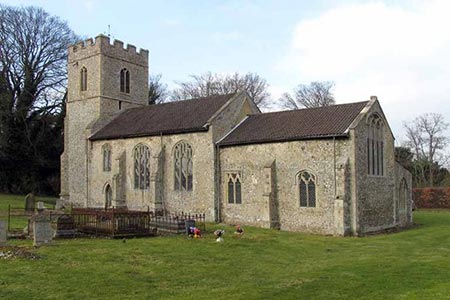
After parking, walk west along tree-lined Pye's Lane towards the centre of the village. You soon reach the village High Street. Bear left into the centre of the village. Continue straight ahead, passing the splendid Parish Church on your left. The High Street leads ahead into Priory Lane. Reaching a sharp right hand bend, with a brown sign pointing to the Priory to the left, follow Priory Lane around to the right. After 70 metres the lane bears right again (grid ref. TF813150).
Turn left here onto a track (Common Road) joining the Nar Valley Way. The track bear right and reaches a junction with Fulmer Lane (grid ref TF807152). Go through the gate and continue on the path along the northern edge of Castle Acre Common. Continue ahead through some trees, follow the boardwalk and cross two bridges to emerge onto a lane (grid ref. TF787150).
Turn left past Mill House to reach a road. Here, continue straight ahead (south-west) and after 400 metres (grid ref. TF785147) turn left down a clear track (opposite a footpath sign). Continue under high voltage power lines. You pass Blakeneyhill Plantation on your left to reach a junction of tracks after about one kilometre from the road (grid ref. TF787137). Turn left and following the blue and white waymarks to walk east past Three-cocked-hat Plantation. At the first 'crossroads' go straight across with a plantation on your right.
At the next 'crossroads' (grid ref. TF800132), turn left onto Petticoat Drove. Follow this clear well-made track north to reach a lane by South Acre Hall (grid ref. TF806144). Turn right and continue along the lane into South Acre. Walk past the church and in a further 200 metres bear left onto a narrow lane signed 'Ford - Unsuitable for motors'. You are now following the Peddar's Way long distance footpath. On your left are some fine views to the ruined priory.
Go over the footbridge by the ford following South Acre Road north. At the first junction (grid ref TF816147) turn right along Blind Lane and continue to a T-junction with Bailey Street (grid ref. TF818148). Turn left and continue past a row of flint-faced cottages on your right. Turn first right down Cuckstool Lane. In a short way, you can turn left through the castle ruins and regain the car park used at the start of the walk.
Other walks nearby
| Walk 2246 | Tittleshall, Mileham & Godwick | easy/mod | 7.0 miles |
| Walk 3256 | Great Bircham & Fring Circular | easy/mod | 8.4 miles |
| Walk 2127 | The Brecks from near Thompson | easy | 6.8 miles |
| Walk 1640 | Snettisham Beach RSPB reserve | easy | 4.0 miles |
| Walk 3416 | Hunstanton from South Beach, Heacham | easy | 6.0 miles |
| Walk 1035 | Burnham Market | easy | 5.5 miles |
| Walk 3514 | Brancaster to Burnham Overy Staithe | easy | 6.0 miles |
| Walk 3640 | Thornham Circular | easy | 5.0 miles |
| Walk 1908 | Wells-next-the-Sea & Holkham Park | easy/mod | 8.0 miles |
| Walk 2101 | Holkham Park circular | easy | 4.5 miles |
Recommended Books & eBooks
No suggestions for this area.Messaging & Social Media
Message Walking Britain and follow the latest news.

Mountain Weather
Stay safe on the mountains with detailed weather forecasts - for iOS devices or for Android devices.