St Benet's Abbey & How Hill from Ludham
The Broads Walk
Nat Park - The Broads
County/Area - Norfolk
Author - Lou Johnson
Length - 8.8 miles / 14.3 km Ascent - 150 feet / 45 metres
Time - 4 hours 30 minutes Grade - easy/mod
Maps 

| Ordnance Survey Explorer OL40 | Sheet Map | 1:25k | BUY |
| Anquet OS Explorer OL40 | Digital Map | 1:25k | BUY |
Walk Route Description
Click image to see photo description.
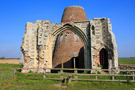
This Norfolk Broads walk starts from the village of Ludham which has fine church worth visiting. The route then follows the River Ant from the ruins of St Benet's Abbey and the adjacent mill north to How Hill where there is a fine thatched mansion and gardens that are open to the public. The final section of the walk is across fields back to the start.
The walks starts from car park adjacent to the moorings on the south side of Ludham village (grid ref. TG391180). Leave the car park and walk north back to the main Yarmouth Road (A1062) through the village. Turn left to the centre of the village. Turn left down the southern end of High Street, which soon becomes Staithe Road. After just under 600 metres turn right along a driveway (grid ref. TG388177). The tarmac driveway soon becomes a track and continues along the edge of a field to reach a track junction (grid ref. TG384180). Turn left here and continue past Ludham Hall to reach Hall Lane (grid ref. TG381174).
Turn left along Hall Common Road for 400 metres. At the first junction (grid ref. TG384173), turn right down St Benet's Road. Continue past the farm (on your right) and follow the clear track ahead for nearly a mile to reach the ruins of St Benet's Abbey and the adjacent ruined drainage mill (grid ref. TG380158). C9ontinue along a gravel path towards riverside moorings. Just before the moorings turn right onto a recently opened grassy path along the embankment. This leads through a typical Norfolk Broads landscape with the River Ant to your left. Continue on this path for a mile to reach Ludham Bridge. Before reaching the bridge drop down to a gate and follow the path away from the river and then turn left up to the main road (grid ref. TG373171).
Cross the road with care and turn left passing toilets and a café before dropping down to the right to re-join the riverbank path heading north. After 1.5 miles (grid ref. TG366184), take the path on the right. Follow this path to the next junction reached in 200 metres. Turn left and continue along the path until you reach Toad Cottage (grid ref. TG370191). Turn right here and follow the track to How Hill Road (grid ref. TG373193).
Turn left along the road for 400 metres and take the bridleway on the right. Stay on the bridleway, ignoring footpath on the right. The bridleway swings to the left. Ignore the footpath on the left and continue to a junction (grid ref. TG379195). Turn right here heading south. After 500 metres, turn left onto a path with the hedge to your right and continue to reach Goffins Lane (grid ref. TG384190). Go straight across and continue on the path to reach Catfield Road. Turn right and walk back into the Ludham village. Reaching the A1062, turn left and then retrace your steps back to the car park used at the start of the walk.
Other walks nearby
| Walk 3694 | River Thurne & Hickling Broad from Potter Heigham | easy/mod | 6.4 miles |
| Walk 2128 | Stokesby & Muck Fleet from Fleggburgh | easy | 7.1 miles |
| Walk 2320 | Muck Fleet & River Bure from near Oby | easy/mod | 8.7 miles |
| Walk 2239 | River Bure and Tunstall Dike from Acle | easy | 6.1 miles |
| Walk 2240 | The River Bure & Upton from Acle | easy | 5.0 miles |
| Walk 1855 | Horsey Circular | easy | 5.1 miles |
| Walk 1992 | Horsey Gap from Horsey | easy | 3.7 miles |
| Walk 3608 | Martham Ferry & River Thurne from West Somerton | easy | 4.0 miles |
| Walk 3609 | Winterton Ness from West Somerton | easy | 5.4 miles |
| Walk 2297 | Honing & East Ruston Circular | easy/mod | 6.4 miles |
Recommended Books & eBooks
No suggestions for this area.Messaging & Social Media
Message Walking Britain and follow the latest news.

Mountain Weather
Stay safe on the mountains with detailed weather forecasts - for iOS devices or for Android devices.