Berwyn Tops from Tan Y Pystyll
Powys Walk
County/Area - Powys & Denbighshire & Wrexham - Powys North
Author - James Martin
Length - 14.0 miles / 22.8 km Ascent - 3100 feet / 939 metres
Time - 10 hours 10 minutes Grade - moderate
Maps 

| Ordnance Survey Explorer 255 | Sheet Map | 1:25k | BUY |
| Anquet OS Explorer 255 | Digital Map | 1:25k | BUY |
| Ordnance Survey Landranger 125 | Sheet Map | 1:50k | BUY |
| Anquet OS Landranger 125 | Digital Map | 1:50k | BUY |
Walk Route Description

Click image to visit gallery of 5 images.
The Berwyn hills rise to over 800 metres and offer some excellent walking. This route visits the highest point - Cadair Berwyn - together with a number of other summits on the main ridge and a connecting ridge too. The walk involves patchy bog so dress appropriately and maybe take a spare pair of socks just in case. The walk starts at the famous waterfall at Tan Y Pystyll where there is a pay and display car park (grid ref SJ073295) or a lay-by located (grid ref SJ074294) which will fit about half a dozen cars.
Continue to the end of the road and take the signed path to Cadair Berwyn. Follow the path up a gentle incline until you reach open ground. The stream that feeds the waterfall should be on your left, take the first path off to the right & begin to climb steadily upwards. After a few minutes the path veers off to the left and a fence leading up and over Trum Felen can be seen. Follow the path adjacent to the fence which takes you over Trum Felen and up to the first summit of the day, Moel Sych. A cairn marks the summit and a crossroads in the fence lies just behind.
Take the stile signed Cadair Berwyn and keep the fence on your left. The ground here is boggy so choose your path carefully, stick to the path adjacent to the fence and eventually you reach a circular cairn shelter with the trig point of Cadair Berwyn a little further beyond. This is the highest point in the Berwyn range & offers good views on a clear day. Leave the summit continuing along the same path with the fence on the left. The path veers away from the fence before joining back up with it at a stile signposted Cadair Bronwen. An optional extra for peak baggers is the clear path often in the form of a raised wooden platform that takes you up to the summit of Cadair Bronwen. This can be tagged in about 30 minutes before returning to the stile and again provides good views in all directions.
Assuming you have either completed or ignored Cadair Bronwen, continue along the path next to the fence. You will see a path that cuts away descending down to the right from a gate. Ignore this and continue on a little further. The fence then heads away to the right. Follow the line of the fence until you reach a small pile of stones which marks the third summit of the day. This is Tomle. This offers good views back across to Cadair Berwyn and Cadair Bronwen.
Depart the summit along the familiar path hugging the fenceline which takes you up and over Foel Wen and eventually brings you to a circular cairn that denotes the summit of Mynydd Tarw. From here take the path to the left hand side of the plantation where the bog patches return. At the corner of the plantation the path leads away to the left heading towards the peak of Rhos which is marked by a boundary stone that you could be forgiven for missing entirely.
After this, the path descends slightly before rising again as it curves around to the right and begins to descend once more. Take care here as the path becomes a little unclear. Head towards the bottom of the field where you will pick up a clear track that leads you past an old disused sheep dip near to the bottom of the plantation you passed earlier and then another that is in use. The track takes you through the middle of some farm buildings where you should take care for dogs. The track then picks up a road which leads you down to a phone box and a good spot to rest for a minute.
There is a footpath directly across the road from the phone box that leads you across a field and to the left of a house where you follow a partially covered aerial wire up towards the corner of the field. From here the path is well defined and runs through a number of fields and some old disused farm buildings before winding through a wooded area. At this point I found a route to the peak of Godor and back but there is no right of way here so do not assume this will be well received by the local farmers. The path through the wooded area winds on for a while and eventually joins the road back up towards Tan Y Pystyll. The mile and a half or so on the road back to the car park where you started provides ample opportunity to reflect on a good day's walking having covered a decent majority of the Berwyn peaks.
Other walks nearby
| Walk 3031 | Cadair Berwyn | moderate | 9.3 miles |
| Walk 1256 | Cadair Bronwen | moderate | 9.5 miles |
| Walk 1989 | Llanarmon Dyffryn Ceiriog Circular | moderate | 6.0 miles |
| Walk 3102 | Bwlch Sych and Tynygarreg from Lake Vyrnwy | moderate | 8.5 miles |
| Walk 2055 | Moel Emoel from near Bala | moderate | 6.0 miles |
| Walk 3655 | Rhewl, Moel y Gamelin & Moel Morfydd | moderate | 5.4 miles |
| Walk 1845 | Castell Dinas Bran from Llangollen | easy/mod | 4.0 miles |
| Walk 3017 | Aran Benllyn & Aran Fawddwy from Llanuwchllyn | mod/hard | 10.0 miles |
| Walk 1067 | Ruabon Mountain & The Limestone Edges of Llangollen | moderate | 11.0 miles |
| Walk 2059 | Castell Carndochan near Bala | easy/mod | 2.5 miles |
Recommended Books & eBooks
The Cambrian Way
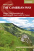 Guidebook to the Cambrian Way, a challenging three-week mountain trek through Wales from Cardiff to Conwy. The 470km un-waymarked route is presented from south to north. Often sticking to long, beautiful ridgelines, it crosses wild and rugged terrain and visits many of Wales's highest mountains, including Snowdon.
More information
Messaging & Social Media
Message Walking Britain and follow the latest news.

Mountain Weather
Stay safe on the mountains with detailed weather forecasts - for iOS devices or for Android devices.