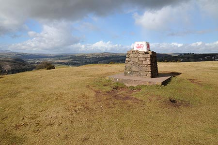
Pen-y-Crug hill fort from Brecon
Brecon Beacons/Bannau Brycheiniog Walk
Nat Park - Brecon Beacons - Brecon Beacons Central
County/Area - Powys
Author - Lou Johnson
Length - 3.0 miles / 4.9 km Ascent - 550 feet / 167 metres
Time - 2 hours 0 minutes Grade - easy
Maps 

| Ordnance Survey Explorer OL12 | Sheet Map | 1:25k | BUY |
| Anquet OS Explorer OL12 | Digital Map | 1:25k | BUY |
| Ordnance Survey Landranger 160 | Sheet Map | 1:50k | BUY |
| Anquet OS Landranger 160 | Digital Map | 1:50k | BUY |
Walk Route Description
Click image to see photo description.
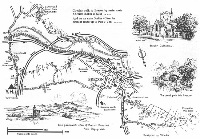
This short Brecon Beacons walk starts on the banks of the River Usk and visits the hill fort of Pen-y-crug which lies to the west of this attractive market town. There are several car parks in the centre but the long-stay car parks by the Watergate Bridge (grid ref. SO042286) and on the promenade (grid ref. SO038289) are the most convenient for this walk. After parking walk to the cathedral and follow Pendre, the B4520 north towards the edge of the built-up area.
Approximately 600 metres along the B4520 from the Cathedral (grid ref. SO042295), turn left onto a surfaced lane heading roughly northwest. Reaching a junction after 600 metres (grid ref. SO038301) turns left along what is a now a narrower track past Crug Vila and into open access country surrounding Pen-y-crug fort. An obvious path leads through the earthworks to reach the OS trig point from where there are excellent views especially south to the Usk Valley.
To return to Brecon, leave the trig point on a clear path heading south-west. This reaches the boundary of the Open Access Land (grid ref. SO032301) from where a signed footpath crosses several fields to reach the Maen-du Well (grid ref. SO039296). From here the path continues to reach a road and a small parking area with an adjacent mini roundabout (grid ref. SO039296). Go straight across the mini roundabout and follow the tarmac path passing in front of two terraces of houses on your left. Reach a path junction at the end of the second terrace, bear right and continue between houses a short way to reach Bron-y-crug road.
Turn left and follow the road as it bends to the right and becomes Dannycrug road. Reaching a T-junction, turn left and almost immediately right into Peppercorn Lane. Follow this to reach the B4520 used on the outward route. Turn right and follow the road to the Cathedral.
This walk can easily be combined with Walk 3564 to make a figure of eight route exploring the countryside to the east of Brecon with a walk along the Monmouthshire and Brecon canal takin g you back to the centre of Brecon.
Originally conceived by Martyn Hanks, this walk was designed for Youth Hostellers staying at the Ty'n-y-Caeau Youth Hostel near Brecon. The route followed a figure of eight and for the convenience of all walkers the route has been split in two with each loop being a separate walk based from the centre of Brecon. The routes were drawn in a 'Wainwright' style and provided annotated maps offering additional information for walkers. Prepared before the days of GPS they were an invaluable resource and Walking Britain is happy to ensure that these walks remain in the public domain.
Other walks nearby
| Walk 3209 | Llanfrynach and Pencelli circular | easy/mod | 5.6 miles |
| Walk 2400 | Pen y Fan from Cwmgwdi near Brecon | moderate | 5.0 miles |
| Walk 1903 | Pen y Fan & Corn Du from Cwmgwdi | moderate | 7.5 miles |
| Walk 2074 | Highest Peaks of the Brecon Beacons | mod/hard | 11.0 miles |
| Walk 3546 | Pen y Bryn from Pencelli | moderate | 5.0 miles |
| Walk 3536 | Pen y Bryn & Carn Pica from Pencelli | mod/hard | 11.3 miles |
| Walk 2648 | The Black Mountain, Brecon Beacons | moderate | 8.0 miles |
| Walk 2641 | Fan Fawr & Fan Frynych, Fforest Fawr | moderate | 6.5 miles |
| Walk 2349 | Pen Y Fan & Corn Du from near Storey Arms | moderate | 4.6 miles |
| Walk 3616 | Fan Fawr from Storey Arms | moderate | 6.0 miles |
Recommended Books & eBooks
The Cambrian Way
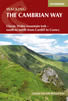 Guidebook to the Cambrian Way, a challenging three-week mountain trek through Wales from Cardiff to Conwy. The 470km un-waymarked route is presented from south to north. Often sticking to long, beautiful ridgelines, it crosses wild and rugged terrain and visits many of Wales's highest mountains, including Snowdon.
More information
Walking on the Brecon Beacons
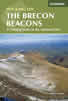 45 circular day walks are described in this guidebook to the Brecon Beacons National Park. From west to east, Mynydd Du, Fforest Fawr, the Brecon Beacons and the Black Mountains these mountain and valley routes offer many options, highlighting the natural features. The walks described explore dramatic waterfalls, wooded gorges and upland valleys.
More information
Messaging & Social Media
Message Walking Britain and follow the latest news.

Mountain Weather
Stay safe on the mountains with detailed weather forecasts - for iOS devices or for Android devices.