Arlesford Creek & Brightlingsea Circular
Essex Walk
County/Area - Essex
Author - Lou Johnson
Length - 6.0 miles / 9.8 km Ascent - 150 feet / 45 metres
Time - 3 hours 10 minutes Grade - easy
Maps 

| Ordnance Survey Explorer 184 | Sheet Map | 1:25k | BUY |
| Anquet OS Explorer 184 | Digital Map | 1:25k | BUY |
| Ordnance Survey Landranger 168 | Sheet Map | 1:50k | BUY |
| Anquet OS Landranger 168 | Digital Map | 1:50k | BUY |
Walk Route Description
Click image to see photo description.
This Essex walk starts from Brightlingsea, which I remember as a child with its beach, river and boats. A return visit years later brought back many happy memories and the chance to explore the area in more detail. The walk starts close to Batemans Tower where there is a car park and toilets (grid ref. TM078162).
Locate Western Promenade and walk along the sea front with Brightlingsea Creek to your right. Walk as far as the Lido and then turn left beside the fence. At the northern end of the Lido turn right and follow the clear path to pass the boating lake on your right. Reaching a road, turn left into Lower Park Road. The road curves to the right and shortly after turn left into Park Drive. Take the second right into Chestnut Way and reaching a T-junction turn left onto Marennes Crescent.
Continue to the end of this road and turn right onto the path (adjacent to house number 34). The path leads behind housing, passes a farm on the left to reach Church Road (grid ref. TM082178). Turn left along Church Road. After 250 metres the road bends right (grid ref. TM080179). Take the tarmac track on the left just after the bench and follow the waymarked path (sign partly hidden in vegetation) to pass a sports field.
The track initially continues between fields and after 350 metres passes between flooded gravel pits. Reaching the end of the flooded pit on your left, the track bends sharp left. Cross a dirt track and follow the path into a wooded area (grid ref. TM073181). The path veers right and then left alongside a service road with flooded gravel pits on either side. Continue ahead to reach a band of trees at a T-junction of wide gravel tracks (grid ref. TM070184). Go straight ahead here following a path into the trees and a gate. Go through the gate and head half right across the field to join Movers Lane (grid ref. TM069187). Again, there is ample evidence of past and current gravel extraction.
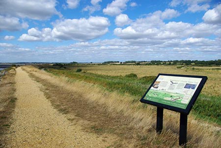
Turn left along Movers Lane. Ignore the track on the left heading to Moverons Farm. Continue walking for just over a kilometre staying on the track as it bears right, left and right again to reach the shore of Arlesford Creek (grid ref. TM063194). Turn left through a gate and follow the path with the creek on your right. The path soon swings round to the left and joins the old railway track-bed which runs alongside the River Colne. You now have nearly three kilometres of easy walking back to Bateman's Tower and the start of the walk.
Other walks nearby
| Walk 3746 | Bradwell on Sea Circular | easy | 6.5 miles |
| Walk 2924 | Tollesbury Wick Marshes from Tollesbury | easy | 7.2 miles |
| Walk 3658 | Manningtree, Flatford Mill and Dedham | easy/mod | 7.1 miles |
| Walk 2366 | The Naze from Walton-on-the-Naze | easy | 6.0 miles |
| Walk 3660 | Stour Valley & Dedham from Flatford Mill | easy | 3.5 miles |
| Walk 2096 | Alton Water, Stutton & Tattingstone | easy | 5.5 miles |
| Walk 2149 | Circuit of Alton Water | easy/mod | 7.6 miles |
| Walk 3724 | River Box from Stoke-by-Nayland | easy | 6.0 miles |
| Walk 1648 | Church End & Erwarton from Shotley Gate | easy | 6.0 miles |
| Walk 3645 | Burnham-on-Crouch to Fambridge | easy/mod | 9.5 miles |
Recommended Books & eBooks
No suggestions for this area.Messaging & Social Media
Message Walking Britain and follow the latest news.

Mountain Weather
Stay safe on the mountains with detailed weather forecasts - for iOS devices or for Android devices.