Blythburgh from Wenhaston
Suffolk Walk
County/Area - Suffolk
Author - Lou Johnson
Length - 5.0 miles / 8.1 km Ascent - 120 feet / 36 metres
Time - 2 hours 40 minutes Grade - easy
Maps 

| Ordnance Survey Explorer 231 | Sheet Map | 1:25k | BUY |
| Anquet OS Explorer 231 | Digital Map | 1:25k | BUY |
| Ordnance Survey Landranger 120 | Sheet Map | 1:50k | BUY |
| Anquet OS Landranger 120 | Digital Map | 1:50k | BUY |
Walk Route Description
Click image to see photo description.
This Suffolk walk starts from the village of Wenhaston and includes one of the finest 15th century church interiors in England at Blythburgh together with a wildlife rich riverside habitat along the banks of the River Blyth. Parking is available at the junction of Byford Lane and Coles Hill (grid ref. TM423758).
After parking walk south on Byford lane and continue straight ahead into The Street. Just after St Peter's Parish Church on the right, turn left into Narrow Way. Continue straight ahead down this residential road which becomes a track after 400 metres. Stay on the track which bends left and then right to reach Laurel Farm (grid ref. TM437752). Continue past the farm, keeping straight ahead at a way marker. Go through the gate following the track which bends to the left. Stay on the track which now bends right. After just over 100 metres leave the track and walk forward into the next field. Aim for the far left-hand corner to reach Wenhaston Lane (grid ref. TM441747).
Turn left along the road and continue to the junction the A12. Turn left and after a few metres take the signed public footpath on the left. This path leads into Church Lane with access to the Holy Trinity Church, Blythburgh on your left.
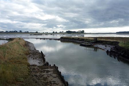
After visiting the church, bear to the left of the entrance and go down the steps at the back. At first walk right and then go left to climb onto the riverbank. Turn upstream (with the river to your right) and follow the clear path for about 2 kilometres. This section of path takes through some fine reed beds which are notes for their varied flora and fauna. Reaching the first bridge continue straight ahead.
At the second bridge, turn left and follow the path which becomes a track leading to Low Farm after 350 metres. Fork right following the field edge and go through gap at the corner. Continue straight across the next field. Turn right at the end of the field to a fingerpost. Turn left here to reach Byford Lane and continue back to the start which is reached after 150 metres.
Other walks nearby
| Walk 1775 | Walberswick Circular | easy | 4.5 miles |
| Walk 2014 | Southwold | easy | 4.0 miles |
| Walk 1529 | Aldeburgh and Thorpeness Circular | easy/mod | 8.5 miles |
| Walk 2237 | Somerleyton & Herringfleet Hills | easy | 3.5 miles |
| Walk 2075 | Tyrrel's Wood and Boudicca Way | easy/mod | 8.5 miles |
| Walk 1834 | Shelton & Fritton Common from Tyrrels Wood | easy/mod | 7.0 miles |
| Walk 2428 | The Rivers Ore & Alde from Orford | easy/mod | 11.0 miles |
| Walk 2446 | Rockland St Mary Circular | easy/mod | 8.1 miles |
| Walk 3348 | River Yare & Claxton from Rockland Staithe | easy | 5.2 miles |
| Walk 2239 | River Bure and Tunstall Dike from Acle | easy | 6.1 miles |
Recommended Books & eBooks
Suffolk Coast and Heath Walks
 Guidebook to three long-distance routes exploring the varied landscapes of the Suffolk Coast and Heaths AONB. The Suffolk Coast Path covers 55 to 60 miles from Lowestoft to Felixstowe. The Stour and Orwell Walk is 40 miles from Felixstowe to Cattawade near Manningtree, while the Sandlings Walk is 59 miles from Ipswich to Southwold.
More information
Messaging & Social Media
Message Walking Britain and follow the latest news.

Mountain Weather
Stay safe on the mountains with detailed weather forecasts - for iOS devices or for Android devices.