Standedge Trail from Marsden
South Pennines Walk
Region - South Pennines
County/Area - West Yorkshire - South Pennines
Author - Lou Johnson
Length - 9.0 miles / 14.6 km Ascent - 1400 feet / 424 metres
Time - 5 hours 50 minutes Grade - moderate
Maps 

| Ordnance Survey Explorer OL21 | Sheet Map | 1:25k | BUY |
| Anquet OS Explorer OL21 | Digital Map | 1:25k | BUY |
| Ordnance Survey Explorer OL1 | Sheet Map | 1:25k | BUY |
| Anquet OS Explorer OL1 | Digital Map | 1:25k | BUY |
| Ordnance Survey Landranger 110 | Sheet Map | 1:50k | BUY |
| Anquet OS Landranger 110 | Digital Map | 1:50k | BUY |
Walk Route Description
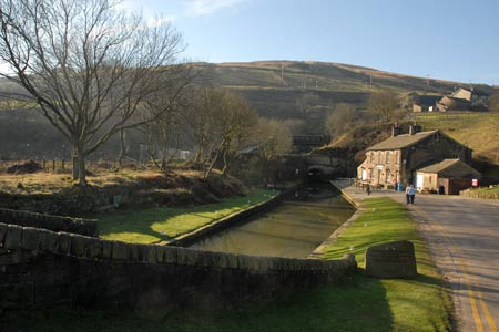
Click image to visit gallery of 12 images.
The village of Marsden has seen its history influenced by moors that surround it. Providing a challenge to road makers, canal engineers and the railway magnates, the influence of the moors is still evident today. This walk uses canal towpath, moorland paths and an old packhorse route to explore the high moors to the west of the village. In addition the route also includes a section of the Pennine Way.
The start is the Standedge Visitor Centre Car Park (Grid ref. SE047118) with its large car park just to the east of the railway station. From here walk west along the canal towpath following the many signs for Standedge Tunnel. Just before the tunnel entrance cross the canal and, keeping to the left of the visitor’s centre follow the access road up to the Tunnel End pub. Turn left along the side of the pub and continue along the valley out of the village.
A recently constructed path through a small nature reserve is an option to walking on the road. This is reached through a gate on the left. The path leads back to the road, which is followed past the hotel on the right to reach a footpath on the left (Grid ref SE030122). Take this path and continue parallel to the river to reach a picturesque packhorse bridge (Grid ref. SE028121). Cross the bridge (Close Gate Bridge) and bear right following the clear path that almost immediately starts to climb. Note - it is worth checking the level of water in the river here as you have to ford it on the return part of the walk. Check you can cross the stream. If not then follow the revised instructions at the end of the walk.
This path, a former packhorse route, climbs across the moor towards the A640 and in its heyday continued to Rochdale. The walk across the moor climbs steadily and you soon get a good retrospective view back towards Marsden. On your right you will see glimpses of March Haigh Reservoir with a line of gritstone crags as a backdrop. Reaching the A640 (grid ref. SE002123) turn sharp left onto the Pennine Way.
This important National Trail is followed for nearly two miles. After crossing a section of moorland the path reaches the millstone grit crags of Standedge. These crags are followed south-east to reach the trig point (grid ref. SE012104), which makes an ideal place to take a break with extensive views west. Leaving the open country the path crosses some walled fields. At grid reference SE015098) leave the Pennine Way and, following the Standedge Trail, cross the stile to follow a wide path or track to Thieves Clough Bridge (grid ref. SE021101). Continue ahead past the derelict building and follow the clear track towards the main road and pub that can be seen ahead.
Cross the road and turn left. Go past the pub and then take the easiest route up through the rough ground to reach a transverse path that runs beneath the power lines you can see from the road. Above this rise the steep slopes of Pule Hill. Having gained the path, turn left (north) and follow it as it contours across the side of Pule Hill. The way ahead is generally easy to find. Passing Owlers, look out for a path (grid ref. SE030117) descending left to the main road. Cross the main road with care and turn right towards Marsden.
If you can cross the river than after a short way along the pavement, turn left down a steep walled path (grid ref. SE029119). If not continue along the main road into Marsden. Those descending to river must ford the stream and then cross Close Gate Bridge and follow the outward route back to the start.
Other walks nearby
| Walk 2613 | Boundary Walk from Marsden | moderate | 13.0 miles |
| Walk 1587 | Scammonden Reservoir | easy | 4.0 miles |
| Walk 2561 | Digley & Ramsden Reservoirs from Wessenden Head | moderate | 9.5 miles |
| Walk 2719 | Huddersfield's green fringe | easy/mod | 10.0 miles |
| Walk 2518 | Black Hill & Four Reservoirs from near Wessenden Head | moderate | 10.0 miles |
| Walk 1586 | Blackmoorfoot Reservoir | easy | 1.5 miles |
| Walk 2914 | The Pots & Pans from Uppermill | easy/mod | 4.5 miles |
| Walk 2634 | Broadstone Hill & the Cotton Famine Road | moderate | 7.0 miles |
| Walk 1583 | Digley Reservoir | easy/mod | 5.0 miles |
| Walk 1091 | Ripponden and the Calderdale Way | easy/mod | 6.5 miles |
Recommended Books & eBooks
Pennine Way Map Booklet
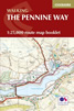 Map of the 270 miles (435km) Pennine Way National Trail, between Edale in the Peak District and Kirk Yetholm in the Scottish Borders. This booklet is included with the Cicerone guidebook to the trail, and shows the full route on Ordnance Survey 1:25,000 maps. This popular long-distance route typically takes three weeks to complete.
More information
The Pennine Way - the Path, the People, the Journey
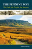 A portrait of the The Pennine Way, Britain's oldest and best known long-distance footpath, stretching 268 miles from the Peak District to the Scottish Borders. This personal, thoughtful and often humorous story of the path's remarkable history, includes the experiences of walkers and local characters on this exhilarating and complex path.
More information
Messaging & Social Media
Message Walking Britain and follow the latest news.

Mountain Weather
Stay safe on the mountains with detailed weather forecasts - for iOS devices or for Android devices.