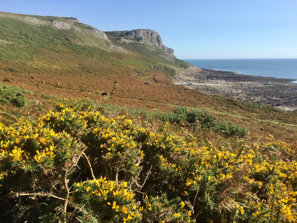
Pwlldu Head & Bishopston Valley from Southgate
Gower Peninsula Walk
Region - Gower Peninsula
County/Area - Swansea
Author - Lou Johnson
Length - 4.0 miles / 6.5 km Ascent - 500 feet / 152 metres
Time - 2 hours 30 minutes Grade - easy
Maps 

| Ordnance Survey Explorer 164 | Sheet Map | 1:25k | BUY |
| Anquet OS Explorer 164 | Digital Map | 1:25k | BUY |
Walk Route Description
Click image to see photo description.
This varied Gower Peninsula walk starts from Southgate and follows the Wales Coast Path to Pwlldu Head from where there is a glorious view along the coast. The route continues along the cliff top before dropping down to Pwlldu Bay. Turning inland the walk continues through the wooded Bishopston Valley before returning to the start.
The start is the National Trust pay and display car park at Westcliff (grid ref. SS554874). After parking walk towards the sea and turn left along a clear path (Wales Coast Path) that runs parallel to a road on your left. After 200 metres fork right and follow a path closer to the edge of the cliffs. The path soon returns to the road which is followed to Hunts Farm. Just past the farm you reach a fingerpost (grid ref. SS565872) where you fork right and follow the clear path around Pwlldu Head. It is worth taking your time as the views are excellent.
After rounding the headland, the path turns north and continues to reach a lane at Pennard Farm (grid ref. SS572870). Continue ahead with the farm on your left to join a track. After 120 metres turn right still following the Wales Coast Path and descend through trees toa track at Pwlldu Bay. (If time permits turn right to explore the fine beach.) Turn left near the stone bridge (signed Bishopston Valley).
Continue along the main path beside a stream for just over a kilometre to reach a path junction (grid ref. SS568879). Turn left into a side valley and follow the rising path up to a gate. Turn left and then ri9ght following the sign to Southgate. Continue along the path soon passing Hael Farm. Pass through the gate and follow the track as it turns left and then right to reach a junction by a bungalow. Turn left into Hael Lane and return to the car park.
Other walks nearby
| Walk 3761 | Cefn Bryn & Three Cliffs Bay from Penmaen | moderate | 9.0 miles |
| Walk 2358 | Parc le Breos near Parkmill | easy | 3.6 miles |
| Walk 2277 | Oxwich Point Circular from Oxwich | easy/mod | 3.5 miles |
| Walk 2287 | Cefn Bryn & Penrice | easy/mod | 7.7 miles |
| Walk 2191 | Cheriton & Weobley Castle from Landimore | easy/mod | 5.2 miles |
| Walk 1960 | Worms Head from Pilton Green | easy/mod | 7.5 miles |
| Walk 2144 | Port-Eynon from Pilton Green | easy/mod | 6.4 miles |
| Walk 1691 | Whiteford Point & Broughton Bay from Llanmadoc | easy/mod | 8.5 miles |
| Walk 2724 | Whiteford Sands from Llanmadoc | easy | 5.1 miles |
| Walk 2424 | Harding's Down & Rhossili Down | moderate | 9.0 miles |
Recommended Books & eBooks
No suggestions for this area.Messaging & Social Media
Message Walking Britain and follow the latest news.

Mountain Weather
Stay safe on the mountains with detailed weather forecasts - for iOS devices or for Android devices.