Cockerham, Glasson & Conder Green
Lancashire Walk
County/Area - Lancashire
Author - Lou Johnson
Length - 6.6 miles / 10.7 km Ascent - 50 feet / 15 metres
Time - 3 hours 20 minutes Grade - easy/mod
Maps 

| Ordnance Survey Explorer 296 | Sheet Map | 1:25k | BUY |
| Anquet OS Explorer 296 | Digital Map | 1:25k | BUY |
Walk Route Description
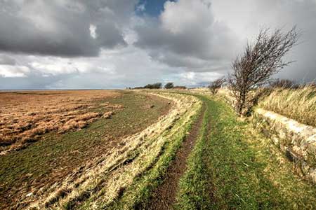
Click image to see photo description.
A linear Lancashire coastal walk full of interest. The route starts from Cockherham and uses field paths to reach the Lancashire Coastal Way which is followed through to Conder Green. Along the way you pass an 800-year-old chapter house, the only remains of Cockersand Abbey, Glasson Dock with its bustling harbour, and the Lune Estuary. Views of Blackpool Tower and the Lake District Fells are a bonus.
The start is a small parking area on the east side of the A588 at Conder Green (grid ref. SD460560). Alternatively, parking is available for patrons at the Stork Hotel on the other side of the main road. After parking take the route 89 bus (Lancaster to Knott end service) from Conder Green and alight in the centre of Cockerham village. Alight from the bus and walk west along the A588 for 50 metres and take the first path on the right by Old mill house. Initially follow the lane which soon leads to field paths, waymarked with yellow arrows, to reach Hillam Lane (grid ref. SD455431).
Turn left along Hillam Lane, pass Hillam Farm, and continue for 800 metres to where the lane bends right and the Lancashire Coastal Way (LCW) joins from the left (grid ref. SD449528). Follow the lane right to reach a caravan site and Rank End Farm. Pass a second caravan site and veer left off Hillam Lane to join a grassy path (LCW). The path soon joins a short section of tarmac road at Bank Houses before continuing along the shoreline. You soon pass the Chapter house at Cockersand Abbey.
The next landmark is Abbey Lighthouse Cottage (grid ref. SD431544). Continue north past Crock Cottage and then turn right onto Marsh Lane just before Crook Farm (grid ref. SD431550). Follow Marsh Lane for 1.4 kilometres to join a road in Glasson. Turn left into Glasson. At the first junction (with a viewpoint on the right), bear right and continue to cross a bridge with the marina on your right. At the next junction turn right in front of the Victoria Inn. Reaching a toilet block on the left, turn left onto a tarmac path and follow the LCW east along the route of an old railway. After just over a kilometre alongside the Lune Estuary you reach Corricks Lane (grid ref. SD457561). Turn sharp right and return to the A588 in Conder Green.
Other walks nearby
| Walk 1641 | Bankhouses via the Lancashire Coastal Way | easy/mod | 7.0 miles |
| Walk 2257 | Clougha Pike from Quernmore | easy/mod | 4.8 miles |
| Walk 1742 | Grit Fell from the Jubilee Tower near Quernmore | moderate | 7.7 miles |
| Walk 2164 | Clougha Pike from the Jubilee Tower | easy/mod | 4.7 miles |
| Walk 2278 | Ward's Stone from Stoops Bridge | mod/hard | 13.0 miles |
| Walk 3459 | Abbeystead Reservoir Circular | easy | 1.6 miles |
| Walk 3457 | Wyre Valley Circular | easy/mod | 6.4 miles |
| Walk 2137 | Clougha & Goldsworthy's Installation Circular | moderate | 5.2 miles |
| Walk 1670 | Hazelhurst Fell, Fair Snape Fell and Parlick | moderate | 11.0 miles |
| Walk 3038 | Wolfhole Crag from Tower Lodge | moderate | 9.0 miles |
Recommended Books & eBooks
Walking on the West Pennine Moors
 This guidebook describes 30 walks on the West Pennine Moors, around Blackburn, Darwen, Chorley and Bolton, home to some of the most inspiring and exhilarating walking country. The walks range from short, easy rambles to more challenging hikes covering a variety of terrain, all of it easily accessible for day walking.
More information
Messaging & Social Media
Message Walking Britain and follow the latest news.

Mountain Weather
Stay safe on the mountains with detailed weather forecasts - for iOS devices or for Android devices.