Manifold Valley and Ecton Hill from Butterton
Peak District Walk
Nat Park - Peak District - Dovedale Manifold Valley
County/Area - Staffordshire
Author - Daryl Smith
Length - 6.3 miles / 10.2 km Ascent - 1100 feet / 333 metres
Time - 4 hours 20 minutes Grade - easy/mod
Maps 

| Ordnance Survey Explorer OL24 | Sheet Map | 1:25k | BUY |
| Anquet OS Explorer OL24 | Digital Map | 1:25k | BUY |
Walk Route Description
Click image to visit gallery of 4 images.
Our superb walk starts from the delightful Staffordshire Peak District village of Butterton. This is perfect walking country with views to savour, geological and historical interest and rich in wildlife with the added bonus of an easy to follow route without crowds! Butterton is just outside the limestone area of the White Peak and is built on and of sandstone. There is a lovely old church at the top of the village whose spire is a conspicuous landmark. Butterton is home to the excellent, highly rated Black Lion Inn (grid ref. SK075565) at the heart of the village, a fine stone building that has welcomed visitors since 1782.
Butterton is best approached from the B5053, turning off at the head of Butterton Moor. Car parking availability in Butterton is extremely limited, if you intend to visit the Black Lion and call ahead, you will be allowed to use the Inn's car park. A small amount of parking is also possible close to the churchyard.
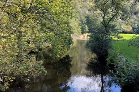
Make your way out of the village around the northern side of the church, turning left on the lane in front of the village hall down towards the Manifold Valley (ignore the road sign). The Manifold Valley is the White Peak at its best, a "magical valley" with "some of the most dazzling landscape in the British Isles" in the words of that great champion of the countryside, the late Candida Lycett Green in her 2009 book Unwrecked England.
Down in the valley go straight ahead over the tunnel portal, over Ecton Bridge and around the foot of Ecton Hill. The tunnel was originally constructed for the Leek & Manifold Valley Light Railway (now part of the Manifold Way); a former owner of Swainsley Hall was one of the principal promoters of the ill-fated railway and the track went into tunnel behind the Hall so as not to disturb his enjoyment of the valley.
You will soon see the old engine house on top of Ecton Mine up above you on the hillside and pass by remains of structures where mineral processing took place. Ecton Mine was in its day the most productive copper mine in the country, innovative engineering was used, and it made a fortune for the Dukes of Devonshire. If you drop down behind the ruins on your left you can see the mouth of Ecton Deep Adit, where water pumped from the lower mine workings was discharged to the river. The height of the engine house above the river is less than one quarter of the total depth of the mine! Rich in ores of copper with some lead and zinc, Ecton Hill was mined extensively until the productive deposits were exhausted; in addition to Ecton Mine there were many smaller enterprises.
Adults and children from surrounding impoverished rural communities worked at Ecton Mine but it must have been a particularly arduous journey travelling from Butterton; the road that you followed and the bridge that you crossed did not exist until mining at Ecton had gone into decline.
Our onward route takes the sharp right turn up a track behind the former mine manager's house but if you have time, it is worth continuing around the bend as far as Apes Tor to see rock formations contorted by unimaginable forces when continents collided. The (sealed) shaft at Apes Tor gave access to an underground canal cleverly used in mining operations.
Returning to the track, go up as far as a most unusual house built by a local MP in the 1930's, turn left in front of the folly but then keep right to follow a permissive path that loops round the hillside up to the engine house that you saw from below. Take time to explore and you can stand on the shaft cap with the lowest level of the mine over 400 metres below your feet.
Continue straight up the hillside past abandoned mine entries, go through a gate and veer right to the trig point at the top of Ecton Hill. Looking back to the north you can see landscape change where the angular White Peak meets the rounded tops of the Dark Peak. Head off in a southerly direction, the permissive path is unmarked but aim for a ruined mine building beyond a small telecoms mast. You may see White Park Cattle in the fields at Broad Ecton Farm, a very distinctive and extremely rare breed. Continue straight ahead to a lane at Back of Ecton, drop down to a junction and turn right; follow the lane to its end then continue down a valley that takes you back to the floor of the Manifold Valley.
Turn right on the lane and keep left on the old road over Dafar Bridge. This is a stretch of the Manifold Valley where the riverbed is often dry. For much of the year the river flows underground for more than 6km, disappearing into "swallet holes" downstream from Wetton Mill before emerging from "boil holes" below Paradise Walk in Ilam Park. You can usually see swallets in the riverbank downstream from Dafar Bridge, if there is enough water in the system to get beyond that point then the river often flows both overground and underground to Ilam.
Continue along the lane to Wetton Mill, just beyond the ford, turn left through a gate into Waterslacks and simply follow the course of Hoo Brook back to Pothooks Lane, Butterton. There is a footbridge often hidden in vegetation to your left if you do not want to walk through the ford. Well beyond Waterslacks the way ahead starts to rise over the flank of Ossoms Hill, turn right through a gate to continue along Hoo Brook.
On Pothooks Lane go down to the ford and then uphill to the village centre. It is unlikely that you will have previously seen a ford like the one at Butterton; traffic approaching Hoo Brook from either direction has to turn left and drive along the bed of the watercourse before turning right to exit the ford.
Ecton Mine is now owned by an educational trust and used for study purposes but the National Trust arranges a seasonal programme of underground visits, these fascinating visits are on one level with no climbing or descending of mine shafts involved.
In wet conditions the route from Waterslacks to Pothooks Lane alongside Hoo Brook can become very muddy. If you want to avoid the mud you can walk up the lane from Wetton Mill back to Butterton, to visit the unusual ford follow the lane down past the front door of the Black Lion.
Other walks nearby
| Walk 2537 | Ecton Hill & Wetton from Wetton Mill | moderate | 7.0 miles |
| Walk 2455 | Lum Edge & Revidge Moor | easy/mod | 6.5 miles |
| Walk 1181 | Wetton Hill & the Manifold Valley | easy/mod | 6.5 miles |
| Walk 1653 | The Manifold Valley from Wetton | easy/mod | 7.8 miles |
| Walk 2681 | Wetton & Manifold Valley from Wetton | easy/mod | 3.6 miles |
| Walk 1021 | Milldale & Hall Dale | easy/mod | 5.0 miles |
| Walk 1257 | Wolfscote Dale | easy/mod | 7.5 miles |
| Walk 1709 | Milldale and Wolfscote Dale | easy/mod | 6.5 miles |
| Walk 3597 | Manifold Valley, Thor's Cave, Ecton & Wetton Hills from Alstonefield | moderate | 10.0 miles |
| Walk 3601 | Dove & Manifold Valleys | moderate | 10.0 miles |
Recommended Books & eBooks
Walking in the Peak District - White Peak East
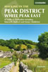 Guidebook describing 42 half-day and day walks in the limestone landscapes of Derbyshire's White Peak, part of the Peak District National Park. One of two volumes, this book covers the east of the region, with potential bases including Bakewell, Eyam, Castleton, Birchover, Matlock and Wirksworth.
More information
Great Mountain Days in the Pennines
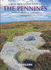 An inspirational guidebook to 50 classic walks on the rolling Pennine landscape. The graded routes, between 6 and 13 miles in length, cover classic Pennine fells and moorland such as Whernside, Ilkley Moor and Pendle Hill; exploring the North and South Pennines, Yorkshire Dales, Howgills and Dark Peak. Many routes are also suited to fell running.
More information
Messaging & Social Media
Message Walking Britain and follow the latest news.

Mountain Weather
Stay safe on the mountains with detailed weather forecasts - for iOS devices or for Android devices.