Lullingstone & Preston Hill near Shoreham (Kent)
Kent Walk
County/Area - Kent
Author - Lou Johnson
Length - 6.6 miles / 10.7 km Ascent - 700 feet / 212 metres
Time - 4 hours 0 minutes Grade - easy/mod
Maps 

| Ordnance Survey Explorer 147 | Sheet Map | 1:25k | BUY |
| Anquet OS Explorer 147 | Digital Map | 1:25k | BUY |
| Ordnance Survey Explorer 162 | Sheet Map | 1:25k | BUY |
| Anquet OS Explorer 162 | Digital Map | 1:25k | BUY |
Walk Route Description
Click image to see photo description.
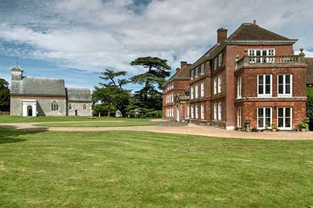
Starting from Lullingstone Park this circular walk follows the River Darent to the village of Shoreham (Kent). The route passes through the village where refreshments are available before climbing onto the downs. The walk then passes the village war memorial before continuing across an undulating landscape to the Lullingstone Golf Club. Continuing the walk, the route follows clear paths across Lullingstone and Preston Hill Country Park to pass the remains of a Roman villa (fee payable). Lullingstone Castle and the adjacent lake. A shorter and similar version of this route can be found at Walk 2156.
The walk starts from the Lullingstone Country car park (grid ref. TQ526638) which lies a short distance off the A225 near Eynsford. After parking return to the road and turn right and almost immediately pass through a wooden kissing gate. Continue along the path (part of the Darent Valley Path) which runs parallel to a road on your left. After 500 metres the path ends at a road. Go straight across to join the continuing path. The waymarked path crosses fields to run parallel with the River Darent on your left. Reaching the edge of Shoreham village, the path crosses the river by a weir and continues with the river now on your right. Continue ahead to reach Church Street (grid ref. TQ521616).
Turn right and continue to a T-junction. Turn right along High Street. Just past the tearoom on the left, turn left along the Landway and join the enclosed footpath heading onto the downs. Entering an open field continue ahead to a path junction (grid ref. TQ514618) a short way into trees. Turn right and continue soon passing the village war memorial on your right from where there is a beautiful view across Shoreham and the valley. Continue to the end of the path and turn left along a gravel driveway to a road. Turn right and keep straight ahead at the next junction. At the next junction turn left up Cockerhurst Road. Reaching the first bungalow on the left, turn right and climb with woodland on your right again with some views to enjoy. Reaching the top of the hill bear right over a stile. Entering a field, the path follows the left-hand edge and heads towards Homewood Farm. At the end of the field, bear left and join a clear track that leads to Redmans Lane (grid ref. TQ511637).
Turn left and after 100 metres, turn right up steps and follow the path across a field. Reaching some iron sheds, keep left, pass through a gate, and enter Upper Beechen Wood. The waymarked path passes through trees, crosses a fairway of the golf course, enters more trees, and crosses another section of the course. Follow the waymarks past the clubhouse and into the car park. Just before the exit to the car park, bear right to join a clear track. Pass Parkgate Farm on your right and join a path across two fields with hedge on your left. At the end of the second field, the path turns right. Follow the path downhill, ignoring the Darent Valley Way going left (grid ref. TQ525652). The path soon reaches the main tarmac driveway through the Lullingstone Estate (with the remains of the Roman Villa on your left). Turn right along the driveway, continue past the impressive gateway to Lullingstone Castle. Where the drive bends left continue ahead on the signed path to follow the Darent Valley Path past the lake on your left to return to the car park.
Other walks nearby
| Walk 1510 | Otford, Romney Street & Woodlands | moderate | 14.5 miles |
| Walk 1610 | Otford, Romney Street & Kemsing | mod/hard | 16.8 miles |
| Walk 3598 | Knockholt via Pratt's Bottom, Mace Farm and The Washneys | easy/mod | 7.3 miles |
| Walk 3441 | Sevenoaks, Seal Chart and Ightham Mote | moderate | 11.0 miles |
| Walk 2210 | Holly Hill & Coldrum Long Barrow | easy/mod | 5.0 miles |
| Walk 2011 | Chartwell from Crockham Hill | easy | 2.8 miles |
| Walk 2284 | Limpsfield Circular | easy/mod | 6.0 miles |
| Walk 2427 | Hever & Markbeech from Chiddingstone | easy | 5.9 miles |
| Walk 1398 | Greenwich Museum, Observatory & Park | easy | 2.3 miles |
| Walk 1471 | Thames Path - Cutty Sark to Tower of London | easy | 6.0 miles |
Recommended Books & eBooks
Walking in Kent
 A guidebook describing 40 walks in the county of Kent. Covering west Kent and The Weald and north and east Kent, including the Kent Downs and the Greensand Hills. Walks of 5 to 9 miles explore rivers and coastline, beautiful countryside and historic villages. With outlines of 11 longer walks ranging from 15 to 163 miles.
More information
Messaging & Social Media
Message Walking Britain and follow the latest news.

Mountain Weather
Stay safe on the mountains with detailed weather forecasts - for iOS devices or for Android devices.