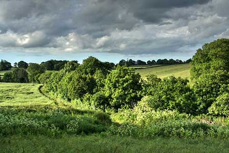
Bourne Valley & Sacombe from Wadesmill
Hertfordshire Walk
County/Area - Hertfordshire
Author - Lou Johnson
Length - 5.8 miles / 9.4 km Ascent - 300 feet / 91 metres
Time - 3 hours 10 minutes Grade - easy/mod
Maps 

| Ordnance Survey Explorer 194 | Sheet Map | 1:25k | BUY |
| Anquet OS Explorer 194 | Digital Map | 1:25k | BUY |
Walk Route Description
Click image to see photo description.
Starting from Wadesmill this varied walk includes the Bourne Valley, a section of former Roman Road, the beautiful village of Sacombe Green, Sacombe Park and pleasant countryside. The route follows paths, bridleways, lanes, and part of the Hertfordshire Way.
Limited on-street parking is available in Wadesmill near the Feathers Inn (grid ref. TL359176). After parking and facing the Inn, turn left. After 100 metres turn left onto the footpath signed to Marshall's Lane. After a kilometre following The Bourne you reach Marshall's Lane. Go straight across to join a bridleway signed to Lowgate Lane. Again, the path runs beside The Bourne for much of the way. Reaching Lowgate Lane (grid ref. TL3532020) turn left along a former Roman Road. After 800 metres the lane leads into a tarmac lane. Keep ahead and take the first signed footpath on the left. After 50 metres the path turns right and crosses a field to exit onto Marshall's Lane in Sacombe Green (grid ref. TL343196).
Turn right, continue past a post box on your right, and then bear left into a lane. Continue ahead and reaching a junction, bear right onto a drive. Continue past Sacombe House (on your right), ignore a track to the left, and continue to a T-junction (grid ref. TL336190). Turn left and pass in front of Salcomebury Farm. And continue across Salcombe Park initially with woodland on your right. The drive curves gently left and passes a group of trees on your left to reach a fork (grid ref. TL333184). Fork left to join the Hertfordshire Way (HW).
Continue along the HW for 800 metres and follow the signed route around Bengo Temple Farm to join a clear track. Pass through trees and follow the track along the left-hand side of a field. Follow the grassy track as it bends left to a corner of a field. Exit the field to the left along the HW. The route the passes Cheising Farm on your left and continues across fields to join Anchor Lane. Turn left into the centre of Wadesmill.
Other walks nearby
| Walk 1698 | Ware to Enfield Lock - Lea Valley - | easy/mod | 12.5 miles |
| Walk 3352 | The Greenwich Meridian, near Ware | easy | 3.3 miles |
| Walk 3123 | Hertford East to Rye House | easy/mod | 8.6 miles |
| Walk 3578 | Hertford and Ware Circular | easy | 5.5 miles |
| Walk 1125 | Widford & Cold Christmas Circular | easy/mod | 9.5 miles |
| Walk 1725 | St Margaret's circular via Widford | moderate | 10.2 miles |
| Walk 2110 | Ash Valley Circular | easy | 5.5 miles |
| Walk 1741 | Rye House circular via Roydon and Stanstead Abbots | easy/mod | 9.1 miles |
| Walk 3530 | Roydon to Epping | easy/mod | 9.3 miles |
| Walk 1402 | Burnham Green, Tewin and the Mimram Valley | easy | 6.0 miles |
Recommended Books & eBooks
No suggestions for this area.Messaging & Social Media
Message Walking Britain and follow the latest news.

Mountain Weather
Stay safe on the mountains with detailed weather forecasts - for iOS devices or for Android devices.