Vale of Ewyas from Llanthony Abbey
Brecon Beacons/Bannau Brycheiniog Walk
Nat Park - Brecon Beacons - Brecon Beacons East
County/Area - Monmouthshire & Powys & Herefordshire
Author - Martyn Hanks
Length - 10.7 miles / 17.4 km Ascent - 2800 feet / 848 metres
Time - 8 hours 10 minutes Grade - moderate
Maps 

| Ordnance Survey Explorer OL13 | Sheet Map | 1:25k | BUY |
| Anquet OS Explorer OL13 | Digital Map | 1:25k | BUY |
| Ordnance Survey Landranger 161 | Sheet Map | 1:50k | BUY |
| Anquet OS Landranger 161 | Digital Map | 1:50k | BUY |
Walk Route Description
Click image to see photo description.
The ridges of the Black Mountains in the eastern part of Brecon Beacons National Park offer some wonderful walking. This walk takes a mid-level route up the Vale of Ewyas from Llanthony Priory north to Capel-y-ffin. From here, the route climbs onto the main ridge running south from Hay Bluff to Hatterrall Hill to follow a section of the Offa's Dyke Path. The walk then descends back to the start.
The walk starts from the free car park adjacent to Llanthony Priory (Grid ref SO288278) where there are toilets and refreshments available in season. After parking, take the exit road from the car park past the entrance to the ruined Priory on your right. Where the access road bears left, continue straight ahead. Go through a gate and across a field to reach a lane. Walk past the pub on your left. Bear left at the lane junction. Walk up this lane turning left up an enclosed path (Grid ref. SO281279) following the course of a small spring. Continue uphill to reach the boundary of Open Access Country (grid ref. SO280278).
Turn right along the flank of Bal Mawr. The onward route uses a mixture of paths and tracks above Nantygwyddel Farm as far as Nant-y-Carnau (grid ref. SO272285). From here regain Open Access Land passing above Sychtre. Continue along paths mainly in Open Access Land for two miles to reach a bridleway (grid ref. SO249311). Turn right down the bridleway and descend to a lane. Turn right down the lane to a road junction at Capel-y-ffin. Turn left up valley and take the first track on the right leading to Blaenau.
Continue on the footpath across fields to reach a lane at grid ref. SO260311. Continue south-east along the track towards The Vision Farm. After 300 metres take the footpath on the right. This path leads steeply through some trees to reach open country at a stile (SO265312). The temptation is to go straight uphill but it is better to turn right to follow the clear path which zigzags up the hillside. The path gains height quickly and easily and eventually levels out. Reaching open moorland there are a few places where there is a choice of path. Stay on the most obvious and continue ahead to reach the main Offa's Dyke Path on the ridge (grid ref. SO270319).
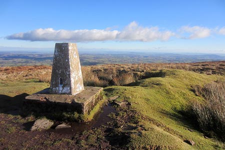
Turn right. You now have just under two miles of easy high-level walking. The views are good and the walking easy as you follow the Offa's Dyke Path. You pass a trig column at 610m (Grid ref. SO280307) followed by a gradual descent and a further easy ascent to reach an un-named flattish top at 605 metres (grid ref. SO288296). As the main path starts to lose height, bear right onto a clear path descending gradually in a southerly direction. This is just before the main path curves to the southeast. The path crosses rough moorland losing height gradually at first before descending more steeply into the Vale of Ewyas. Continue downhill through zigzag paths. Complete the walk by following the path between two small woods and then continue across fields back to the start.
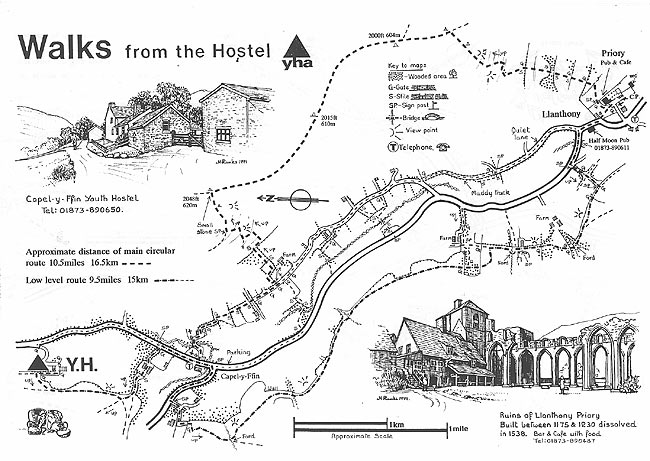
This walk is one of many routes prepared by Martyn Hanks for Youth Hostellers. The routes were drawn in a 'Wainwright' style and provided annotated maps offering additional information for walkers. Prepared before the days of GPS they were an invaluable resource and Walking Britain is happy to ensure that these walks remain in the public domain. This walk was drawn for hostellers visiting Capel-y-ffin hostel which has now, sadly, closed.
Other walks nearby
| Walk 3622 | Llanthony Priory from Longtown | mod/hard | 7.0 miles |
| Walk 3204 | Hay Bluff & Twmpa | moderate | 10.3 miles |
| Walk 2935 | Llanthony Priory from Capel-y-ffin | easy/mod | 7.7 miles |
| Walk 1660 | Craswall Priory & Hay Bluff | easy/mod | 6.0 miles |
| Walk 1238 | Hay Bluff & Twmpa Circular | moderate | 6.0 miles |
| Walk 1271 | Sugar Loaf circular | moderate | 6.0 miles |
| Walk 1664 | The Sugar Loaf | easy | 3.5 miles |
| Walk 1106 | Waun Fach | mod/hard | 7.5 miles |
| Walk 2065 | Waun Fach & Y Grib from Pengenfford | moderate | 6.5 miles |
| Walk 3717 | Table Mountain from Crickhowell | easy/mod | 5.0 miles |
Recommended Books & eBooks
Walking in Carmarthenshire
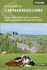 Guidebook to 30 walking routes (2 to 10 miles) in Carmarthenshire, south Wales, including sections of Carmarthenshire Coast Path. Walks for all abilities, including coastal, river, forest and hill walks in Cambrian Mountains, Tywi Valley, Y Mynydd Du (Black Mountains) and Brecon Beacons. Easy access from Bristol, Cardiff and Swansea.
More information
Walking on the Brecon Beacons
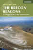 45 circular day walks are described in this guidebook to the Brecon Beacons National Park. From west to east, Mynydd Du, Fforest Fawr, the Brecon Beacons and the Black Mountains these mountain and valley routes offer many options, highlighting the natural features. The walks described explore dramatic waterfalls, wooded gorges and upland valleys.
More information
Messaging & Social Media
Message Walking Britain and follow the latest news.

Mountain Weather
Stay safe on the mountains with detailed weather forecasts - for iOS devices or for Android devices.