Howgills WalksWalking Routes & Hiking Trails
Find Howgills walks from the list below which features the best walking routes in the area. Most are circular walks and are listed from the shortest and easiest to the longest more challenging routes.
The Howgills walks listed below cater for walkers of all abilities from easy low-level walks to the high fells. All walks are free to download and print and all routes have GPX files. Most of the Howgill Fells lie within the Yorkshire Dales National Park but some of the northern fells lie outside the boundaries. The walks reach all the major summits including the Calf which is the highest point in the area. One of the highlights of these fells is Cautley Spout, which after heavy rain is a spectacular waterfall. The Howgill fells can be confusing in poor visibility so care should be taken when cloud obscures the summits.
| Walk | Description | Grade | Miles |
|---|---|---|---|
| 1387★ | Cautley Spout from Cross Keys | easy | 2.00 |
| 1393★☩ | Yarlside from Cross Keys | moderate | 4.00 |
| 3006★☩ | Cautley Spout & The Calf from Cross Keys | moderate | 5.50 |
| 1839★☩ | Blease Fell & Hare Shaw from Tebay | easy/mod | 5.70 |
| 1342★☩ | Randygill Top from Weasdale | moderate | 6.00 |
| 3385★☩ | Carlingill Beck, Black Force & Whin's End | mod/hard | 6.50 |
| 3008★☩ | Winder & Arant Haw from Sedbergh | moderate | 7.00 |
| 3007★☩ | Fell Head & The Calf from Howgill | moderate | 7.50 |
| 2253★ | Uldale Falls & Wandale from Rawthey Bridge | moderate | 8.50 |
| 2458★ | Winder, The Calf & Fell Head from Howgill | moderate | 9.80 |
| 1616★☩ | Bowderdale and the Calf | moderate | 10.00 |
| 2438★☩ | Cautley Spout & the Calf from Sedbergh | moderate | 10.00 |
| 1196★☩ | The Calf from Sedbergh | mod/hard | 10.50 |
★ GPS file ☩ Route profile
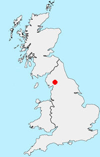
Location Map
Howgills Guide
Situated east of the Lake District, the Howgills lie mostly within the boundaries of the Yorkshire Dales National Park. The Howgills are one of the forgotten walking areas in England. The "hippo like" outlines of the fells are distinctive, most often seen by those tearing up the M6 motorway between Kendal and Penrith. Despite the lack of crags it is great walking country and you can wander for hours in the knowledge you are unlikely to meet more than a handful of other people. Poor parking (except in Sedbergh and a few other areas) helps to keep the number of people wandering the Howgills to a minimum.
Howgills Walking Guide
Other walks in Britain - For a list of all the areas where walks are available go to the Main Walk Index.
Walk grading - Learn how each walk is assessed and select a walk to suit your ability and experience by going to Walk Grading Details.
Messaging & Social Media
Message Walking Britain and follow the latest news.

Mountain Weather
Stay safe on the mountains with detailed weather forecasts - for iOS devices or for Android devices.