Buck's Mill & Peppercombe
Devon Walk
County/Area - Devon
Author - Lou Johnson
Length - 6.2 miles / 10.1 km Ascent - 1100 feet / 333 metres
Time - 4 hours 10 minutes Grade - easy/mod
Maps 

| Ordnance Survey Explorer 126 | Sheet Map | 1:25k | BUY |
| Anquet OS Explorer 126 | Digital Map | 1:25k | BUY |
Walk Route Description
Click image to see photo description.
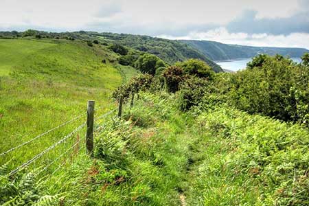
This North Devon walk starts from Buck's Mill and follows an inland route exploring hills and valleys to reach Peppercombe. From here the walk joins the South West Coast path which follows an undulating route high above the sea to return to the start.
The walk starts from Buck's Mill car park (grid ref. SS358233). After parking return to the lane and turn right towards the sea. Where the lane bends left, cross a footbridge on the right and take the path which passes to the left of the cottage. The path soon starts climbing through woodland with a stream down on your right. The path exits the woodland into open countryside and continues across a field with a hedge on your right. Pass through Lower Worthygate Farm. Cross a stile to the left of the farmhouse and soon after head right to a path junction (grid ref. SS368231) where you fork left and continue with a hedge on your left across two fields to a lane.
Turn right down the lane to reach the A39. Cross the road with care to the no through road opposite. After a brief climb the lane descends into a valley and reaches a lane at Broad Parkham (grid ref. SS378221). Turn left and at the next junction (post box opposite) turn left again. Continue to where the lane bends left and take the signed footpath on the right-hand side of the bend. Continue for 200 metres to a footpath junction and turn left and drop down to a stile and bridge over a stream. Once across the stream bear right to a stile on your right (easily missed). Head across a field to a gate Continue with hedge on your left to Bank Hall Farm (grid ref. SS389223). Pass through the yard to a gate. Bear left along hedge to a stile and gate. Follow the waymark to the corner of field and climb steps to a stile. In the next field aim for the top right-hand corner, cross a stile, and join a track enclosed with hedges.
Follow the track through West Goldsworthy Farm and continue along the farm's access drive. Where the drive turns right, walk ahead and follow the path along the right hand side of a field with a garage on your right. Continue to the A39 at Horns Cross. Cross the A39 and walk past the Coach and Horses and turn left along a lane. At the end of the tarmac, turn right through a gate with adjacent two-way fingerpost. Keep ahead along the clear track down through the Peppercombe Valley. Reaching a bridge turn left onto the signed coast path (South West Coast Path). The well-signed path offers fine views along the coast and leads down to the lane Buck's Mill. Turn left and walk back up to the car park.
Other walks nearby
| Walk 1719 | Clovelly & the South West Coast Path | easy/mod | 6.0 miles |
| Walk 1047 | Abbotsham Cliff beach and Kipling's Tor, Westward Ho! | easy | 3.5 miles |
| Walk 1824 | Hartland Point Circular | easy | 3.0 miles |
| Walk 3208 | Stoke & Hartland Quay | moderate | 6.4 miles |
| Walk 2161 | Appledore to Westward Ho! | easy | 4.5 miles |
| Walk 1261 | Hartland Point circular | moderate | 10.0 miles |
| Walk 3207 | Knap Head to Mansley Cliff | moderate | 8.0 miles |
| Walk 1788 | Welcombe Mouth and Darracott | moderate | 6.0 miles |
| Walk 2028 | Croyde to Baggy Point Circular | easy | 5.5 miles |
| Walk 1996 | Woodford & Hollygrove Wood | easy/mod | 5.1 miles |
Recommended Books & eBooks
South West Coast Path Map Booklet - Minehead to St Ives
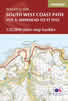 Map of the northern section of the 630 mile (1014km) South West Coast Path National Trail. Covers the trail from Minehead to St Ives along the north Devon and Cornish coastline. This convenient and compact booklet of Ordnance Survey 1:25,000 maps shows the route, providing all of the mapping you need to walk the trail in either direction.
More information
The South West Coast Path
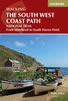 Guidebook to walking the entire South West Coast Path National Trail. The route runs for 630 miles from Minehead to Poole along the north Devon, Cornish, south Devon and Dorset coastline. Divided into 45 stages, this long-distance coastal trek could be completed within 4 weeks, or walked in sections. Guide includes maps and essential information.
More information
Messaging & Social Media
Message Walking Britain and follow the latest news.

Mountain Weather
Stay safe on the mountains with detailed weather forecasts - for iOS devices or for Android devices.