Ferryside & Llansaint
Carmarthenshire Walk
County/Area - Carmarthenshire
Author - Lou Johnson
Length - 5.0 miles / 8.1 km Ascent - 750 feet / 227 metres
Time - 3 hours 20 minutes Grade - easy/mod
Maps 

| Ordnance Survey Explorer 177 | Sheet Map | 1:25k | BUY |
| Anquet OS Explorer 177 | Digital Map | 1:25k | BUY |
Walk Route Description
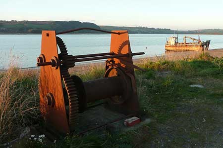
Click image to see photo description.
This walk from Ferryside starts beside Afon Tywi (River Towy) and explores the pleasant green landscape lying to the west of the village. Initially the route follows the Wales Coast Path along one of its inland sections to Llansaint. After a steady climb you reach a hill near Pengay Farm which offers excellent views across the Twyi Estuary and beyond to a rolling landscape. The return route follows field paths to return to the start. Ferryside does have a railway station if you wish to use public transport. Ferryside also has a good range of amenities.
The walk starts from the centre of Ferryside at the car park opposite the station (grid ref. SN366104). After parking walk along Port Way, passing the level crossing on your right to a bush shelter also on your right. Turn right along an alley as directed by the footpath sign by the bush shelter to follow the Wales Coast Path. The path soon turns right and continues between houses. You soon join a tarmac lane, which is followed offering a good view across the Afon Twyi. Where the lane forks, bear right, and continue to the end of the tarmac. Continue along the path which passes through trees to exit onto a lane (grid ref. SN366094).
Turn right down the lane and take the first lane on the left. Shortly after you join this lane, turn left up steps to continue along the Wales Coast Path. The onward path is well waymarked and after a steady climb you reach the highest point of the walk passing a trig column on your left (132 m.). Continue ahead to pass through the yard of Pengay Farm to join a lane (grid ref. SN373085). Bear right along the lane and after 200 metres turn right through a metal gate. The path crosses a field and then descends steeply into a wooded valley to reach a lane. Turn left and after a short way turn right through a metal gate.
Another steep climb through trees takes across a field and through a caravan site to a lane. Bear left and follow the lane (Hoel Gwernant) into Llansaint. Reach a T-junction, where the Wales Coast Path goes right, turn left along Maes yr Eglwys. Follow the road keeping the church on your left. Follow the wall past the church and continue ahead keeping the King's Arms on your left. Continue a short way to a T-junction. Turn right and take the first footpath on your left. The fingerpost is hidden in a tree. Cross the stile and follow the path enclosed by hedges to reach a field. Go half right across the field into another field. Initially, keep the hedge on your left before heading half right down to the left of a small sewage works and lane (grid ref. SN381086).
Turn right and take the first path on the left. A short climb through trees leads to a field. Go half left across this field to a lane. Turn right along the lane to where it bends right and take the path on the left (grid ref. SN380088). Follow the path with hedge on your right to a gate. Continue along the left-hand side of the next field to the left-hand corner. Continue along the enclosed path between hedges to descend steps to a lane at Broadlay. Turn right and continue to a tarmac drive leading to Y Plas on the left. Take the path on the left of the drive through a gate and across a small field to enter another field.
Turn right keeping the hedge on your right across the next field. The path continues with the hedge on your left across two more fields before it cuts left through the hedge to across smaller field with hedge right. Go straight across the next and final field and descend to a road (Port Way). Turn left and follow this road down to the centre of Ferryside and the car park used at the start of the walk.
Other walks nearby
| Walk 3369 | Pendine to Amroth Coast Path | moderate | 5.7 miles |
| Walk 1691 | Whiteford Point & Broughton Bay from Llanmadoc | easy/mod | 8.5 miles |
| Walk 2724 | Whiteford Sands from Llanmadoc | easy | 5.1 miles |
| Walk 2191 | Cheriton & Weobley Castle from Landimore | easy/mod | 5.2 miles |
| Walk 2424 | Harding's Down & Rhossili Down | moderate | 9.0 miles |
| Walk 3258 | The Beacon from Rossili | easy | 4.0 miles |
| Walk 1967 | Worms Head from Rhossili | easy | 3.3 miles |
| Walk 1209 | Saundersfoot & Tenby | easy/mod | 4.5 miles |
| Walk 1960 | Worms Head from Pilton Green | easy/mod | 7.5 miles |
| Walk 2144 | Port-Eynon from Pilton Green | easy/mod | 6.4 miles |
Recommended Books & eBooks
Walking in Carmarthenshire
 Guidebook to 30 walking routes (2 to 10 miles) in Carmarthenshire, south Wales, including sections of Carmarthenshire Coast Path. Walks for all abilities, including coastal, river, forest and hill walks in Cambrian Mountains, Tywi Valley, Y Mynydd Du (Black Mountains) and Brecon Beacons. Easy access from Bristol, Cardiff and Swansea.
More information
Messaging & Social Media
Message Walking Britain and follow the latest news.

Mountain Weather
Stay safe on the mountains with detailed weather forecasts - for iOS devices or for Android devices.